Interstate 794
| ||||
|---|---|---|---|---|
|
Lake Freeway East–West Freeway | ||||
 | ||||
| Route information | ||||
| Maintained by WisDOT | ||||
| Length: | 3.50 mi[1] (5.63 km) | |||
| Existed: | Early 1980s – present | |||
| Major junctions | ||||
| West end: |
| |||
| East end: |
| |||
| Location | ||||
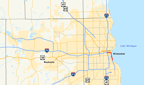
| Counties: | Milwaukee | |||
| Highway system | ||||
| ||||

Interstate 794 (abbreviated I-794 and also known as the East–West Freeway and Lake Freeway) is a 3.50-mile (5.63 km) Interstate Highway spur route in Milwaukee County in the U.S. state of Wisconsin. It is one of two auxiliary Interstates in the Milwaukee metropolitan area and serves the lakefront, the Port of Milwaukee and connects downtown with the southeastern suburbs of St. Francis, Cudahy and South Milwaukee.
Route description
I-794 begins at the Marquette Interchange in downtown Milwaukee, where Interstate 94 and Interstate 43 meet. It continues eastward through downtown and turns southward near Lake Michigan at Lincoln Memorial Drive. The route crosses the Milwaukee River and the Port of Milwaukee as well as the Henry Maier Festival Park via the Hoan Bridge. The entire route is elevated on a viaduct. The interstate designation ends at exit 3 at Carferry Drive, which provides access to the Lake Express ferry to Muskegon, Michigan; the highway continues south as WIS 794, also known as the Lake Parkway, to the intersection of Pennsylvania and Edgerton Avenues on Cudahy's west side, running parallel and adjacent to the east side of General Mitchell International Airport.[2] Traffic volumes on I-794 range from 40,400 vehicles per day on the Hoan Bridge to 100,000 on the east–west Freeway.[3]
History
The original plans for the Lake Freeway called for it to begin north of downtown Milwaukee at a connection to the proposed Park East Freeway, then to travel south from the downtown Milwaukee area to General Mitchell International Airport. However, the Hoan Bridge was the only segment of the freeway to be built before strong opposition to the freeway resulted in its cancellation.[4] This led to the Hoan Bridge being called the "Bridge to Nowhere" as it sat unused, with both of its ends unconnected to any other road, for three years. The unfinished bridge was used as the site of the car chase scene in the movie The Blues Brothers.[5] An east–west freeway was later constructed between the Marquette Interchange and the Hoan Bridge, creating what is now known as I-794.
As part of his campaign against freeways in Milwaukee, Mayor John O. Norquist proposed to tear down the I-794 portion of the east–west freeway in 1995 in favor of a surface boulevard. He believed that the freeway was cutting off the Historic Third Ward from the rest of downtown Milwaukee. His effort failed when opposition to the removal cited increased traffic volume on the road as well as the new Lake Parkway nearing completion. After opening, the Lake Parkway helped traffic volumes on I-794 to increase to 111,000 vehicles per day by 2004.[5]
The Marquette Interchange construction project undertaken between 2004 and 2008 rebuilt the east-west viaduct section of I-794 between the interchange and the Milwaukee River.
In February 2010, Milwaukee County Supervisor Patricia Jursik and South Milwaukee Mayor Tom Zepecki proposed a plan to expand I-794/Lake Parkway to Racine County. The expansion would follow an existing railroad corridor and was intended to relieve traffic along I-94.[6]
Exit list
The entire route is in Milwaukee, Milwaukee County.
| mi | km | Exit[7] | Destinations | Notes | |
|---|---|---|---|---|---|
| 0.0 | 0.0 | 1A | Western terminus | ||
| 0.4 | 0.64 | 1B | |||
| 0.4 | 0.64 | 1C | |||
| 0.6 | 0.97 | 1H | St. Paul Avenue / James Lovell Street | Eastbound exit from I-43 north / I-94 west only[8] | |
| 0.7 | 1.1 | 1D | Plankinton Avenue | Eastbound exit from I-43 north / I-94 west only[8] | |
| 0.8– 0.9 | 1.3– 1.4 | Bridge over the Milwaukee River | |||
| 0.9 | 1.4 | 1E | EB: Jackson Street south / Van Buren Street north WB: Milwaukee Street – Downtown | Signed eastbound for Jackson and Van Buren streets and westbound for Milwaukee Street | |
| 1.1 | 1.8 | 1F | EB: Lakefront WB: Michigan Street / Lincoln Memorial Drive | Signed eastbound for the lakefront, and Michigan Street westbound | |
| 2.0 | 3.2 | Bridge over the Kinnickinnic River | |||
| 3.1 | 5.0 | 3 | Port of Milwaukee | ||
| 3.5 | 5.6 | – | Eastern terminus | ||
| 1.000 mi = 1.609 km; 1.000 km = 0.621 mi | |||||
References
- ↑ "Route Log and Finder List - Table 2". Federal Highway Administration. October 31, 2002. Retrieved 2007-12-12.
- ↑ "Milwaukee Co." (pdf). Wisconsin Department of Transportation. Retrieved 2007-12-12.
- ↑ "2007 Milwaukee County Freeway System 2007 Mainline AADT Only Annual Average Daily Traffic (map 2 of 3)" (pdf). Wisconsin Department of Transportation. Retrieved 2009-03-07.
- ↑ Lake Freeway at Wisconsin Highways
- 1 2 Bessert, Chris. "Wisconsin Highways: Highways 400-894 (I-894)". Wisconsin Highways. Retrieved 2009-03-07.
- ↑ Plan to Expand Lake Parkway in Works Retrieved 2010-09-12
- ↑ Wisconsin Department of Transportation. "Exit numbers on Interstate 794". Retrieved 2007-12-12.
- 1 2 Google (2007-12-12). "Interstate 794" (Map). Google Maps. Google. Retrieved 2007-12-12.
External links
- East–West Freeway at Wisconsin Highways
- Lake Freeway at Wisconsin Highways
- Hoan Bridge: 2000 from Wisconsin Highways
1Unsigned | ||