Lake Park, Georgia
| Lake Park, Georgia | |
|---|---|
| City | |
|
Lake Park City Hall | |
 Location in Lowndes County and the state of Georgia | |
| Coordinates: 30°41′5″N 83°11′16″W / 30.68472°N 83.18778°WCoordinates: 30°41′5″N 83°11′16″W / 30.68472°N 83.18778°W | |
| Country | United States |
| State | Georgia |
| County | Lowndes |
| Government | |
| • Mayor | Eric Schindler |
| Area | |
| • Total | 1.4 sq mi (3.8 km2) |
| • Land | 1.4 sq mi (3.7 km2) |
| • Water | 0 sq mi (0.1 km2) |
| Elevation | 157 ft (48 m) |
| Population (2000) | |
| • Total | 549 |
| • Density | 392.1/sq mi (144.5/km2) |
| Time zone | Eastern (EST) (UTC-5) |
| • Summer (DST) | EDT (UTC-4) |
| ZIP code | 31636 |
| Area code(s) | 229 |
| FIPS code | 13-44704[1] |
| GNIS feature ID | 0332166[2] |
| Website | http://cityoflakeparkga.com/ |

Lake Park is a city in Lowndes County, Georgia, United States. The population was 549 at the 2000 census.
Geography
Lake Park is located at 30°41′5″N 83°11′16″W / 30.68472°N 83.18778°W (30.684704, -83.187639).[3]
According to the United States Census Bureau, the city has a total area of 1.5 square miles (3.9 km2), of which, 1.4 square miles (3.6 km2) of it is land and 0.04 square miles (0.10 km2) of it (2.72%) is water.
Demographics
| Historical population | |||
|---|---|---|---|
| Census | Pop. | %± | |
| 1900 | 319 | — | |
| 1910 | 285 | −10.7% | |
| 1920 | 310 | 8.8% | |
| 1930 | 424 | 36.8% | |
| 1940 | 387 | −8.7% | |
| 1950 | 334 | −13.7% | |
| 1960 | 338 | 1.2% | |
| 1970 | 361 | 6.8% | |
| 1980 | 439 | 21.6% | |
| 1990 | 500 | 13.9% | |
| 2000 | 549 | 9.8% | |
| 2010 | 733 | 33.5% | |
| Est. 2015 | 730 | [4] | −0.4% |
As of the census[1] of 2000, there were 549 people, 224 households, and 140 families residing in the city. The population density was 385.5 people per square mile (149.3/km²). There were 262 housing units at an average density of 184.0 per square mile (71.2/km²). The racial makeup of the city was 80.15% White, 15.66% African American, 1.82% Native American, 0.36% Asian, 0.36% from other races, and 1.64% from two or more races. Hispanic or Latino of any race were 4.19% of the population.
There were 224 households out of which 28.1% had children under the age of 18 living with them, 45.5% were married couples living together, 14.3% had a female householder with no husband present, and 37.5% were non-families. 35.7% of all households were made up of individuals and 18.8% had someone living alone who was 65 years of age or older. The average household size was 2.31 and the average family size was 2.96.
In the city the population was spread out with 22.6% under the age of 18, 8.7% from 18 to 24, 25.1% from 25 to 44, 22.2% from 45 to 64, and 21.3% who were 65 years of age or older. The median age was 41 years. For every 100 females there were 84.2 males. For every 100 females age 18 and over, there were 81.6 males.
The median income for a household in the city was $28,359, and the median income for a family was $31,806. Males had a median income of $30,521 versus $17,083 for females. The per capita income for the city was $17,715. About 12.8% of families and 19.8% of the population were below the poverty line.
References
- 1 2 "American FactFinder". United States Census Bureau. Retrieved 2008-01-31.
- ↑ "US Board on Geographic Names". United States Geological Survey. 2007-10-25. Retrieved 2008-01-31.
- ↑ "US Gazetteer files: 2010, 2000, and 1990". United States Census Bureau. 2011-02-12. Retrieved 2011-04-23.
- ↑ "Annual Estimates of the Resident Population for Incorporated Places: April 1, 2010 to July 1, 2015". Retrieved July 2, 2016.
- ↑ "Census of Population and Housing". Census.gov. Retrieved June 4, 2015.
External links
Municipalities and communities of Lowndes County, Georgia, United States | ||
|---|---|---|
| Cities | 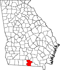 | |
| Town | ||
| CDP | ||
| Unincorporated communities | ||