Lake Terrace/Lake Oaks, New Orleans
| Lake Terrace/Lake Oaks | |
| New Orleans Neighborhood | |
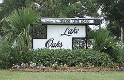 Lake Oaks sign on Elysian Fields Avenue. Note the "Developed by Orleans Levee Board" heading. | |
| Country | United States |
|---|---|
| State | Louisiana |
| City | New Orleans |
| Planning District | District 6, Gentilly District |
| Elevation | 0 ft (0.0 m) |
| Coordinates | 30°01′41″N 90°03′42″W / 30.02806°N 90.06167°WCoordinates: 30°01′41″N 90°03′42″W / 30.02806°N 90.06167°W |
| Area | 18.26 sq mi (47.3 km2) |
| - land | 1.51 sq mi (4 km2) |
| - water | 16.75 sq mi (43 km2), 91.73% |
| Population | 675 (2010) |
| Density | 37/sq mi (14/km2) |
| Timezone | CST (UTC-6) |
| - summer (DST) | CDT (UTC-5) |
| Area code | 504 |
Lake Terrace/Lake Oaks is a neighborhood of the city of New Orleans, Louisiana. A sub-district of the city's Gentilly District, its boundaries as defined by the City Planning Commission are: Lake Pontchartrain to the north; the Industrial Canal to the east; Leon C. Simon Drive, Elysian Fields Avenue, New York Street, the London Avenue Canal, and Robert E. Lee Boulevard to the south; and Bayou St. John to the west. The neighborhood comprises the Lake Terrace and Lake Oaks subdivisions, the principal campus of the University of New Orleans, and the University of New Orleans Research & Technology Park — all built on land reclaimed from Lake Pontchartrain.
The Lakefront (or lakefront) is a term sometimes used for the larger neighborhood created by the Orleans Levee Board's land-reclamation initiative in early 20th-century New Orleans. It includes Lake Terrace and Lake Oaks, as well as Lakeshore Drive, the lakefront park system, the University of New Orleans, Lake Vista, and Lakeshore. It is considered one of the wealthier areas of the city.
History
This was the original location of Milneburg, whose historic name has been revived by a modern neighborhood somewhat farther south.
Land was reclaimed from Lake Pontchartrain in an Orleans Levee Board project which began in the 1920s and was completed in the 1930s, creating the space now occupied by the neighborhood.
The Pontchartrain Beach amusement park, originally opened within the present-day Lake Terrace subdivision in the 1920s, moved to newly reclaimed land at the foot of Elysian Fields Avenue in the 1930s and remained a popular attraction through the early 1980s.
During World War II, the area included important war-effort facilities such as Higgins Industries shipyards, Camp Leroy Johnson, and a Naval air base called NAS New Orleans. NAS New Orleans later moved across the Mississippi River to Belle Chasse, and the site of the former naval air station was developed into the principal campus of the University of New Orleans.
After Hurricane Katrina in 2005, while some homes and businesses flooded (especially those on and near Robert E. Lee Boulevard/Leon C. Simon Drive) the majority of the section – like the majority of the lakefront – escaped the disastrous post-Katrina flooding, by virtue of the higher elevation of this man-made land. After Katrina, the lakefront appeared as a slender, curiously undamaged, and almost wholly recovered zone adjacent to the much-lower-lying and hard-hit Lakeview and Gentilly neighborhoods on the other side of Robert E. Lee Boulevard/Leon C. Simon Drive.
Geography
Lake Terrace/Lake Oaks is located at 30°01′41″N 90°03′42″W / 30.02806°N 90.06167°W [1] and has an elevation of 0 feet (0.0 m).[2] According to the United States Census Bureau, the district has a total area of 18.26 square miles (47.3 km2). 1.51 square miles (3.9 km2) of which is land and 16.75 square miles (43.4 km2) (91.73%) of which is water.
Though Lake Terrace, Lake Oaks, and the other Lakefront neighborhoods of Lake Vista and Lakeshore contain numerous fine examples of mid-20th century modernism, no local or national historic district has been established to bring attention to this unique architectural inventory, or to the noteworthy overall design of New Orleans' Lakefront neighborhood. Lacking local historic district designation to protect the existing built environment from unwarranted demolitions, the mid-20th century architectural fabric of the Lakefront is being slowly eroded as existing residential structures are torn down to accommodate new construction.
Adjacent neighborhoods
- Pontchartrain Park (south)
- Milneburg (south)
- St. Anthony (south)
- Dillard (south)
- Lakeshore/Lake Vista (west)
Boundaries
The City Planning Commission defines the boundaries of Lake Terrace/Lake Oaks as these streets: Lake Pontchartrain, the Industrial Canal, Leon C. Simon Drive, Elysian Fields Avenue, New York Street, the London Avenue Canal and Robert E. Lee Boulevard and Bayou St. John.[3]
Demographics
As of the census of 2000, there were 2,162 people, 689 households, and 526 families residing in the neighborhood.[4] The population density was 1,432 /mi² (5541 /km²).
As of the census of 2010, there were 2,464 people, 982 households, and 544 families residing in the neighborhood.[4]
Government and infrastructure
The Federal Bureau of Investigation operates its New Orleans Field Office in Gentilly, in the Lake Terrace/Lake Oaks area.[5]
Children's education
New Orleans Public Schools within the neighborhood are directly administered or supervised (depending on whether the school is a public charter) by either the Orleans Parish School Board (OPSB) or the Recovery School District.
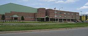
Benjamin Franklin High School, an OPSB-supervised public charter school, is in Lake Terrace/Lake Oaks.[6]
See also
References
- ↑ "US Gazetteer files: 2010, 2000, and 1990". United States Census Bureau. 2011-02-12. Retrieved 2011-04-23.
- ↑ "US Board on Geographic Names". United States Geological Survey. 2007-10-25. Retrieved 2008-01-31.
- ↑ Greater New Orleans Community Data Center. "Lake Terrace/Lake Oaks Neighborhood". Retrieved 2008-06-21.
- 1 2 "Lake Terrace/Lake Oaks Neighborhood". Greater New Orleans Community Data Center. Retrieved 6 January 2012.
- ↑ "New Orleans Division." Federal Bureau of Investigation. Retrieved on June 9, 2015. "2901 Leon C. Simon Boulevard New Orleans, LA 70126"
- ↑ "Benjamin Franklin High School". School Facilities Master Plan for Orleans Parish. New Orleans Public Schools. January 2008. Archived from the original (PDF) on 2009-05-12. Retrieved 2010-02-26.