Lake of the Woods, Ontario
- For other places with the same name, see Lake of the Woods (disambiguation).
| Lake of the Woods | |
|---|---|
| Township (single-tier) | |
| Township of Lake of the Woods | |
|
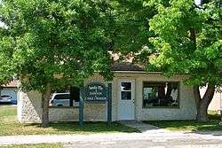
Township office in Rainy River | |
 Lake of the Woods | |
| Coordinates: 49°00′N 94°23′W / 49.000°N 94.383°WCoordinates: 49°00′N 94°23′W / 49.000°N 94.383°W | |
| Country |
|
| Province |
|
| District | Rainy River |
| Formed | January 1, 1998 |
| Government | |
| • Mayor | Valerie Pizey |
| • Federal riding | Thunder Bay—Rainy River |
| • Prov. riding | Kenora—Rainy River |
| Area[1] | |
| • Land | 751.95 km2 (290.33 sq mi) |
| Population (2011)[1] | |
| • Total | 296 |
| • Density | 0.4/km2 (1/sq mi) |
| Time zone | CST (UTC-6) |
| • Summer (DST) | CDT (UTC-5) |
| Postal Code FSA | P0W |
| Area code(s) | 807 |
| Website | www.lakeofthewoods.ca |
Lake of the Woods is a township in the Canadian province of Ontario, located within the Rainy River District. The township is located on the eponymous Lake of the Woods, consisting of mainland in the south-east part of the lake, the southern shores of Aulneau Peninsula, along with several islands in the lake, including Big Island and Bigsby Island. It fully surrounds the Anishnaabeg of Naongashiing, Big Grassy River 35G, Big Island Mainland 93, and Saug-a-Gaw-Sing 1 First Nation reserves.
The township was formed on January 1, 1998, when the former incorporated townships of Morson and McCrosson/Tovell were amalgamated. The following year portions of Unorganized Kenora District were annexed.[2]
The primary communities within the township are Bergland, Minahico and Morson.
Demographics
| Canada census – Lake of the Woods community profile | |||
|---|---|---|---|
| 2011 | 2006 | 2001 | |
| Population: | 296 (-8.4% from 2006) | 323 (-2.1% from 2001) | 330 (-24.3% from 1996) |
| Land area: | 751.95 km2 (290.33 sq mi) | 751.17 km2 (290.03 sq mi) | 753.24 km2 (290.83 sq mi) |
| Population density: | 0.4/km2 (1.0/sq mi) | 0.4/km2 (1.0/sq mi) | 0.4/km2 (1.0/sq mi) |
| Median age: | 49.5 (M: 50.8, F: 48.6) | 43.8 (M: 43.0, F: 43.8) | |
| Total private dwellings: | 555 | 622 | 582 |
| Median household income: | $44,012 | $43,487 | |
| References: 2011[1] 2006[3] 2001[4] | |||
Population trend:[5]
- Population in 2011: 296
- Population in 2006: 323
- Population in 2001: 330
- Population total in 1996: 436
- Morson (township): 192
- McCrosson and Tovell (township): 240
- Population in 1991:
- Morson (township): 206
- McCrosson and Tovell (township): 246
See also
References
- 1 2 3 "Lake of the Woods census profile". 2011 Census of Population. Statistics Canada. Retrieved 2012-03-30.
- ↑ "History". Lake of the Woods Township. Retrieved 2011-05-06.
- ↑ "2006 Community Profiles". Canada 2006 Census. Statistics Canada. March 30, 2011. Retrieved 2011-05-05.
- ↑ "2001 Community Profiles". Canada 2001 Census. Statistics Canada. February 17, 2012. Retrieved 2011-05-05.
- ↑ Statistics Canada: 1996, 2001, 2006 census
External links

| Towns |  | |
|---|---|---|
| Townships | ||
| First Nations | ||
| Indian reserves |
| |
| Unorganized areas | ||
| ||