Lamba, Shetland
Not to be confused with The Lamb (island), Firth of Forth.
| Norse name | Lambey |
|---|---|
 Beacon at south-west of Lamba | |
| Location | |
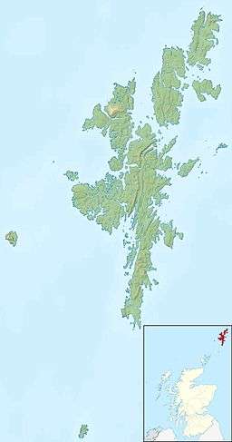 Lamba Lamba shown within Shetland | |
| OS grid reference | HU390816 |
| Physical geography | |
| Island group | Shetland |
| Area | 43 ha (0.17 sq mi) |
| Area rank | 215 [1] |
| Highest elevation | 35 m (115 ft) |
| Administration | |
| Sovereign state | United Kingdom |
| Country | Scotland |
| Council area | Shetland Islands |
| Demographics | |
| Population | 0[2] |
| References | [3][4] |
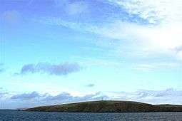
Lamba is an uninhabited island in Yell Sound in Shetland. It lies 1.5 km (0.93 mi) north of the entrance to the Sullom Voe inlet. Rising 35 metres above sea level, it has an area of 43 hectares (0.17 sq mi). Its main features are a 27m high light marking the entrance to Sullom Voe,[5] and an adjacent communications mast.
There are similarly named places, Lamba in the Faroe Islands and Lambay in Ireland.
Coordinates: 60°31′00″N 1°17′26″W / 60.516581°N 1.290622°W
Footnotes
- ↑ Area and population ranks: there are c. 300 islands over 20 ha in extent and 93 permanently inhabited islands were listed in the 2011 census.
- ↑ National Records of Scotland (15 August 2013) (pdf) Statistical Bulletin: 2011 Census: First Results on Population and Household Estimates for Scotland - Release 1C (Part Two). "Appendix 2: Population and households on Scotland’s inhabited islands". Retrieved 17 August 2013.
- ↑ Haswell-Smith, Hamish (2004). The Scottish Islands. Edinburgh: Canongate. ISBN 978-1-84195-454-7.
- ↑ Ordnance Survey. Get-a-map (Map). 1:25,000. Leisure. Ordinance Survey. Retrieved 21 August 2013.
- ↑ "Overview of The Lamb". Gazetteer for Scotland. Retrieved 4 October 2008.
This article is issued from Wikipedia - version of the 8/27/2016. The text is available under the Creative Commons Attribution/Share Alike but additional terms may apply for the media files.