Landsat 6
 | |
| Mission type | Earth imaging |
|---|---|
| Operator | NASA / NOAA |
| Mission duration | Failed to orbit |
| Spacecraft properties | |
| Launch mass | 2,750 kilograms (6,060 lb) |
| Power | 1259 watts |
| Start of mission | |
| Launch date | October 5, 1993 |
| Rocket | Titan II(23)G/Star-37XFP-ISS |
| Launch site | Vandenberg AFB SLC-4W |
| Orbital parameters | |
| Reference system | Geocentric |
| Regime | Sun-synchronous |
| Perigee | 705 kilometres (438 mi) |
| Apogee | 705 kilometres (438 mi) |
| Inclination | 98.3° |
| Period | 98.9 minutes |
| Epoch | Planned |
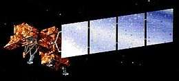
Landsat 6, equipped with upgraded versions of the instruments on its predecessor, was designed to carry forward the Landsat program. It was launched on October 5, 1993 using a Titan II launch vehicle, but failed to reach orbit.[1] As a consequence, Landsat 4 and Landsat 5 were used well beyond their designed lifespan. Landsat 6 omitted the Multi-Spectral Scanner found on its predecessors, but carried an Enhanced Thematic Mapper, which improved on the previous Thematic Mapper by adding a 15m-resolution panchromatic band.[2]
References
- ↑ "Landsat 6 failure attributed to ruptured manifold" (PDF) (Press release). NOAA. March 10, 1995.
- ↑ "Landsat 6". USGS.
This article is issued from Wikipedia - version of the 5/3/2016. The text is available under the Creative Commons Attribution/Share Alike but additional terms may apply for the media files.