Lapwai, Idaho
| Lapwai, Idaho | |
|---|---|
| City | |
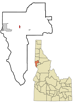 Location of Lapwai, Idaho | |
| Coordinates: 46°24′16″N 116°48′16″W / 46.40444°N 116.80444°WCoordinates: 46°24′16″N 116°48′16″W / 46.40444°N 116.80444°W | |
| Country | United States |
| State | Idaho |
| County | Nez Perce |
| Area[1] | |
| • Total | 0.81 sq mi (2.10 km2) |
| • Land | 0.80 sq mi (2.07 km2) |
| • Water | 0.01 sq mi (0.03 km2) |
| Elevation | 955 ft (291 m) |
| Population (2010)[2] | |
| • Total | 1,137 |
| • Estimate (2012[3]) | 1,140 |
| • Density | 1,421.3/sq mi (548.8/km2) |
| Time zone | Pacific (PST) (UTC-8) |
| • Summer (DST) | PDT (UTC-7) |
| ZIP code | 83540 |
| Area code(s) | 208 |
| FIPS code | 16-45370 |
| GNIS feature ID | 0396768 |
| Website | cityoflapwai.com |
Lapwai is a city in Nez Perce County, Idaho, United States. Its population was 1,137 at the 2010 census, and it is the seat of government of the Nez Perce Indian Reservation.
History
The area that is today Lapwai was the home of Hin-ma-tute-ke-kaikt, also known as Big Thunder and later as James. It was here that Henry H. Spalding established a Protestant mission among the Nez Perce in 1836. This was also the general region that Bill Craig settled since his wife was James' daughter.[4]
The city's predecessor, Fort Lapwai, operated on the site from 1863 to 1884. The village of Lapwai was incorporated in 1911,[5][6] with a model rural school.[7]
The word "Lapwai" means place of the butterflies, as the area had thousands in early summer in earlier years.[8]
Lapwai is part of the Lewiston, ID-WA Metropolitan Statistical Area.
Geography
Lapwai is located at 46°24′16″N 116°48′16″W / 46.40444°N 116.80444°W (46.404388, -116.804376).,[9] at an elevation of 955 feet (291 m) above sea level
According to the United States Census Bureau, the city has a total area of 0.81 square miles (2.10 km2), of which, 0.80 square miles (2.07 km2) is land and 0.01 square miles (0.03 km2) is water.[1]
Transportation
Highway
 - US 95 - to Lewiston (north & west) and Grangeville (southeast)
Railroad
The city is served by the BG&CM Railroad, a freight carrier which operates on the former Second Subdivision line of the Camas Prairie Railroad.
Education
The public schools in Lapwai are operated by Lapwai School District #341, led by Lapwai High School.
Demographics
| Historical population | |||
|---|---|---|---|
| Census | Pop. | %± | |
| 1870 | 91 | — | |
| 1880 | 165 | 81.3% | |
| 1920 | 359 | — | |
| 1930 | 416 | 15.9% | |
| 1940 | 426 | 2.4% | |
| 1950 | 480 | 12.7% | |
| 1960 | 500 | 4.2% | |
| 1970 | 400 | −20.0% | |
| 1980 | 1,043 | 160.8% | |
| 1990 | 932 | −10.6% | |
| 2000 | 1,134 | 21.7% | |
| 2010 | 1,137 | 0.3% | |
| Est. 2015 | 1,147 | [10] | 0.9% |
2010 census
As of the census[2] of 2010, there were 1,137 people, 369 households, and 272 families residing in the city. The population density was 1,421.3 inhabitants per square mile (548.8/km2). There were 397 housing units at an average density of 496.3 per square mile (191.6/km2). The racial makeup of the city was 16.6% White, 0.4% African American, 78.1% Native American, 0.1% Asian, 0.7% from other races, and 4.1% from two or more races. Hispanic or Latino of any race were 4.0% of the population.
There were 369 households of which 46.9% had children under the age of 18 living with them, 35.2% were married couples living together, 26.8% had a female householder with no husband present, 11.7% had a male householder with no wife present, and 26.3% were non-families. 22.8% of all households were made up of individuals and 8.7% had someone living alone who was 65 years of age or older. The average household size was 3.08 and the average family size was 3.58.
The median age in the city was 30.8 years. 31.4% of residents were under the age of 18; 10.9% were between the ages of 18 and 24; 23.9% were from 25 to 44; 24.6% were from 45 to 64; and 9.3% were 65 years of age or older. The gender makeup of the city was 48.7% male and 51.3% female.
2000 census
At the 2000 census,[12] there were 1,134 people, 339 households, and 270 families residing in the city. The population density was 1,466.9 people per square mile (568.6/km²). There were 364 housing units at an average density of 470.9 per square mile (182.5/km²). The racial makeup of the city was 16.14% White, 0.53% African American, 81.39% Native American, 0.62% from other races, and 1.32% from two or more races. Hispanic or Latino of any race were 4.32% of the population.
There were 339 households out of which 48.1% had children under the age of 18 living with them, 40.1% were married couples living together, 27.1% had a female householder with no husband present, and 20.1% were non-families. 17.1% of all households were made up of individuals and 6.8% had someone living alone who was 65 years of age or older. The average household size was 3.35 and the average family size was 3.68.
In the city the population was spread out with 39.8% under the age of 18, 9.3% from 18 to 24, 26.6% from 25 to 44, 17.7% from 45 to 64, and 6.5% who were 65 years of age or older. The median age was 26 years. For every 100 females there were 92.2 males. For every 100 females age 18 and over, there were 90.8 males.
The median income for a household in the city was $26,800, and the median income for a family was $30,417. Males had a median income of $31,382 versus $22,109 for females. The per capita income for the city was $10,159. About 20.5% of families and 23.7% of the population were below the poverty line, including 30.5% of those under age 18 and 10.2% of those age 65 or over.
Notable residents
- Lillian Disney, wife of Walt Disney
See also
References
- 1 2 "US Gazetteer files 2010". United States Census Bureau. Retrieved 2012-12-18.
- 1 2 "American FactFinder". United States Census Bureau. Retrieved 2012-12-18.
- ↑ "Population Estimates". United States Census Bureau. Retrieved 2013-06-03.
- ↑ Alvin M. Joseph, The Nez Perce and the Opening of the Northwest (Lincoln: University of Nebraska Press, 1971)
- ↑ Wilson, Darol (January 30, 1971). "Lapwai became village -- 60 years ago today". Lewiston Morning Tribune. p. 6.
- ↑ "Lapwai growing". Lewiston Morning Tribune. October 29, 1911. p. 10.
- ↑ "Historic Fort Lapwai now site of model rural school". Lewiston Morning Tribune. April 21, 1912. p. 9.
- ↑ Ruark, Janice (November 25, 1977). "Once early-day fort, Lapwai Indians' home". Spokane Daily Chronicle. p. 3.
- ↑ "US Gazetteer files: 2010, 2000, and 1990". United States Census Bureau. 2011-02-12. Retrieved 2011-04-23.
- ↑ "Annual Estimates of the Resident Population for Incorporated Places: April 1, 2010 to July 1, 2015". Retrieved July 2, 2016.
- ↑ "Census of Population and Housing". Census.gov. Retrieved June 4, 2015.
- ↑ "American FactFinder". United States Census Bureau. Retrieved 2008-01-31.
External links
- Official website
- Lapwai School District #341
- University of Idaho Library - digital archives - Lapwai
- University of Washington Libraries - digital archives - Lapwai
Municipalities and communities of Nez Perce County, Idaho, United States | ||
|---|---|---|
| Cities | ||
| CDP | ||
| Unincorporated communities | ||