Laugnac
| Laugnac | ||
|---|---|---|
|
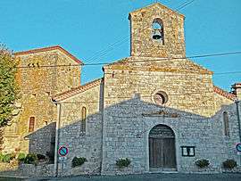
The church and tower in Laugnac | ||
| ||
 Laugnac | ||
|
Location within Nouvelle-Aquitaine region  Laugnac | ||
| Coordinates: 44°18′26″N 0°36′20″E / 44.3072°N 0.6056°ECoordinates: 44°18′26″N 0°36′20″E / 44.3072°N 0.6056°E | ||
| Country | France | |
| Region | Nouvelle-Aquitaine | |
| Department | Lot-et-Garonne | |
| Arrondissement | Arrondissement of Agen | |
| Canton | Canton of Prayssas | |
| Intercommunality | Communauté de communes du canton de Prayssas | |
| Government | ||
| • Mayor (2001–2008) | Jean-Pierre Ducos | |
| Area1 | 17.35 km2 (6.70 sq mi) | |
| Population (1999)2 | 614 | |
| • Density | 35/km2 (92/sq mi) | |
| Time zone | CET (UTC+1) | |
| • Summer (DST) | CEST (UTC+2) | |
| INSEE/Postal code | 47140 / 47360 | |
| Elevation |
90–246 m (295–807 ft) (avg. 120 m or 390 ft) | |
|
1 French Land Register data, which excludes lakes, ponds, glaciers > 1 km² (0.386 sq mi or 247 acres) and river estuaries. 2 Population without double counting: residents of multiple communes (e.g., students and military personnel) only counted once. | ||

Laugnac is a commune in the Lot-et-Garonne department in south-western France.
See also
| Wikimedia Commons has media related to Laugnac. |
This article is issued from Wikipedia - version of the 3/15/2015. The text is available under the Creative Commons Attribution/Share Alike but additional terms may apply for the media files.