Tayrac, Lot-et-Garonne
| Tayrac | ||
|---|---|---|
|
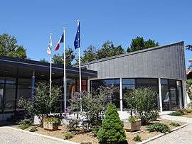
The town hall in Tayrac | ||
| ||
 Tayrac | ||
|
Location within Nouvelle-Aquitaine region  Tayrac | ||
| Coordinates: 44°11′53″N 0°50′33″E / 44.1981°N 0.8425°ECoordinates: 44°11′53″N 0°50′33″E / 44.1981°N 0.8425°E | ||
| Country | France | |
| Region | Nouvelle-Aquitaine | |
| Department | Lot-et-Garonne | |
| Arrondissement | Arrondissement of Agen | |
| Canton | Canton of Beauville | |
| Intercommunality | Communauté de communes des Coteaux de Beauville | |
| Government | ||
| • Mayor (2004–2008) | Gilbert Tovo | |
| Area1 | 12.89 km2 (4.98 sq mi) | |
| Population (1 999)2 | 320 | |
| • Density | 25/km2 (64/sq mi) | |
| Time zone | CET (UTC+1) | |
| • Summer (DST) | CEST (UTC+2) | |
| INSEE/Postal code | 47305 / 47270 | |
| Elevation |
62–193 m (203–633 ft) (avg. 195 m or 640 ft) | |
|
1 French Land Register data, which excludes lakes, ponds, glaciers > 1 km² (0.386 sq mi or 247 acres) and river estuaries. 2 Population without double counting: residents of multiple communes (e.g., students and military personnel) only counted once. | ||
.svg.png)
Tayrac is a commune in the Lot-et-Garonne department in south-western France.
Geography
The Séoune forms the commune's southern border.
See also
| Wikimedia Commons has media related to Tayrac (Lot-et-Garonne). |
This article is issued from Wikipedia - version of the 3/16/2015. The text is available under the Creative Commons Attribution/Share Alike but additional terms may apply for the media files.