Laurel Lake, New Jersey
| Laurel Lake, New Jersey | |
|---|---|
| Census-designated place | |
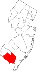
 Map of Laurel Lake highlighted within Cumberland County. Right: Location of Cumberland County in New Jersey. | |
| Coordinates: 39°19′35″N 75°01′50″W / 39.326293°N 75.03062°WCoordinates: 39°19′35″N 75°01′50″W / 39.326293°N 75.03062°W | |
| Country |
|
| State |
|
| County | Cumberland |
| Township | Commercial |
| Area[1] | |
| • Total | 1.863 sq mi (4.827 km2) |
| • Land | 1.740 sq mi (4.508 km2) |
| • Water | 0.123 sq mi (0.319 km2) 6.61% |
| Elevation[2] | 59 ft (18 m) |
| Population (2010 Census)[3] | |
| • Total | 2,989 |
| • Density | 1,717.3/sq mi (663.1/km2) |
| Time zone | Eastern (EST) (UTC-5) |
| • Summer (DST) | Eastern (EDT) (UTC-4) |
| ZIP code | 08332 - Millville[4] |
| Area code(s) | 856 |
| FIPS code | 3439120[1][5] |
| GNIS feature ID | 02390038[1][6] |
Laurel Lake is an unincorporated community and census-designated place (CDP) located within Commercial Township, in Cumberland County, New Jersey, United States.[7][8] It is part of the Vineland-Millville-Bridgeton Primary Metropolitan Statistical Area for statistical purposes. As of the 2010 United States Census, the CDP's population was 2,929.[3]
Geography
According to the United States Census Bureau, the CDP had a total area of 1.863 square miles (4.827 km2), including 1.740 square miles (4.508 km2) of land and 0.123 square miles (0.319 km2) of water (6.61%).[1][9]
Demographics
| Historical population | |||
|---|---|---|---|
| Census | Pop. | %± | |
| 2000 | 2,929 | — | |
| 2010 | 2,989 | 2.0% | |
| Population sources: 2010[3] | |||
Census 2010
At the 2010 United States Census, there were 2,989 people, 1,091 households, and 753.9 families residing in the CDP. The population density was 1,717.3 per square mile (663.1/km2). There were 1,230 housing units at an average density of 706.7 per square mile (272.9/km2). The racial makeup of the CDP was 90.10% (2,693) White, 3.71% (111) Black or African American, 0.33% (10) Native American, 0.54% (16) Asian, 0.00% (0) Pacific Islander, 1.74% (52) from other races, and 3.58% (107) from two or more races. Hispanics or Latinos of any race were 6.52% (195) of the population.[3]
There were 1,091 households, of which 32.3% had children under the age of 18 living with them, 39.0% were married couples living together, 18.9% had a female householder with no husband present, and 30.9% were non-families. 23.6% of all households were made up of individuals, and 8.3% had someone living alone who was 65 years of age or older. The average household size was 2.74 and the average family size was 3.15.[3]
In the CDP, 26.5% of the population were under the age of 18, 9.5% from 18 to 24, 28.0% from 25 to 44, 26.1% from 45 to 64, and 9.9% who were 65 years of age or older. The median age was 35.4 years. For every 100 females there were 99.3 males. For every 100 females age 18 and over, there were 98.7 males.[3]
Census 2000
As of the 2000 United States Census[5] there were 2,929 people, 1,078 households, and 767 families residing in the CDP. The population density was 642.6/km² (1,663.3/mi²). There were 1,240 housing units at an average density of 272.0/km² (704.1/mi²). The racial makeup of the CDP was 95.05% White, 1.74% African American, 0.41% Native American, 0.14% Asian, 0.03% Pacific Islander, 0.82% from other races, and 1.81% from two or more races. Hispanic or Latino of any race were 4.30% of the population.[10]
There were 1,078 households out of which 37.8% had children under the age of 18 living with them, 46.3% were married couples living together, 16.1% had a female householder with no husband present, and 28.8% were non-families. 22.8% of all households were made up of individuals and 8.3% had someone living alone who was 65 years of age or older. The average household size was 2.72 and the average family size was 3.13.[10]
In the CDP the population was spread out with 28.8% under the age of 18, 10.1% from 18 to 24, 30.5% from 25 to 44, 19.7% from 45 to 64, and 10.8% who were 65 years of age or older. The median age was 32 years. For every 100 females there were 98.7 males. For every 100 females age 18 and over, there were 96.6 males.[10]
The median income for a household in the CDP was $32,041, and the median income for a family was $32,432. Males had a median income of $33,299 versus $21,048 for females. The per capita income for the CDP was $12,965. About 15.7% of families and 17.8% of the population were below the poverty line, including 22.8% of those under age 18 and 19.6% of those age 65 or over.[10]
References
- 1 2 3 4 Gazetteer of New Jersey Places, United States Census Bureau. Accessed July 21, 2016.
- ↑ U.S. Geological Survey Geographic Names Information System: Laurel Lake Census Designated Place, Geographic Names Information System. Accessed November 2, 2012.
- 1 2 3 4 5 6 DP-1 - Profile of General Population and Housing Characteristics: 2010 Demographic Profile Data for Laurel Lake CDP, New Jersey, United States Census Bureau. Accessed November 2, 2012.
- ↑ Look Up a ZIP Code for Laurel Lake, NJ, United States Postal Service. Accessed November 2, 2012.
- 1 2 American FactFinder, United States Census Bureau. Accessed September 4, 2014.
- ↑ US Board on Geographic Names, United States Geological Survey. Accessed September 4, 2014.
- ↑ New Jersey: 2010 - Population and Housing Unit Counts - 2010 Census of Population and Housing (CPH-2-32), United States Census Bureau, August 2012. Accessed October 18, 2012.
- ↑ Locality Search, State of New Jersey. Accessed April 19, 2015.
- ↑ US Gazetteer files: 2010, 2000, and 1990, United States Census Bureau. Accessed September 4, 2014.
- 1 2 3 4 DP-1 - Profile of General Demographic Characteristics: 2000 from the Census 2000 Summary File 1 (SF 1) 100-Percent Data for Laurel Lake CDP, New Jersey, United States Census Bureau. Accessed November 2, 2012.