Lauria
| Lauria | |
|---|---|
| Comune | |
| Comune di Lauria | |
 | |
.svg.png) Lauria within the Province of Potenza | |
 Lauria Location of Lauria in Italy | |
| Coordinates: 40°03′N 15°50′E / 40.050°N 15.833°ECoordinates: 40°03′N 15°50′E / 40.050°N 15.833°E | |
| Country | Italy |
| Region | Basilicata |
| Province / Metropolitan city | Potenza (PZ) |
| Frazioni | see list |
| Government | |
| • Mayor | Angelo Lamboglia |
| Area | |
| • Total | 175 km2 (68 sq mi) |
| Elevation | 430 m (1,410 ft) |
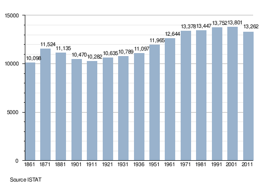
| Population (31 December 2015)[1] | |
| • Total | 12,919 |
| • Density | 74/km2 (190/sq mi) |
| Demonym(s) | Laurioti |
| Time zone | CET (UTC+1) |
| • Summer (DST) | CEST (UTC+2) |
| Postal code | 85044 |
| Dialing code | 0973 |
| Patron saint | Bl. Domenico Lentini |
| Saint day | 25 February |
| Website | Official website |
Lauria is an Italian town and comune of the province of Potenza, in Basilicata, situated near the borders of Calabria. It is a walled town on the steep side of a hill with another portion in the plain below. As of 2015 it had a population of 12,919.[1]
History
The original nucleus of the city appeared probably in the 10th century, near the place where later the Sanctuary of Madonna dell'Armo was edificated. The Castle, later attributed to Roger of Lauria, was built by Saracens. In the 12th century Lauria was the seat of a Norman fief, which was held by Gibel and then by his son Richard of Lauria, who died in the battle of Benevento on 1266.[2]
His son Roger of Lauria was a famous admiral of the 13th century.
In 1806 the city was destroyed and the population slaughtered by the French soldiers under general André Masséna, as punishment for having supported the Bourbon kings.
Geography
Located in southern Basilicata and included in the Appennino Lucano - Val d'Agri - Lagonegrese National Park, Lauria is a hill town divided into a pair of wards: the upper one named Castello and the lower one named Borgo. The municipality borders with Castelluccio Superiore, Castelsaraceno, Lagonegro, Laino Borgo (CS), Latronico, Moliterno, Nemoli, Tortora (CS) and Trecchina.[3][4]
Frazioni
Lauria counts the following hamlets (frazioni) and localities: Acqua delle Donne, Alte Coste, Borgo Seluci, Bivio Seluci, Canicella, Cavallo, Cerase, Cesinelle, Cogliandrino, Gremile, Galdo, Fabbricato, Iacoia, Iacoia di Sotto, Madonna del Carmine, Malfitano, Mazzarella, Melara-Ovo della Vacca, Montegaldo, Pecorone, Piano Cataldo, Piano della Menta, Piano Focara, Pietraferrata, Piscitella, Prestieri, Rosa, Rosa di Sotto, Rosa Molino, Santa Barbara, Santa Filomena, San Giuseppe, Santa Lucia, Seluci, Serino, Seta, Taverna del Postiere, Timparossa, and Timpone di Seluci.
Demographics
Main sights
- The remains of the Castle (13th century)
- The Sanctuary of the Assunta
- The Mother Church of St. Nicholas
- The church of St. James (15th century)
- The Convent of Immacolata (16th century), with a noteworthy cloister
Transport
Lauria is not served by a near airport, anyway the nearest airport is Salerno-Pontecagnano 129 kilometres (80 mi) from Lauria. Other airports are Lamezia Terme and Napoli-Capodichino.
The town is served by the A3 motorway Naples-Reggio Calabria, at the exits "Lauria Nord" and "Lauria Sud" and, until the closure in 1979, by the Lagonegro–Castrovillari-Spezzano Albanese railway.[5]
Gallery
|
.jpg)


Main sights
- The remains of the Castle (13th century)
- The Sanctuary of the Assunta
- The Mother Church of St. Nicholas
- The church of St. James (15th century)
- The Convent of Immacolata (16th century), with a noteworthy cloister
Transport
Lauria is not served by a near airport, anyway the nearest airport is Salerno-Pontecagnano 129 kilometres (80 mi) from Lauria. Other airports are Lamezia Terme and Napoli-Capodichino.
The town is served by the A3 motorway Naples-Reggio Calabria, at the exits "Lauria Nord" and "Lauria Sud" and, until the closure in 1979, by the Lagonegro–Castrovillari-Spezzano Albanese railway.[6]
People
- Roger of Lauria - admiral
- Domenico Lentini - priest
- Rocco Papaleo - actor, film director and singer
- Giovanni Pittella - politician
References
 This article incorporates text from a publication now in the public domain: Chisholm, Hugh, ed. (1911). "article name needed". Encyclopædia Britannica (11th ed.). Cambridge University Press.
- 1 2 Population data from Istat
- ↑ (Italian) History of Lauria
- ↑ 40203 Lauria on OpenStreetMap
- ↑ (Italian) Geography of Lauria
- ↑ (Italian) List of FCL railway lines
- ↑ (Italian) List of FCL railway lines
External links
| Wikimedia Commons has media related to Lauria. |
- Official website (Italian)
- Lauria on comuni-italiani.it (Italian)