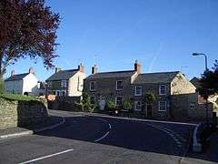
Lavendon
| Lavendon | |
 |
|
 Lavendon |
|
| Population | 1,303 (2011 Census including Warrington, Bucks)[1] |
|---|---|
| OS grid reference | SP915535 |
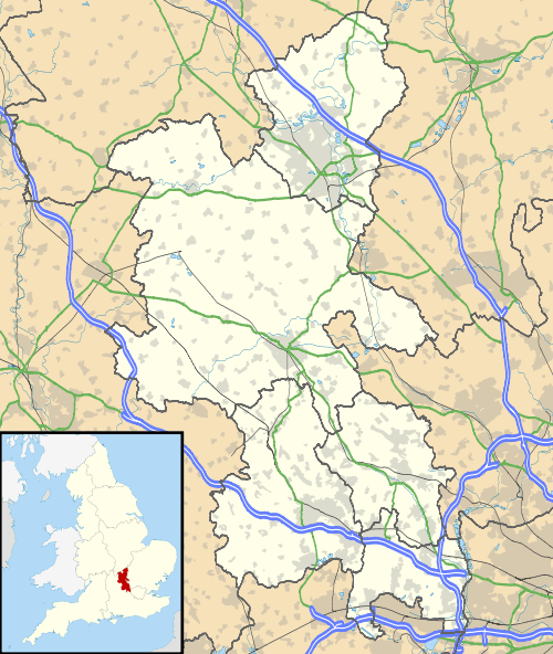
| Civil parish | Lavendon |
| Unitary authority | Milton Keynes |
| Ceremonial county | Buckinghamshire |
| Region | South East |
| Country | England |
| Sovereign state | United Kingdom |
| Post town | OLNEY |
| Postcode district | MK46 |
| Dialling code | 01234 |
| Police | Thames Valley |
| Fire | Buckinghamshire |
| Ambulance | South Central |
| EU Parliament | South East England |
| UK Parliament | Milton Keynes North |
|
|
Coordinates: 52°10′19″N 0°39′47″W / 52.172°N 0.663°W
Lavendon is a village and civil parish in the Borough of Milton Keynes and ceremonial county of Buckinghamshire, England.[2] It is the northernmost village in the Borough, near Olney, eight miles WNW of Bedford, eight miles NNE of Newport Pagnell.
Nearby places are Warrington, and Cold Brayfield in Milton Keynes Borough, and Harrold and Carlton over the border in Bedfordshire.
History
The village name is derived from a personal name and a place-name element from the Old English language (Lafan + denu), and means 'Lafa's valley'. In the Domesday Book of 1086 the village was recorded as Lavendene and Lawendene.[3]
At Castle Farm are the earthworks of a motte-and-bailey castle created in the twelfth century by de Bidun family as the headquarters of their barony of Lavendon.[4] The castle was last recorded in 1232.
The village was once the location of a Premonstratensian abbey, founded between 1155 and 1158 by John de Bidun. The abbey was suppressed in the Dissolution of the Monasteries in 1536.[5] It stood at what is now Grange Farm.
The village is on the route of the 1936 Jarrow March, there is a small plaque on the churchyard wall to commemorate this.
Modern Lavendon
The parish church is dedicated to St Michael, and there is a small but active Baptist Chapel.
The village has a combined school for children from reception (4years) through to year 6 (11years). It also has a village store and Post Office, an independent garage, village hall and two public houses, the Green Man and The Horseshoe. There is also a pre-school and a nursery.
The company Tusting has a small factory on Olney Road producing a wide range of luxury leather goods which are exported worldwide.
References
- ↑ Neighbourhood Statistics 2011 Census, Accessed 4 February 2013
- ↑ Parishes in Milton Keynes - Milton Keynes Council.
- ↑ V. Watts, The Cambridge Dictionary of Place-Names (Cambridge University Press: Cambridge, 2004), p. 363
- ↑ I. J. Sanders, English Baronies: A Study of Their Origin and Descent, 1086-1327 (Clarendon: Oxford, 1960), p. 128; F. Stenton, The First Century of English Feudalism, 1066-1166, 2nd edition (Clarendon Press: Oxford, 1961), p. 205n
- ↑ D. Knowles and R. N. Hadcock, Medieval Religious Houses of England and Wales, 2nd edition (Longmans: London, 1971), pp. 184, 190
External links
![]() Media related to Lavendon at Wikimedia Commons
Media related to Lavendon at Wikimedia Commons