Lempira Department
| Lempira | |
|---|---|
| Department | |
 | |
| Country |
|
| Municipalities | 28 |
| Founded | 1825 |
| Seat | Gracias |
| Government | |
| • Type | Departmental |
| Area | |
| • Total | 4,234 km2 (1,635 sq mi) |
| Population (2015)[1] | |
| • Total | 333,125 |
| • Density | 79/km2 (200/sq mi) |
| Time zone | -6 |
| Postal code | 42101, 42201 |
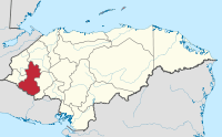
Lempira is one of the 18 departments of Honduras, Central America, located in the western part of the country with borders with El Salvador. It was named Gracias department until 1943, and the departmental capital is Gracias.
In colonial times, Gracias was an early important administrative center for the Spaniards. It eventually lost importance to Antigua, in Guatemala.
Lempira is a rugged department, and it is relatively isolated from the rest of the country. The highest mountain peak in Honduras, Cerro las Minas, is in Lempira. The department was named after Lempira, a local chieftain of the Lenca people who fought against the Spanish conquistadores in the early 16th century. Opals are mined near the town of Opatoro.
The department covers a total surface area of 4,290 km² and, in 2005, had an estimated population of 277,910.
Municipalities
- Belén
- Candelaria
- Cololaca
- Erandique
- Gracias
- Gualcince
- Guarita
- La Campa
- La Iguala
- Las Flores
- La Unión
- La Virtud
- Lepaera
- Mapulaca
- Piraera
- San Andrés
- San Francisco
- San Juan Guarita
- San Manuel Colohete
- San Marcos de Caiquín
- San Rafael
- San Sebastián
- Santa Cruz
- Talgua
- Tambla
- Tomalá
- Valladolid
- Virginia
Template:Honduras
Coordinates: 14°35′N 88°35′W / 14.583°N 88.583°W
References
- ↑ "GeoHive - Honduras extended". Retrieved 2015. Check date values in:
|access-date=(help)