Leroy Township, Audubon County, Iowa
| Leroy Township, Audubon County | |
|---|---|
| Township | |
 | |
| Coordinates: 41°43′50″N 094°55′14″W / 41.73056°N 94.92056°WCoordinates: 41°43′50″N 094°55′14″W / 41.73056°N 94.92056°W | |
| Country |
|
| State |
|
| County | Audubon |
| Area | |
| • Total | 36.8 sq mi (95.4 km2) |
| • Land | 36.8 sq mi (95.4 km2) |
| • Water | 0 sq mi (0 km2) |
| Elevation[1] | 1,434 ft (437 m) |
| Population (2010) | |
| • Total | 2,496 |
| • Density | 68/sq mi (26.2/km2) |
| FIPS code | 19-92418[2] |
| GNIS feature ID | 0468205 |
Leroy Township is one of twelve townships in Audubon County, Iowa, United States. As of the 2010 census, its population was 2,496.[3]
History
Leroy Township was organized in 1873.[4]
Geography
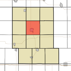
Leroy Township covers an area of 36.8 square miles (95.4 km2) and contains one incorporated settlement, Audubon. According to the USGS, it contains five cemeteries: Aretas Lodge, Arlington Heights, Luccocks Grove, Maple Grove and Saint Patrick's Catholic Cemetery.
References
- ↑ "US Board on Geographic Names". United States Geological Survey. 2007-10-25. Retrieved 2008-01-31.
- ↑ "American FactFinder". United States Census Bureau. Archived from the original on September 11, 2013. Retrieved 2008-01-31.
- ↑ "Geographic Identifiers: 2010 Demographic Profile Data (G001): Leroy township, Audubon County, Iowa". U.S. Census Bureau, American Factfinder. Retrieved May 9, 2013.
- ↑ Andrews, Henry Franklin (1915). History of Audubon County, Iowa: Its People, Industries, and Institutions. Brookhaven Press. p. 58.
External links
Municipalities and communities of Audubon County, Iowa, United States | ||
|---|---|---|
| Cities | ||
| Townships | ||
| Unincorporated communities | ||
This article is issued from Wikipedia - version of the 11/3/2016. The text is available under the Creative Commons Attribution/Share Alike but additional terms may apply for the media files.