Les Planes d'Hostoles
| Les Planes d'Hostoles | |
|---|---|
| Municipality | |
|
St. Christopher's parish church | |
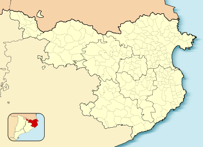
 Les Planes d'Hostoles  Les Planes d'Hostoles Location in Catalonia | |
| Coordinates: ES 42°3′22″N 2°32′23″E / 42.05611°N 2.53972°ECoordinates: ES 42°3′22″N 2°32′23″E / 42.05611°N 2.53972°E | |
| Country |
|
| Community |
|
| Province |
|
| Comarca | Garrotxa |
| Government | |
| • Mayor | Eduard Llorà Cullet (2015)[1] |
| Area[2] | |
| • Total | 37.5 km2 (14.5 sq mi) |
| Population (2014)[1] | |
| • Total | 1,694 |
| • Density | 45/km2 (120/sq mi) |
| Website |
www |
Les Planes d'Hostoles is a village and municipality in the province of Girona and autonomous community of Catalonia, Spain. The municipality covers an area of 37.51 square kilometres (14.48 sq mi) and as of 2011 had a population of 1708 people.[3]
References
- 1 2 "Ajuntament de les Planes d'Hostoles". Generalitat of Catalonia. Retrieved 2015-11-13.
- ↑ "El municipi en xifres: Les Planes d'Hostoles". Statistical Institute of Catalonia. Retrieved 2015-11-23.
- ↑ "Girona: Población por municipios y sexo:Cifras oficiales de población resultantes de la revisión del Padrón municipal a 1 de enero de 2011". Instituto Nacional de Estadística. Archived from the original on May 21, 2012. Retrieved 31 May 2012.
 |
Sant Feliu de Pallerols | Sant Aniol de Finestres |  | |
| Rupit i Pruit | |
|||
| ||||
| | ||||
| Susqueda | Amer |
This article is issued from Wikipedia - version of the 11/10/2016. The text is available under the Creative Commons Attribution/Share Alike but additional terms may apply for the media files.
