Levels, West Virginia
| Levels | |
|---|---|
| Unincorporated community | |
|
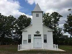
Levels United Methodist Church | |
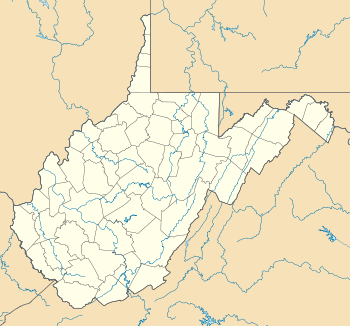 Levels  Levels Location within the state of West Virginia | |
| Coordinates: 39°29′4″N 78°33′13″W / 39.48444°N 78.55361°WCoordinates: 39°29′4″N 78°33′13″W / 39.48444°N 78.55361°W | |
| Country | United States |
| State | West Virginia |
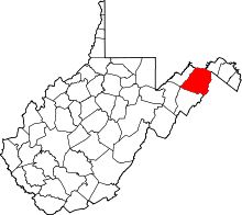
| County | Hampshire |
| Population (2000) | |
| • Total | 147 |
| Time zone | Eastern (EST) (UTC-5) |
| • Summer (DST) | EDT (UTC-4) |
| ZIP codes | 25431 |
| GNIS feature ID | 1541801[1] |
Levels is an unincorporated community in Hampshire County in the U.S. state of West Virginia. According to the 2000 census, the Levels community has a population of 147.[2] It is home to John J. Cornwell Elementary School.
The community was so named on account of the relatively level original town site.[3] Levels was originally known as Levels Cross Roads because of its location at the intersection of four roads in north-central Hampshire County: Bright's Hollow Road (County Route 5/5) north to Okonoko, Little Cacapon-Levels Road (County Route 3/3) southeast to Slanesville, Jersey Mountain Road (County Route 5) south to Romney, and Frenches Station Road (County Route 5/7) northwest to South Branch Depot.
Notable residents
- Howard Llewellyn Swisher (1870–1945), American businessperson, real estate developer, and historian
Churches
- Church of the Brethren
- Capon Chapel Church of the Brethren, Little Cacapon-Levels Road (CR 3/3)
- Oak Grove Church of the Brethren, Jersey Mountain Road (CR 5)
- Methodist
- Levels United Methodist Church, Jersey Mountain Road (CR 5)
References
- ↑ U.S. Geological Survey Geographic Names Information System: Levels, West Virginia
- ↑ Levels, West Virginia ZIP code profile, DownloadZIPCode.com. Accessed 2008-01-19.
- ↑ Kenny, Hamill (1945). West Virginia Place Names: Their Origin and Meaning, Including the Nomenclature of the Streams and Mountains. Piedmont, WV: The Place Name Press. p. 369.
External links

-
 Media related to Levels, West Virginia at Wikimedia Commons