List of Gold Coast suburbs
| Suburbs in the City of Gold Coast | |
|---|---|
 | |
| Location | City of Gold Coast |
| Number | 81 suburbs |
| Populations | 0 (Southern Moreton Bay Islands) – 28,315 (Southport) |
| Areas | 0.6 square kilometres (0.23 sq mi) (Steiglitz) – 100.6 square kilometres (38.8 sq mi) (Numinbah Valley) |
| Subdivisions | Neighbourhoods |
There are eighty-one suburbs in the City of Gold Coast, a local government area in Queensland, Australia. The local government area has been amended several times since its creation in 1948, most dramatically by its amalgamation in 1994 with the Shire of Albert, and losing a section centred on Beenleigh north of the Albert River to Logan City in March 2008.
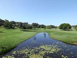
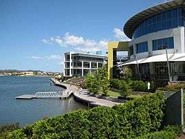
Fifty-two are gazetted as suburbs and twenty-nine as localities. Many suburbs have been established on reclaimed land including saltmarshes, mangroves and tidal flats. Some of these suburbs have developed extensive canal waterways.[1] There are many shopping centres on the Gold Coast.
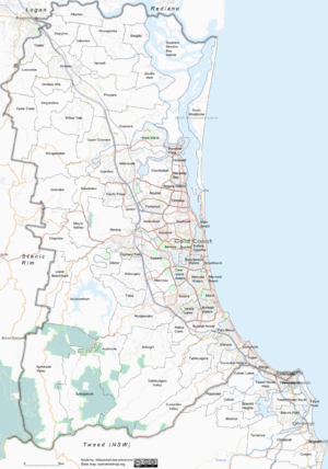
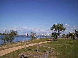
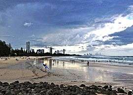
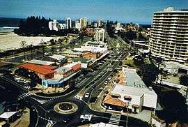
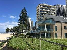
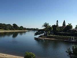
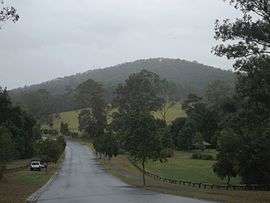
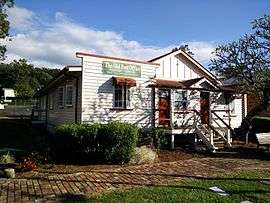
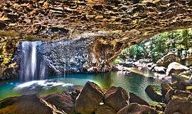
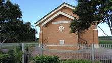
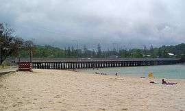
Suburbs
.png)


Former suburbs
| Name | Type | Fate | Reference(s) |
|---|---|---|---|
| Andrews | Suburb | Abolished – its territory was absorbed into Varsity Lakes and Burleigh Heads in 2002 | [356][465][466] |
| Stephens | Suburb | Abolished – its territory was absorbed into Varsity Lakes and Burleigh Heads in 2002 | [465][467] |
| Kerrydale | Suburb | Abolished – its territory was absorbed into Robina in 1995 | [358] |
| Moondewara | Located on South Stradbroke Island but lost into the sea with the northern migration of the Nerang River estuary | ||
Notes
- ↑ The neighbourhood West Burleigh is located within the suburb Burleigh Heads however unlike the suburb which has the postcode 4220, it has the postcode 4219.[75]
- ↑ This is a City, Town, Township.[76]
- ↑ According to the gazetter, it is located within Broadbeach Waters. However it is *actually* in Clear Island Waters. Need to show the boundaries of Broadbeach Waters and Clear Island Waters have changed.
- ↑ This is a Rock.[113]
- ↑ This is a Point, Head, Headland, Ness.[116]
- ↑ This is a Point, Head, Headland, Ness.[180]
- ↑ This is a City, Town, Township.[192]
- ↑ This is a Harbour, Haven.[193]
- ↑ This is a Bay.[233]
- ↑ This is an Island, Island Group, Islet.[235]
- ↑ This is an Island, Island Group, Islet.[333]
- ↑ This is an Island, Island Group, Islet.[334]
- ↑ This is a Beach.[405]
- ↑ This is a Beach.[406]
References
- General references
- "Queensland Globe". State of Queensland. Retrieved 11 December 2016.
- "Place names gazetteer - Queensland". State of Queensland. Retrieved 11 December 2016.
- Inline references
- ↑ McPhee, D. (2015). "Marine environments on the Gold Coast: out with the old, in with the new". In Hundloe, Tor; McDougall, Bridgette; Page, Craig. The Gold Coast Transformed: From Wilderness to Urban Ecosystem. Csiro Publishing. ISBN 978-1-4863-0330-4. Retrieved 7 March 2016.
- ↑ "Advancetown (entry 46023)". Queensland Place Names. Queensland Government. Retrieved 17 June 2016.
- ↑ Australian Bureau of Statistics (31 October 2012). "Advancetown (State Suburb)". 2011 Census QuickStats. Retrieved 17 June 2016.
- 1 2 3 4 5 6 7 8 9 10 11 12 "Gold Coast Inner Hinterland". Queensland Places. Centre for the Government of Queensland, University of Queensland. Retrieved 16 June 2016.
- ↑ "Advancetown history". City of Gold Coast. Council of City of Gold Coast. Retrieved 16 June 2016.
- ↑ "Advancetown Postcode, QLD". Auspost.com.au. Australia Post. Retrieved 19 June 2016.
- ↑ "Alberton (entry 48111)". Queensland Place Names. Queensland Government. Retrieved 17 June 2016.
- ↑ Australian Bureau of Statistics (31 October 2012). "Alberton (State Suburb)". 2011 Census QuickStats. Retrieved 17 June 2016.
- ↑ "Alberton history". City of Gold Coast. Council of City of Gold Coast. Retrieved 16 June 2016.
- 1 2 "Jacobs Well - Alberton". profile.id community profile. Council of City of Gold Coast. Retrieved 18 June 2016.
- ↑ "Alberton Postcode, QLD". Auspost.com.au. Australia Post. Retrieved 30 June 2016.
- ↑ "Arundel (entry 46024)". Queensland Place Names. Queensland Government. Retrieved 17 June 2016.
- ↑ Australian Bureau of Statistics (31 October 2012). "Arundel (State Suburb)". 2011 Census QuickStats. Retrieved 17 June 2016.
- ↑ "Arundel". Queensland Places. Centre for the Government of Queensland, University of Queensland. Retrieved 16 June 2016.
- ↑ "Arundel". profile.id community profile. Council of City of Gold Coast. Retrieved 18 June 2016.
- ↑ "Arundel Postcode, QLD". Auspost.com.au. Australia Post. Retrieved 30 June 2016.
- ↑ "Ashmore (entry 46025)". Queensland Place Names. Queensland Government. Retrieved 17 June 2016.
- ↑ Australian Bureau of Statistics (31 October 2012). "Ashmore (State Suburb)". 2011 Census QuickStats. Retrieved 17 June 2016.
- ↑ "Ashmore". Queensland Places. Centre for the Government of Queensland, University of Queensland. Retrieved 16 June 2016.
- ↑ "Ashmore history". City of Gold Coast. Council of City of Gold Coast. Retrieved 16 June 2016.
- ↑ "Ashmore". profile.id community profile. Council of City of Gold Coast. Retrieved 30 June 2016.
- ↑ "Ashmore Postcode, QLD". Auspost.com.au. Australia Post. Retrieved 30 June 2016.
- ↑ "Austinville (entry 46026)". Queensland Place Names. Queensland Government. Retrieved 17 June 2016.
- ↑ Australian Bureau of Statistics (31 October 2012). "Austinville (State Suburb)". 2011 Census QuickStats. Retrieved 17 June 2016.
- ↑ "Austinville history". City of Gold Coast. Council of City of Gold Coast. Retrieved 16 June 2016.
- ↑ "Austinville Postcode, QLD". Auspost.com.au. Australia Post. Retrieved 30 June 2016.
- ↑ "Benowa (entry 46027)". Queensland Place Names. Queensland Government. Retrieved 17 June 2016.
- ↑ Australian Bureau of Statistics (31 October 2012). "Benowa (State Suburb)". 2011 Census QuickStats. Retrieved 17 June 2016.
- ↑ "Benowa". Queensland Places. Centre for the Government of Queensland, University of Queensland. Retrieved 16 June 2016.
- ↑ "Benowa history". City of Gold Coast. Council of City of Gold Coast. Retrieved 16 June 2016.
- ↑ "Benowa". profile.id community profile. Council of City of Gold Coast. Retrieved 30 June 2016.
- ↑ "Benowa Postcode, QLD". Auspost.com.au. Australia Post. Retrieved 30 June 2016.
- ↑ "Biggera Waters (entry 46028)". Queensland Place Names. Queensland Government. Retrieved 17 June 2016.
- ↑ Australian Bureau of Statistics (31 October 2012). "Biggera Waters (State Suburb)". 2011 Census QuickStats. Retrieved 17 June 2016.
- ↑ "Biggera Waters". Queensland Places. Centre for the Government of Queensland, University of Queensland. Retrieved 16 June 2016.
- ↑ "Biggera Waters history". City of Gold Coast. Council of City of Gold Coast. Retrieved 16 June 2016.
- ↑ "Biggera Waters". profile.id community profile. Council of City of Gold Coast. Retrieved 30 June 2016.
- ↑ "Biggera Waters Postcode, QLD". Auspost.com.au. Australia Post. Retrieved 30 June 2016.
- ↑ "Bilinga (entry 46029)". Queensland Place Names. Queensland Government. Retrieved 17 June 2016.
- ↑ Australian Bureau of Statistics (31 October 2012). "Bilinga (State Suburb)". 2011 Census QuickStats. Retrieved 17 June 2016.
- ↑ "Bilinga". Queensland Places. Centre for the Government of Queensland, University of Queensland. Retrieved 16 June 2016.
- ↑ "Bilinga history". City of Gold Coast. Council of City of Gold Coast. Retrieved 16 June 2016.
- ↑ "Bilinga Postcode, QLD". Auspost.com.au. Australia Post. Retrieved 30 June 2016.
- ↑ "Bonogin (entry 46030)". Queensland Place Names. Queensland Government. Retrieved 17 June 2016.
- ↑ Australian Bureau of Statistics (31 October 2012). "Bonogin (State Suburb)". 2011 Census QuickStats. Retrieved 17 June 2016.
- ↑ "Bonogin". Queensland Places. Centre for the Government of Queensland, University of Queensland. Retrieved 16 June 2016.
- ↑ "Bonogin history". City of Gold Coast. Council of City of Gold Coast. Retrieved 16 June 2016.
- 1 2 "Mudgeeraba - Bonogin". profile.id community profile. Council of City of Gold Coast. Retrieved 30 June 2016.
- ↑ "Bonogin Postcode, QLD". Auspost.com.au. Australia Post. Retrieved 30 June 2016.
- ↑ "Broadbeach (entry 46031)". Queensland Place Names. Queensland Government. Retrieved 17 June 2016.
- ↑ Australian Bureau of Statistics (31 October 2012). "Broadbeach (State Suburb)". 2011 Census QuickStats. Retrieved 17 June 2016.
- ↑ "Broadbeach". Queensland Places. Centre for the Government of Queensland, University of Queensland. Retrieved 16 June 2016.
- ↑ "Broadbeach history". City of Gold Coast. Council of City of Gold Coast. Retrieved 16 June 2016.
- 1 2 "Mermaid Beach - Broadbeach". profile.id community profile. Council of City of Gold Coast. Retrieved 30 June 2016.
- ↑ "Broadbeach Postcode, QLD". Auspost.com.au. Australia Post. Retrieved 30 June 2016.
- ↑ "Rio Vista (entry 28511)". Queensland Place Names. Queensland Government. Retrieved 18 June 2016.
- ↑ "Florida Gardens (entry 12814)". Queensland Place Names. Queensland Government. Retrieved 18 June 2016.
- ↑ "Miami Keys (entry 39195)". Queensland Place Names. Queensland Government. Retrieved 18 June 2016.
- ↑ "Rialto (entry 28416)". Queensland Place Names. Queensland Government. Retrieved 4 July 2016.
- 1 2 "Cypress Gardens (entry 9143)". Queensland Place Names. Queensland Government. Retrieved 1 July 2016.
- ↑ "Moana (entry 22407)". Queensland Place Names. Queensland Government. Retrieved 4 July 2016.
- ↑ "Broadbeach Waters (entry 46032)". Queensland Place Names. Queensland Government. Retrieved 17 June 2016.
- ↑ Australian Bureau of Statistics (31 October 2012). "Broadbeach Waters (State Suburb)". 2011 Census QuickStats. Retrieved 17 June 2016.
- ↑ "Broadbeach Waters". Queensland Places. Centre for the Government of Queensland, University of Queensland. Retrieved 16 June 2016.
- ↑ "Broadbeach Waters history". City of Gold Coast. Council of City of Gold Coast. Retrieved 16 June 2016.
- ↑ "Broadbeach Waters". profile.id community profile. Council of City of Gold Coast. Retrieved 30 June 2016.
- ↑ "Broadbeach Waters Postcode, QLD". Auspost.com.au. Australia Post. Retrieved 30 June 2016.
- ↑ "Sorrento (entry 31408)". Queensland Place Names. Queensland Government. Retrieved 18 June 2016.
- ↑ "Bundall (entry 46033)". Queensland Place Names. Queensland Government. Retrieved 17 June 2016.
- ↑ Australian Bureau of Statistics (31 October 2012). "Bundall (State Suburb)". 2011 Census QuickStats. Retrieved 17 June 2016.
- ↑ "Bundall". Queensland Places. Centre for the Government of Queensland, University of Queensland. Retrieved 16 June 2016.
- ↑ "Bundall history". City of Gold Coast. Council of City of Gold Coast. Retrieved 16 June 2016.
- ↑ "Bundall". profile.id community profile. Council of City of Gold Coast. Retrieved 30 June 2016.
- ↑ "Bundall Postcode, QLD". Auspost.com.au. Australia Post. Retrieved 30 June 2016.
- ↑ "West Burleigh Postcode, QLD". Auspost.com.au. Australia Post. Retrieved 30 June 2016.
- ↑ "North Burleigh (entry 47764)". Queensland Place Names. Queensland Government. Retrieved 1 July 2016.
- ↑ "Sorrento (entry 18366)". Queensland Place Names. Queensland Government. Retrieved 30 June 2016.
- ↑ "Sorrento (entry 37032)". Queensland Place Names. Queensland Government. Retrieved 30 June 2016.
- ↑ "Burleigh Heads (entry 46034)". Queensland Place Names. Queensland Government. Retrieved 17 June 2016.
- ↑ Australian Bureau of Statistics (31 October 2012). "Burleigh Heads (State Suburb)". 2011 Census QuickStats. Retrieved 17 June 2016.
- ↑ "Burleigh Heads". Queensland Places. Centre for the Government of Queensland, University of Queensland. Retrieved 16 June 2016.
- 1 2 "Burleigh history". City of Gold Coast. Council of City of Gold Coast. Retrieved 16 June 2016.
- ↑ "Burleigh Heads". profile.id community profile. Council of City of Gold Coast. Retrieved 30 June 2016.
- ↑ "Burleigh Heads Postcode, QLD". Auspost.com.au. Australia Post. Retrieved 30 June 2016.
- ↑ "Burleigh Waters (entry 46035)". Queensland Place Names. Queensland Government. Retrieved 17 June 2016.
- ↑ Australian Bureau of Statistics (31 October 2012). "Burleigh Waters (State Suburb)". 2011 Census QuickStats. Retrieved 17 June 2016.
- ↑ "Burleigh Waters". Queensland Places. Centre for the Government of Queensland, University of Queensland. Retrieved 16 June 2016.
- ↑ "Burleigh Waters". profile.id community profile. Council of City of Gold Coast. Retrieved 30 June 2016.
- ↑ "Burleigh Waters Postcode, QLD". Auspost.com.au. Australia Post. Retrieved 30 June 2016.
- ↑ "Goodings Corner (entry 14218)". Queensland Place Names. Queensland Government. Retrieved 4 July 2016.
- ↑ "Carrara (entry 46036)". Queensland Place Names. Queensland Government. Retrieved 17 June 2016.
- ↑ Australian Bureau of Statistics (31 October 2012). "Carrara (State Suburb)". 2011 Census QuickStats. Retrieved 17 June 2016.
- 1 2 "Carrara and Merrimac". Queensland Places. Centre for the Government of Queensland, University of Queensland. Retrieved 16 June 2016.
- ↑ "Carrara history". City of Gold Coast. Council of City of Gold Coast. Retrieved 16 June 2016.
- ↑ "Carrara". profile.id community profile. Council of City of Gold Coast. Retrieved 30 June 2016.
- ↑ "Carrara Postcode, QLD". Auspost.com.au. Australia Post. Retrieved 30 June 2016.
- ↑ "Cedar Creek (entry 46037)". Queensland Place Names. Queensland Government. Retrieved 17 June 2016.
- ↑ Australian Bureau of Statistics (31 October 2012). "Cedar Creek (State Suburb)". 2011 Census QuickStats. Retrieved 17 June 2016.
- ↑ "Cedar Creek". Queensland Places. Centre for the Government of Queensland, University of Queensland. Retrieved 16 June 2016.
- ↑ "Cedar Creek history". City of Gold Coast. Council of City of Gold Coast. Retrieved 16 June 2016.
- ↑ "Cedar Creek Postcode, QLD". Auspost.com.au. Australia Post. Retrieved 30 June 2016.
- ↑ "Kulboombin (entry 18571)". Queensland Place Names. Queensland Government. Retrieved 4 July 2016.
- ↑ "Clagiraba (entry 46038)". Queensland Place Names. Queensland Government. Retrieved 17 June 2016.
- ↑ Australian Bureau of Statistics (31 October 2012). "Clagiraba (State Suburb)". 2011 Census QuickStats. Retrieved 17 June 2016.
- ↑ "Clagiraba history". City of Gold Coast. Council of City of Gold Coast. Retrieved 16 June 2016.
- ↑ "Clagiraba Postcode, QLD". Auspost.com.au. Australia Post. Retrieved 30 June 2016.
- ↑ "Clear Island Waters (entry 46039)". Queensland Place Names. Queensland Government. Retrieved 17 June 2016.
- ↑ Australian Bureau of Statistics (31 October 2012). "Clear Island Waters (State Suburb)". 2011 Census QuickStats. Retrieved 17 June 2016.
- ↑ "Clear Island Waters". Queensland Places. Centre for the Government of Queensland, University of Queensland. Retrieved 16 June 2016.
- ↑ "Clear Island Waters". profile.id community profile. Council of City of Gold Coast. Retrieved 30 June 2016.
- ↑ "Clear Island Waters Postcode, QLD". Auspost.com.au. Australia Post. Retrieved 30 June 2016.
- ↑ "Rainbow Bay (entry 27921)". Queensland Place Names. Queensland Government. Retrieved 1 July 2016.
- ↑ "Snapper Rocks (entry 31326)". Queensland Place Names. Queensland Government. Retrieved 1 July 2016.
- ↑ "Greenmount (entry 14786)". Queensland Place Names. Queensland Government. Retrieved 1 July 2016.
- ↑ "Kirra (entry 18304)". Queensland Place Names. Queensland Government. Retrieved 1 July 2016.
- ↑ "Point Danger (entry 9312)". Queensland Place Names. Queensland Government. Retrieved 1 July 2016.
- ↑ "Coolangatta (entry 46040)". Queensland Place Names. Queensland Government. Retrieved 17 June 2016.
- ↑ Australian Bureau of Statistics (31 October 2012). "Coolangatta (State Suburb)". 2011 Census QuickStats. Retrieved 17 June 2016.
- ↑ "Coolangatta". Queensland Places. Centre for the Government of Queensland, University of Queensland. Retrieved 16 June 2016.
- ↑ "Coolangatta history". City of Gold Coast. Council of City of Gold Coast. Retrieved 16 June 2016.
- ↑ "Coolangatta". profile.id community profile. Council of City of Gold Coast. Retrieved 30 June 2016.
- ↑ "Coolangatta Postcode, QLD". Auspost.com.au. Australia Post. Retrieved 30 June 2016.
- ↑ "Coombabah (entry 46041)". Queensland Place Names. Queensland Government. Retrieved 17 June 2016.
- ↑ Australian Bureau of Statistics (31 October 2012). "Coombabah (State Suburb)". 2011 Census QuickStats. Retrieved 17 June 2016.
- ↑ "Coombabah". Queensland Places. Centre for the Government of Queensland, University of Queensland. Retrieved 16 June 2016.
- ↑ "Coombabah history". City of Gold Coast. Council of City of Gold Coast. Retrieved 30 June 2016.
- ↑ "Coombabah". profile.id community profile. Council of City of Gold Coast. Retrieved 30 June 2016.
- ↑ "Coombabah Postcode, QLD". Auspost.com.au. Australia Post. Retrieved 30 June 2016.
- ↑ "Coomera (entry 46042)". Queensland Place Names. Queensland Government. Retrieved 17 June 2016.
- ↑ Australian Bureau of Statistics (31 October 2012). "Coomera (State Suburb)". 2011 Census QuickStats. Retrieved 17 June 2016.
- ↑ "Coomera". Coomera and Coomera Shire. Centre for the Government of Queensland, University of Queensland. Retrieved 16 June 2016.
- 1 2 "Coomera history". City of Gold Coast. Council of City of Gold Coast. Retrieved 30 June 2016.
- ↑ "Coomera". profile.id community profile. Council of City of Gold Coast. Retrieved 30 June 2016.
- ↑ "Coomera Postcode, QLD". Auspost.com.au. Australia Post. Retrieved 30 June 2016.
- ↑ "Currumbin (entry 46043)". Queensland Place Names. Queensland Government. Retrieved 17 June 2016.
- ↑ Australian Bureau of Statistics (31 October 2012). "Currumbin (State Suburb)". 2011 Census QuickStats. Retrieved 17 June 2016.
- ↑ "Currumbin". Queensland Places. Centre for the Government of Queensland, University of Queensland. Retrieved 16 June 2016.
- 1 2 3 "Currumbin history". City of Gold Coast. Council of City of Gold Coast. Retrieved 30 June 2016.
- 1 2 "Currumbin - Tugun". profile.id community profile. Council of City of Gold Coast. Retrieved 30 June 2016.
- ↑ "Currumbin Postcode, QLD". Auspost.com.au. Australia Post. Retrieved 30 June 2016.
- ↑ "Currumbin Waters (entry 46045)". Queensland Place Names. Queensland Government. Retrieved 17 June 2016.
- ↑ Australian Bureau of Statistics (31 October 2012). "Currumbin Waters (State Suburb)". 2011 Census QuickStats. Retrieved 17 June 2016.
- ↑ "Currumbin Waters". Queensland Places. Centre for the Government of Queensland, University of Queensland. Retrieved 16 June 2016.
- ↑ "Currumbin Waters". profile.id community profile. Council of City of Gold Coast. Retrieved 30 June 2016.
- ↑ "Currumbin Waters Postcode, QLD". Auspost.com.au. Australia Post. Retrieved 30 June 2016.
- ↑ "Garden Of Eden (entry 13430)". Queensland Place Names. Queensland Government. Retrieved 4 July 2016.
- ↑ "Hanging Rock (entry 15317)". Queensland Place Names. Queensland Government. Retrieved 4 July 2016.
- ↑ "Piggabeen Crossing Place (entry 26710)". Queensland Place Names. Queensland Government. Retrieved 4 July 2016.
- ↑ "Ridgetop (entry 28473)". Queensland Place Names. Queensland Government. Retrieved 4 July 2016.
- ↑ "The Gap (entry 33939)". Queensland Place Names. Queensland Government. Retrieved 4 July 2016.
- ↑ "Currumbin Valley (entry 46044)". Queensland Place Names. Queensland Government. Retrieved 17 June 2016.
- ↑ Australian Bureau of Statistics (31 October 2012). "Currumbin Valley (State Suburb)". 2011 Census QuickStats. Retrieved 17 June 2016.
- ↑ "Currumbin Valley". Queensland Places. Centre for the Government of Queensland, University of Queensland. Retrieved 16 June 2016.
- 1 2 "Currumbin Valley - Tallebudgera". profile.id community profile. Council of City of Gold Coast. Retrieved 30 June 2016.
- ↑ "Currumbin Valley Postcode, QLD". Auspost.com.au. Australia Post. Retrieved 30 June 2016.
- ↑ "Elanora (entry 46046)". Queensland Place Names. Queensland Government. Retrieved 17 June 2016.
- ↑ Australian Bureau of Statistics (31 October 2012). "Elanora (State Suburb)". 2011 Census QuickStats. Retrieved 17 June 2016.
- ↑ "Elanora". Queensland Places. Centre for the Government of Queensland, University of Queensland. Retrieved 16 June 2016.
- ↑ "Elanora history". City of Gold Coast. Council of City of Gold Coast. Retrieved 30 June 2016.
- ↑ "Elanora". profile.id community profile. Council of City of Gold Coast. Retrieved 30 June 2016.
- ↑ "Elanora Postcode, QLD". Auspost.com.au. Australia Post. Retrieved 30 June 2016.
- ↑ "Gaven (entry 46047)". Queensland Place Names. Queensland Government. Retrieved 17 June 2016.
- ↑ Australian Bureau of Statistics (31 October 2012). "Gaven (State Suburb)". 2011 Census QuickStats. Retrieved 17 June 2016.
- ↑ "Gaven". Queensland Places. Centre for the Government of Queensland, University of Queensland. Retrieved 16 June 2016.
- ↑ "Gaven history". City of Gold Coast. Council of City of Gold Coast. Retrieved 30 June 2016.
- 1 2 "Pacific Pines - Gaven". profile.id community profile. Council of City of Gold Coast. Retrieved 30 June 2016.
- ↑ "Gaven Postcode, QLD". Auspost.com.au. Australia Post. Retrieved 30 June 2016.
- ↑ "Gilberton (entry 46048)". Queensland Place Names. Queensland Government. Retrieved 17 June 2016.
- ↑ "Gilberton Postcode, QLD". Auspost.com.au. Australia Post. Retrieved 30 June 2016.
- ↑ "Latimers Crossing (entry 19036)". Queensland Place Names. Queensland Government. Retrieved 4 July 2016.
- ↑ "Gilston (entry 48133)". Queensland Place Names. Queensland Government. Retrieved 17 June 2016.
- ↑ Australian Bureau of Statistics (31 October 2012). "Gilston (State Suburb)". 2011 Census QuickStats. Retrieved 17 June 2016.
- ↑ "Gilston history". City of Gold Coast. Council of City of Gold Coast. Retrieved 30 June 2016.
- ↑ "Gilston Postcode, QLD". Auspost.com.au. Australia Post. Retrieved 30 June 2016.
- ↑ "Guanaba (entry 46050)". Queensland Place Names. Queensland Government. Retrieved 17 June 2016.
- ↑ Australian Bureau of Statistics (31 October 2012). "Guanaba (State Suburb)". 2011 Census QuickStats. Retrieved 17 June 2016.
- ↑ "Guanaba history". City of Gold Coast. Council of City of Gold Coast. Retrieved 30 June 2016.
- 1 2 "Guanaba - Springbrook". profile.id community profile. Council of City of Gold Coast. Retrieved 30 June 2016.
- ↑ "Guanaba Postcode, QLD". Auspost.com.au. Australia Post. Retrieved 30 June 2016.
- ↑ "Coombabah Lake (entry 8165)". Queensland Place Names. Queensland Government. Retrieved 1 July 2016.
- ↑ "Helensvale (entry 46052)". Queensland Place Names. Queensland Government. Retrieved 17 June 2016.
- ↑ Australian Bureau of Statistics (31 October 2012). "Helensvale (State Suburb)". 2011 Census QuickStats. Retrieved 17 June 2016.
- ↑ "Helensvale". Queensland Places. Centre for the Government of Queensland, University of Queensland. Retrieved 16 June 2016.
- ↑ "Helensvale history". City of Gold Coast. Council of City of Gold Coast. Retrieved 30 June 2016.
- ↑ "Helensvale". profile.id community profile. Council of City of Gold Coast. Retrieved 30 June 2016.
- ↑ "Helensvale Postcode, QLD". Auspost.com.au. Australia Post. Retrieved 30 June 2016.
- ↑ "Highland Park (entry 46052)". Queensland Place Names. Queensland Government. Retrieved 17 June 2016.
- ↑ Australian Bureau of Statistics (31 October 2012). "Highland Park (State Suburb)". 2011 Census QuickStats. Retrieved 17 June 2016.
- ↑ "Highland Park". Queensland Places. Centre for the Government of Queensland, University of Queensland. Retrieved 16 June 2016.
- ↑ "Highland Park". profile.id community profile. Council of City of Gold Coast. Retrieved 30 June 2016.
- ↑ "Highland Park Postcode, QLD". Auspost.com.au. Australia Post. Retrieved 30 June 2016.
- ↑ "Sanctuary Cove (entry 29566)". Queensland Place Names. Queensland Government. Retrieved 1 July 2016.
- ↑ "Hope Harbour (entry 16110)". Queensland Place Names. Queensland Government. Retrieved 1 July 2016.
- ↑ "Boykambil (entry 4218)". Queensland Place Names. Queensland Government. Retrieved 1 July 2016.
- ↑ "Santa Barbara (entry 29936)". Queensland Place Names. Queensland Government. Retrieved 1 July 2016.
- ↑ "Hope Island (entry 46054)". Queensland Place Names. Queensland Government. Retrieved 17 June 2016.
- ↑ Australian Bureau of Statistics (31 October 2012). "Hope Island (State Suburb)". 2011 Census QuickStats. Retrieved 17 June 2016.
- ↑ "Hope Island". Queensland Places. Centre for the Government of Queensland, University of Queensland. Retrieved 16 June 2016.
- ↑ "Hope Island history". City of Gold Coast. Council of City of Gold Coast. Retrieved 30 June 2016.
- ↑ "Hope Island". profile.id community profile. Council of City of Gold Coast. Retrieved 30 June 2016.
- ↑ "Hope Island Postcode, QLD". Auspost.com.au. Australia Post. Retrieved 30 June 2016.
- ↑ "Hollywell (entry 46053)". Queensland Place Names. Queensland Government. Retrieved 17 June 2016.
- ↑ Australian Bureau of Statistics (31 October 2012). "Hollywell (State Suburb)". 2011 Census QuickStats. Retrieved 17 June 2016.
- ↑ "Hollywell". Queensland Places. Centre for the Government of Queensland, University of Queensland. Retrieved 16 June 2016.
- 1 2 "Paradise Point - Hollywell". profile.id community profile. Council of City of Gold Coast. Retrieved 30 June 2016.
- ↑ "Hollywell Postcode, QLD". Auspost.com.au. Australia Post. Retrieved 30 June 2016.
- ↑ "Jacobs Well (entry 46055)". Queensland Place Names. Queensland Government. Retrieved 17 June 2016.
- ↑ Australian Bureau of Statistics (31 October 2012). "Jacobs Well (State Suburb)". 2011 Census QuickStats. Retrieved 17 June 2016.
- ↑ "Jacobs Well". Queensland Places. Centre for the Government of Queensland, University of Queensland. Retrieved 16 June 2016.
- ↑ "Jacobs Well history". City of Gold Coast. Council of City of Gold Coast. Retrieved 30 June 2016.
- ↑ "Jacobs Well Postcode, QLD". Auspost.com.au. Australia Post. Retrieved 30 June 2016.
- ↑ "Kingsholme (entry 46056)". Queensland Place Names. Queensland Government. Retrieved 17 June 2016.
- ↑ Australian Bureau of Statistics (31 October 2012). "Kingsholme (State Suburb)". 2011 Census QuickStats. Retrieved 17 June 2016.
- ↑ "Kingsholme history". City of Gold Coast. Council of City of Gold Coast. Retrieved 30 June 2016.
- ↑ "Kingsholme Postcode, QLD". Auspost.com.au. Australia Post. Retrieved 30 June 2016.
- ↑ "Heydon Heights (entry 15831)". Queensland Place Names. Queensland Government. Retrieved 4 July 2016.
- ↑ "Labrador (entry 46057)". Queensland Place Names. Queensland Government. Retrieved 17 June 2016.
- ↑ Australian Bureau of Statistics (31 October 2012). "Labrador (State Suburb)". 2011 Census QuickStats. Retrieved 17 June 2016.
- ↑ "Labrador". Queensland Places. Centre for the Government of Queensland, University of Queensland. Retrieved 16 June 2016.
- ↑ "Labrador history". City of Gold Coast. Council of City of Gold Coast. Retrieved 30 June 2016.
- ↑ "Labrador". profile.id community profile. Council of City of Gold Coast. Retrieved 30 June 2016.
- ↑ "Labrador Postcode, QLD". Auspost.com.au. Australia Post. Retrieved 30 June 2016.
- ↑ "Lower Beechmont (entry 46058)". Queensland Place Names. Queensland Government. Retrieved 17 June 2016.
- ↑ Australian Bureau of Statistics (31 October 2012). "Lower Beechmont (State Suburb)". 2011 Census QuickStats. Retrieved 17 June 2016.
- ↑ "Beechmont and Lower Beechmont". Queensland Places. Centre for the Government of Queensland, University of Queensland. Retrieved 16 June 2016.
- ↑ "Lower Beechmont history". City of Gold Coast. Council of City of Gold Coast. Retrieved 30 June 2016.
- ↑ "Lower Beechmont Postcode, QLD". Auspost.com.au. Australia Post. Retrieved 30 June 2016.
- ↑ "Luscombe (entry 46059)". Queensland Place Names. Queensland Government. Retrieved 17 June 2016.
- ↑ Australian Bureau of Statistics (31 October 2012). "Luscombe (State Suburb)". 2011 Census QuickStats. Retrieved 17 June 2016.
- ↑ "Luscombe history". City of Gold Coast. Council of City of Gold Coast. Retrieved 30 June 2016.
- ↑ "Luscombe Postcode, QLD". Auspost.com.au. Australia Post. Retrieved 30 June 2016.
- ↑ "The Spit (entry 34127)". Queensland Place Names. Queensland Government. Retrieved 4 July 2016.
- ↑ "Marine Stadium (entry 49294)". Queensland Place Names. Queensland Government. Retrieved 1 July 2016.
- ↑ "Paradise Waters (entry 26051)". Queensland Place Names. Queensland Government. Retrieved 1 July 2016.
- ↑ "MacIntosh Island (entry 20417)". Queensland Place Names. Queensland Government. Retrieved 1 July 2016.
- ↑ "Main Beach (entry 46540)". Queensland Place Names. Queensland Government. Retrieved 17 June 2016.
- ↑ Australian Bureau of Statistics (31 October 2012). "Main Beach (State Suburb)". 2011 Census QuickStats. Retrieved 17 June 2016.
- ↑ "Main Beach". Queensland Places. Centre for the Government of Queensland, University of Queensland. Retrieved 16 June 2016.
- ↑ "Main Beach history". City of Gold Coast. Council of City of Gold Coast. Retrieved 30 June 2016.
- ↑ "Main Beach". profile.id community profile. Council of City of Gold Coast. Retrieved 30 June 2016.
- ↑ "Main Beach Postcode, QLD". Auspost.com.au. Australia Post. Retrieved 30 June 2016.
- ↑ "Maudsland (entry 49319)". Queensland Place Names. Queensland Government. Retrieved 17 June 2016.
- ↑ Australian Bureau of Statistics (31 October 2012). "Maudsland (State Suburb)". 2011 Census QuickStats. Retrieved 17 June 2016.
- 1 2 "Oxenford - Maudsland". profile.id community profile. Council of City of Gold Coast. Retrieved 30 June 2016.
- ↑ "Maudsland Postcode, QLD". Auspost.com.au. Australia Post. Retrieved 30 June 2016.
- ↑ "Nobby Beach (entry 39209)". Queensland Place Names. Queensland Government. Retrieved 1 July 2016.
- ↑ "Mermaid Beach (entry 46061)". Queensland Place Names. Queensland Government. Retrieved 17 June 2016.
- ↑ Australian Bureau of Statistics (31 October 2012). "Mermaid Beach (State Suburb)". 2011 Census QuickStats. Retrieved 17 June 2016.
- ↑ "Mermaid Beach". Queensland Places. Centre for the Government of Queensland, University of Queensland. Retrieved 16 June 2016.
- 1 2 "Mermaid Beach history". City of Gold Coast. Council of City of Gold Coast. Retrieved 30 June 2016.
- ↑ "Mermaid Beach Postcode, QLD". Auspost.com.au. Australia Post. Retrieved 30 June 2016.
- ↑ "Mermaid Waters (entry 46062)". Queensland Place Names. Queensland Government. Retrieved 17 June 2016.
- ↑ Australian Bureau of Statistics (31 October 2012). "Mermaid Waters (State Suburb)". 2011 Census QuickStats. Retrieved 17 June 2016.
- ↑ "Mermaid Waters". Queensland Places. Centre for the Government of Queensland, University of Queensland. Retrieved 16 June 2016.
- ↑ "Mermaid Waters". profile.id community profile. Council of City of Gold Coast. Retrieved 30 June 2016.
- ↑ "Mermaid Waters Postcode, QLD". Auspost.com.au. Australia Post. Retrieved 30 June 2016.
- ↑ "Merrimac (entry 46063)". Queensland Place Names. Queensland Government. Retrieved 17 June 2016.
- ↑ Australian Bureau of Statistics (31 October 2012). "Merrimac (State Suburb)". 2011 Census QuickStats. Retrieved 17 June 2016.
- ↑ "Merrimac history". City of Gold Coast. Council of City of Gold Coast. Retrieved 30 June 2016.
- ↑ "Merrimac". profile.id community profile. Council of City of Gold Coast. Retrieved 30 June 2016.
- ↑ "Merrimac Postcode, QLD". Auspost.com.au. Australia Post. Retrieved 30 June 2016.
- ↑ "Miami (entry 46064)". Queensland Place Names. Queensland Government. Retrieved 17 June 2016.
- ↑ Australian Bureau of Statistics (31 October 2012). "Miami (State Suburb)". 2011 Census QuickStats. Retrieved 17 June 2016.
- 1 2 "Miami". Queensland Places. Centre for the Government of Queensland, University of Queensland. Retrieved 16 June 2016.
- ↑ "Miami history". City of Gold Coast. Council of City of Gold Coast. Retrieved 30 June 2016.
- ↑ "Miami". profile.id community profile. Council of City of Gold Coast. Retrieved 30 June 2016.
- ↑ "Miami Postcode, QLD". Auspost.com.au. Australia Post. Retrieved 30 June 2016.
- ↑ "Molendinar (entry 46065)". Queensland Place Names. Queensland Government. Retrieved 17 June 2016.
- ↑ Australian Bureau of Statistics (31 October 2012). "Molendinar (State Suburb)". 2011 Census QuickStats. Retrieved 17 June 2016.
- ↑ "Molendinar history". City of Gold Coast. Council of City of Gold Coast. Retrieved 30 June 2016.
- ↑ "Molendinar". profile.id community profile. Council of City of Gold Coast. Retrieved 30 June 2016.
- ↑ "Molendinar Postcode, QLD". Auspost.com.au. Australia Post. Retrieved 30 June 2016.
- ↑ "Mount Nathan (entry 46066)". Queensland Place Names. Queensland Government. Retrieved 17 June 2016.
- ↑ Australian Bureau of Statistics (31 October 2012). "Mount Nathan (State Suburb)". 2011 Census QuickStats. Retrieved 17 June 2016.
- 1 2 "Nerang - Mount Nathan". profile.id community profile. Council of City of Gold Coast. Retrieved 30 June 2016.
- ↑ "Mount Nathan Postcode, QLD". Auspost.com.au. Australia Post. Retrieved 30 June 2016.
- ↑ Allen & Lane 1914, p. 26
- ↑ Hanlon 1935, p. 234
- ↑ Watson 1944, p. 105
- ↑ "Mudgeeraba (entry 46067)". Queensland Place Names. Queensland Government. Retrieved 17 June 2016.
- ↑ Australian Bureau of Statistics (31 October 2012). "Mudgeeraba (State Suburb)". 2011 Census QuickStats. Retrieved 17 June 2016.
- ↑ "Mudgeeraba". Queensland Places. Centre for the Government of Queensland, University of Queensland. Retrieved 16 June 2016.
- ↑ "Mudgeeraba history". City of Gold Coast. Council of City of Gold Coast. Retrieved 30 June 2016.
- ↑ "Mudgeeraba Postcode, QLD". Auspost.com.au. Australia Post. Retrieved 30 June 2016.
- ↑ "Mallawa (entry 20716)". Queensland Place Names. Queensland Government. Retrieved 4 July 2016.
- ↑ "Natural Bridge (entry 47850)". Queensland Place Names. Queensland Government. Retrieved 17 June 2016.
- ↑ "Natural Bridge history". City of Gold Coast. Council of City of Gold Coast. Retrieved 30 June 2016.
- ↑ "Natural Bridge Postcode, QLD". Auspost.com.au. Australia Post. Retrieved 30 June 2016.
- ↑ "Nerang (entry 48134)". Queensland Place Names. Queensland Government. Retrieved 17 June 2016.
- ↑ Australian Bureau of Statistics (31 October 2012). "Nerang (State Suburb)". 2011 Census QuickStats. Retrieved 17 June 2016.
- ↑ "Nerang and Nerang Shire". Queensland Places. Centre for the Government of Queensland, University of Queensland. Retrieved 16 June 2016.
- ↑ "Nerang history". City of Gold Coast. Council of City of Gold Coast. Retrieved 30 June 2016.
- ↑ "Nerang Postcode, QLD". Auspost.com.au. Australia Post. Retrieved 30 June 2016.
- ↑ "Neranwood (entry 46070)". Queensland Place Names. Queensland Government. Retrieved 17 June 2016.
- ↑ "Neranwood Postcode, QLD". Auspost.com.au. Australia Post. Retrieved 30 June 2016.
- ↑ "Norwell (entry 46071)". Queensland Place Names. Queensland Government. Retrieved 17 June 2016.
- ↑ Australian Bureau of Statistics (31 October 2012). "Norwell (State Suburb)". 2011 Census QuickStats. Retrieved 17 June 2016.
- 1 2 "Pimpama Island". Queensland Places. Centre for the Government of Queensland, University of Queensland. Retrieved 16 June 2016.
- ↑ "Norwell history". City of Gold Coast. Council of City of Gold Coast. Retrieved 30 June 2016.
- ↑ "Norwell Postcode, QLD". Auspost.com.au. Australia Post. Retrieved 30 June 2016.
- ↑ "Numinbah Valley (entry 47851)". Queensland Place Names. Queensland Government. Retrieved 17 June 2016.
- ↑ Australian Bureau of Statistics (31 October 2012). "Numinbah Valley (State Suburb)". 2011 Census QuickStats. Retrieved 17 June 2016.
- ↑ "Numinbah Valley history". City of Gold Coast. Council of City of Gold Coast. Retrieved 30 June 2016.
- ↑ "Numinbah Valley Postcode, QLD". Auspost.com.au. Australia Post. Retrieved 30 June 2016.
- ↑ "Cupania (entry 28511)". Queensland Place Names. Queensland Government. Retrieved 4 July 2016.
- ↑ "Ormeau (entry 46073)". Queensland Place Names. Queensland Government. Retrieved 17 June 2016.
- ↑ Australian Bureau of Statistics (31 October 2012). "Ormeau (State Suburb)". 2011 Census QuickStats. Retrieved 17 June 2016.
- ↑ "Ormeau". Queensland Places. Centre for the Government of Queensland, University of Queensland. Retrieved 16 June 2016.
- 1 2 "Ormeau history". City of Gold Coast. Council of City of Gold Coast. Retrieved 30 June 2016.
- 1 2 "Ormeau - Yatala". profile.id community profile. Council of City of Gold Coast. Retrieved 30 June 2016.
- ↑ "Ormeau Postcode, QLD". Auspost.com.au. Australia Post. Retrieved 30 June 2016.
- ↑ "Ormeau Hills (entry 46074)". Queensland Place Names. Queensland Government. Retrieved 17 June 2016.
- ↑ Australian Bureau of Statistics (31 October 2012). "Ormeau Hills (State Suburb)". 2011 Census QuickStats. Retrieved 17 June 2016.
- ↑ "Ormeau Hills". Queensland Places. Centre for the Government of Queensland, University of Queensland. Retrieved 16 June 2016.
- ↑ "Ormeau Hills Postcode, QLD". Auspost.com.au. Australia Post. Retrieved 30 June 2016.
- ↑ "Studio Village (entry 39101)". Queensland Place Names. Queensland Government. Retrieved 1 July 2016.
- ↑ "Oxenford (entry 46075)". Queensland Place Names. Queensland Government. Retrieved 17 June 2016.
- ↑ Australian Bureau of Statistics (31 October 2012). "Oxenford (State Suburb)". 2011 Census QuickStats. Retrieved 17 June 2016.
- ↑ "Oxenford". Queensland Places. Centre for the Government of Queensland, University of Queensland. Retrieved 16 June 2016.
- ↑ "Oxenford history". City of Gold Coast. Council of City of Gold Coast. Retrieved 30 June 2016.
- ↑ "Oxenford Postcode, QLD". Auspost.com.au. Australia Post. Retrieved 30 June 2016.
- ↑ "Pacific Pines (entry 46076)". Queensland Place Names. Queensland Government. Retrieved 17 June 2016.
- ↑ Australian Bureau of Statistics (31 October 2012). "Pacific Pines (State Suburb)". 2011 Census QuickStats. Retrieved 17 June 2016.
- ↑ "Pacific Pines". Queensland Places. Centre for the Government of Queensland, University of Queensland. Retrieved 16 June 2016.
- ↑ "Pacific Pines history". City of Gold Coast. Council of City of Gold Coast. Retrieved 30 June 2016.
- ↑ "Pacific Pines Postcode, QLD". Auspost.com.au. Australia Post. Retrieved 30 June 2016.
- ↑ "Palm Beach (entry 46077)". Queensland Place Names. Queensland Government. Retrieved 17 June 2016.
- ↑ Australian Bureau of Statistics (31 October 2012). "Palm Beach (State Suburb)". 2011 Census QuickStats. Retrieved 17 June 2016.
- ↑ "Palm Beach". Queensland Places. Centre for the Government of Queensland, University of Queensland. Retrieved 16 June 2016.
- ↑ "Palm Beach history". City of Gold Coast. Council of City of Gold Coast. Retrieved 30 June 2016.
- ↑ "Palm Beach". profile.id community profile. Council of City of Gold Coast. Retrieved 30 June 2016.
- ↑ "Palm Beach Postcode, QLD". Auspost.com.au. Australia Post. Retrieved 30 June 2016.
- ↑ "Ephraim Island (entry 11799)". Queensland Place Names. Queensland Government. Retrieved 1 July 2016.
- ↑ "Sovereign Islands (entry 31576)". Queensland Place Names. Queensland Government. Retrieved 1 July 2016.
- ↑ "Paradise Point (entry 46078)". Queensland Place Names. Queensland Government. Retrieved 17 June 2016.
- ↑ Australian Bureau of Statistics (31 October 2012). "Paradise Point (State Suburb)". 2011 Census QuickStats. Retrieved 17 June 2016.
- ↑ "Paradise Point". Queensland Places. Centre for the Government of Queensland, University of Queensland. Retrieved 16 June 2016.
- ↑ "Paradise Point Postcode, QLD". Auspost.com.au. Australia Post. Retrieved 30 June 2016.
- ↑ "Parkwood (entry 46079)". Queensland Place Names. Queensland Government. Retrieved 17 June 2016.
- ↑ Australian Bureau of Statistics (31 October 2012). "Parkwood (State Suburb)". 2011 Census QuickStats. Retrieved 17 June 2016.
- ↑ "Parkwood". Queensland Places. Centre for the Government of Queensland, University of Queensland. Retrieved 16 June 2016.
- ↑ "Parkwood". profile.id community profile. Council of City of Gold Coast. Retrieved 30 June 2016.
- ↑ "Parkwood Postcode, QLD". Auspost.com.au. Australia Post. Retrieved 30 June 2016.
- ↑ "Green Meadows (entry 14749)". Queensland Place Names. Queensland Government. Retrieved 4 July 2016.
- ↑ "Mccoys Pocket (entry 21326)". Queensland Place Names. Queensland Government. Retrieved 4 July 2016.
- ↑ "Pimpama (entry 46080)". Queensland Place Names. Queensland Government. Retrieved 17 June 2016.
- ↑ Australian Bureau of Statistics (31 October 2012). "Pimpama (State Suburb)". 2011 Census QuickStats. Retrieved 17 June 2016.
- ↑ "Pimpama". Queensland Places. Centre for the Government of Queensland, University of Queensland. Retrieved 16 June 2016.
- ↑ "Pimpama history". City of Gold Coast. Council of City of Gold Coast. Retrieved 30 June 2016.
- ↑ "Pimpama". profile.id community profile. Council of City of Gold Coast. Retrieved 30 June 2016.
- ↑ "Pimpama Postcode, QLD". Auspost.com.au. Australia Post. Retrieved 30 June 2016.
- ↑ "Anglers Paradise (entry 613)". Queensland Place Names. Queensland Government. Retrieved 4 July 2016.
- ↑ "Reedy Creek (entry 46081)". Queensland Place Names. Queensland Government. Retrieved 17 June 2016.
- ↑ Australian Bureau of Statistics (31 October 2012). "Reedy Creek (State Suburb)". 2011 Census QuickStats. Retrieved 17 June 2016.
- ↑ "Reedy Creek". Queensland Places. Centre for the Government of Queensland, University of Queensland. Retrieved 16 June 2016.
- 1 2 "Reedy Creek - Andrews". profile.id community profile. Council of City of Gold Coast. Retrieved 30 June 2016.
- ↑ "Reedy Creek Postcode, QLD". Auspost.com.au. Australia Post. Retrieved 30 June 2016.
- 1 2 "Robina (entry 46082)". Queensland Place Names. Queensland Government. Retrieved 17 June 2016.
- ↑ Australian Bureau of Statistics (31 October 2012). "Robina (State Suburb)". 2011 Census QuickStats. Retrieved 17 June 2016.
- ↑ "Robina". Queensland Places. Centre for the Government of Queensland, University of Queensland. Retrieved 16 June 2016.
- ↑ "Robina history". City of Gold Coast. Council of City of Gold Coast. Retrieved 30 June 2016.
- ↑ "Robina". profile.id community profile. Council of City of Gold Coast. Retrieved 30 June 2016.
- ↑ "Robina Postcode, QLD". Auspost.com.au. Australia Post. Retrieved 30 June 2016.
- ↑ "Runaway Bay (entry 46083)". Queensland Place Names. Queensland Government. Retrieved 17 June 2016.
- ↑ Australian Bureau of Statistics (31 October 2012). "Runaway Bay (State Suburb)". 2011 Census QuickStats. Retrieved 17 June 2016.
- ↑ "Runaway Bay". Queensland Places. Centre for the Government of Queensland, University of Queensland. Retrieved 16 June 2016.
- ↑ "Runaway Bay history". City of Gold Coast. Council of City of Gold Coast. Retrieved 30 June 2016.
- ↑ "Runaway Bay". profile.id community profile. Council of City of Gold Coast. Retrieved 30 June 2016.
- ↑ "Runaway Bay Postcode, QLD". Auspost.com.au. Australia Post. Retrieved 30 June 2016.
- ↑ "Couran (entry 8563)". Queensland Place Names. Queensland Government. Retrieved 4 July 2016.
- ↑ "Currigee (entry 9082)". Queensland Place Names. Queensland Government. Retrieved 4 July 2016.
- ↑ "South Stradbroke (entry 46084)". Queensland Place Names. Queensland Government. Retrieved 17 June 2016.
- ↑ Australian Bureau of Statistics (31 October 2012). "South Stradbroke (State Suburb)". 2011 Census QuickStats. Retrieved 17 June 2016.
- ↑ "Stradbroke Island". Queensland Places. Centre for the Government of Queensland, University of Queensland. Retrieved 16 June 2016.
- ↑ "South Stradbroke history". City of Gold Coast. Council of City of Gold Coast. Retrieved 30 June 2016.
- ↑ "South Stradbroke Postcode, QLD". Auspost.com.au. Australia Post. Retrieved 30 June 2016.
- ↑ "Southern Moreton Bay Islands (entry 46085)". Queensland Place Names. Queensland Government. Retrieved 17 June 2016.
- ↑ Australian Bureau of Statistics (31 October 2012). "Southern Moreton Bay Islands (State Suburb)". 2011 Census QuickStats. Retrieved 17 June 2016.
- ↑ "Southern Moreton Bay Islands history". City of Gold Coast. Council of City of Gold Coast. Retrieved 30 June 2016.
- ↑ "Musgrave Hill (entry 23651)". Queensland Place Names. Queensland Government. Retrieved 1 July 2016.
- ↑ "Southport (entry 46086)". Queensland Place Names. Queensland Government. Retrieved 17 June 2016.
- ↑ Australian Bureau of Statistics (31 October 2012). "Southport (State Suburb)". 2011 Census QuickStats. Retrieved 17 June 2016.
- ↑ "Southport". Queensland Places. Centre for the Government of Queensland, University of Queensland. Retrieved 16 June 2016.
- ↑ "Southport history". City of Gold Coast. Council of City of Gold Coast. Retrieved 30 June 2016.
- ↑ "Southport". profile.id community profile. Council of City of Gold Coast. Retrieved 30 June 2016.
- ↑ "Southport Postcode, QLD". Auspost.com.au. Australia Post. Retrieved 30 June 2016.
- ↑ "Springbrook (entry 46087)". Queensland Place Names. Queensland Government. Retrieved 17 June 2016.
- ↑ Australian Bureau of Statistics (31 October 2012). "Springbrook (State Suburb)". 2011 Census QuickStats. Retrieved 17 June 2016.
- ↑ "Springbrook". Queensland Places. Centre for the Government of Queensland, University of Queensland. Retrieved 16 June 2016.
- ↑ "Springbrook history". City of Gold Coast. Council of City of Gold Coast. Retrieved 30 June 2016.
- ↑ "Springbrook Postcode, QLD". Auspost.com.au. Australia Post. Retrieved 30 June 2016.
- ↑ "Stapylton (entry 46100)". Queensland Place Names. Queensland Government. Retrieved 17 June 2016.
- ↑ Australian Bureau of Statistics (31 October 2012). "Stapylton (State Suburb)". 2011 Census QuickStats. Retrieved 17 June 2016.
- ↑ "Stapylton". Queensland Places. Centre for the Government of Queensland, University of Queensland. Retrieved 16 June 2016.
- ↑ "Stapylton history". City of Gold Coast. Council of City of Gold Coast. Retrieved 30 June 2016.
- ↑ "Stapylton Postcode, QLD". Auspost.com.au. Australia Post. Retrieved 30 June 2016.
- ↑ "Cabbage Tree Point (entry 5634)". Queensland Place Names. Queensland Government. Retrieved 4 July 2016.
- ↑ "Steiglitz (entry 46101)". Queensland Place Names. Queensland Government. Retrieved 17 June 2016.
- ↑ Australian Bureau of Statistics (31 October 2012). "Steiglitz (State Suburb)". 2011 Census QuickStats. Retrieved 17 June 2016.
- ↑ "Steiglitz". Queensland Places. Centre for the Government of Queensland, University of Queensland. Retrieved 16 June 2016.
- ↑ "Steiglitz Postcode, QLD". Auspost.com.au. Australia Post. Retrieved 30 June 2016.
- ↑ "Isle of Capri (entry 16879)". Queensland Place Names. Queensland Government. Retrieved 1 July 2016.
- ↑ "Chevron Island (entry 7047)". Queensland Place Names. Queensland Government. Retrieved 1 July 2016.
- ↑ "Paradise Island (entry 26046)". Queensland Place Names. Queensland Government. Retrieved 1 July 2016.
- ↑ "Northcliffe Beach (entry 47766)". Queensland Place Names. Queensland Government. Retrieved 1 July 2016.
- ↑ "Budds Beach (entry 42185)". Queensland Place Names. Queensland Government. Retrieved 1 July 2016.
- ↑ "Cronin Island (entry 8805)". Queensland Place Names. Queensland Government. Retrieved 1 July 2016.
- ↑ "Surfers Paradise (entry 46088)". Queensland Place Names. Queensland Government. Retrieved 17 June 2016.
- ↑ Australian Bureau of Statistics (31 October 2012). "Surfers Paradise (State Suburb)". 2011 Census QuickStats. Retrieved 17 June 2016.
- ↑ "Surfers Paradise". Queensland Places. Centre for the Government of Queensland, University of Queensland. Retrieved 16 June 2016.
- ↑ "Surfers Paradise history". City of Gold Coast. Council of City of Gold Coast. Retrieved 30 June 2016.
- ↑ "Surfers Paradise". profile.id community profile. Council of City of Gold Coast. Retrieved 30 June 2016.
- ↑ "Surfers Paradise Postcode, QLD". Auspost.com.au. Australia Post. Retrieved 30 June 2016.
- ↑ "Tallai (entry 46089)". Queensland Place Names. Queensland Government. Retrieved 17 June 2016.
- ↑ Australian Bureau of Statistics (31 October 2012). "Tallai (State Suburb)". 2011 Census QuickStats. Retrieved 17 June 2016.
- 1 2 "Worongary and Tallai". Queensland Places. Centre for the Government of Queensland, University of Queensland. Retrieved 16 June 2016.
- 1 2 "Worongary - Tallai". profile.id community profile. Council of City of Gold Coast. Retrieved 30 June 2016.
- ↑ "Tallai Postcode, QLD". Auspost.com.au. Australia Post. Retrieved 30 June 2016.
- ↑ "Tallebudgera (entry 46090)". Queensland Place Names. Queensland Government. Retrieved 17 June 2016.
- ↑ Australian Bureau of Statistics (31 October 2012). "Tallebudgera (State Suburb)". 2011 Census QuickStats. Retrieved 17 June 2016.
- 1 2 "Tallebudgera and Tallebudgera Valley". Queensland Places. Centre for the Government of Queensland, University of Queensland. Retrieved 16 June 2016.
- 1 2 "Tallebudgera history". City of Gold Coast. Council of City of Gold Coast. Retrieved 30 June 2016.
- ↑ "Tallebudgera Postcode, QLD". Auspost.com.au. Australia Post. Retrieved 30 June 2016.
- ↑ "Ingleside (entry 16680)". Queensland Place Names. Queensland Government. Retrieved 1 July 2016.
- ↑ "Tallebudgera Valley (entry 46091)". Queensland Place Names. Queensland Government. Retrieved 17 June 2016.
- ↑ Australian Bureau of Statistics (31 October 2012). "Tallebudgera Valley (State Suburb)". 2011 Census QuickStats. Retrieved 17 June 2016.
- ↑ "Tallebudgera Valley Postcode, QLD". Auspost.com.au. Australia Post. Retrieved 30 June 2016.
- ↑ "Tugun Heights (entry 35274)". Queensland Place Names. Queensland Government. Retrieved 4 July 2016.
- ↑ "Tugun (entry 46092)". Queensland Place Names. Queensland Government. Retrieved 17 June 2016.
- ↑ Australian Bureau of Statistics (31 October 2012). "Tugun (State Suburb)". 2011 Census QuickStats. Retrieved 17 June 2016.
- ↑ "Tugun". Queensland Places. Centre for the Government of Queensland, University of Queensland. Retrieved 16 June 2016.
- ↑ "Tugun history". City of Gold Coast. Council of City of Gold Coast. Retrieved 30 June 2016.
- ↑ "Tugun Postcode, QLD". Auspost.com.au. Australia Post. Retrieved 30 June 2016.
- ↑ "Upper Coomera (entry 49320)". Queensland Place Names. Queensland Government. Retrieved 17 June 2016.
- ↑ Australian Bureau of Statistics (31 October 2012). "Upper Coomera (State Suburb)". 2011 Census QuickStats. Retrieved 17 June 2016.
- ↑ "Upper Coomera". Queensland Places. Centre for the Government of Queensland, University of Queensland. Retrieved 16 June 2016.
- 1 2 "Upper Coomera - Willow Vale". profile.id community profile. Council of City of Gold Coast. Retrieved 30 June 2016.
- ↑ "Upper Coomera Postcode, QLD". Auspost.com.au. Australia Post. Retrieved 30 June 2016.
- ↑ "Varsity Lakes (entry 46094)". Queensland Place Names. Queensland Government. Retrieved 17 June 2016.
- ↑ Australian Bureau of Statistics (31 October 2012). "Varsity Lakes (State Suburb)". 2011 Census QuickStats. Retrieved 17 June 2016.
- ↑ "Varsity Lakes". Queensland Places. Centre for the Government of Queensland, University of Queensland. Retrieved 16 June 2016.
- ↑ "Varsity Lakes". profile.id community profile. Council of City of Gold Coast. Retrieved 30 June 2016.
- ↑ "Varsity Lakes Postcode, QLD". Auspost.com.au. Australia Post. Retrieved 30 June 2016.
- ↑ "Willow Vale (entry 46095)". Queensland Place Names. Queensland Government. Retrieved 17 June 2016.
- ↑ Australian Bureau of Statistics (31 October 2012). "Willow Vale (State Suburb)". 2011 Census QuickStats. Retrieved 17 June 2016.
- ↑ "Willow Vale Postcode, QLD". Auspost.com.au. Australia Post. Retrieved 30 June 2016.
- ↑ "Wongawallan (entry 46096)". Queensland Place Names. Queensland Government. Retrieved 17 June 2016.
- ↑ Australian Bureau of Statistics (31 October 2012). "Wongawallan (State Suburb)". 2011 Census QuickStats. Retrieved 17 June 2016.
- ↑ "Wongawallan history". City of Gold Coast. Council of City of Gold Coast. Retrieved 30 June 2016.
- ↑ "Wongawallan Postcode, QLD". Auspost.com.au. Australia Post. Retrieved 30 June 2016.
- ↑ "Pimpama Island (entry 26753)". Queensland Place Names. Queensland Government. Retrieved 4 July 2016.
- ↑ "Woongoolba (entry 46102)". Queensland Place Names. Queensland Government. Retrieved 17 June 2016.
- ↑ Australian Bureau of Statistics (31 October 2012). "Woongoolba (State Suburb)". 2011 Census QuickStats. Retrieved 17 June 2016.
- ↑ "Woongoolba history". City of Gold Coast. Council of City of Gold Coast. Retrieved 30 June 2016.
- ↑ "Woongoolba Postcode, QLD". Auspost.com.au. Australia Post. Retrieved 30 June 2016.
- ↑ "Worongary (entry 46097)". Queensland Place Names. Queensland Government. Retrieved 17 June 2016.
- ↑ Australian Bureau of Statistics (31 October 2012). "Worongary (State Suburb)". 2011 Census QuickStats. Retrieved 17 June 2016.
- ↑ "Worongary history". City of Gold Coast. Council of City of Gold Coast. Retrieved 30 June 2016.
- ↑ "Worongary Postcode, QLD". Auspost.com.au. Australia Post. Retrieved 30 June 2016.
- ↑ "Yatala (entry 46098)". Queensland Place Names. Queensland Government. Retrieved 17 June 2016.
- ↑ Australian Bureau of Statistics (31 October 2012). "Yatala (State Suburb)". 2011 Census QuickStats. Retrieved 17 June 2016.
- ↑ "Yatala". Queensland Places. Centre for the Government of Queensland, University of Queensland. Retrieved 16 June 2016.
- ↑ "Yatala history". City of Gold Coast. Council of City of Gold Coast. Retrieved 30 June 2016.
- ↑ "Yatala Postcode, QLD". Auspost.com.au. Australia Post. Retrieved 30 June 2016.
- 1 2 "Andrews". Queensland Places. Centre for the Government of Queensland, University of Queensland. Retrieved 16 June 2016.
- ↑ "Andrews history". City of Gold Coast. Council of City of Gold Coast. Retrieved 16 June 2016.
- ↑ "Stephens history". City of Gold Coast. Council of City of Gold Coast. Retrieved 16 June 2016.
- Cited bibliography
- Allen, John; Lane, John (1914). "Grammar, Vocabulary and Notes of the Wangerriburra Tribe". In Cumming, Anthony James. Annual Report of the Chief Protector of Aboriginals for the Year 1913 (PDF). Queensland Parliamentary Papers. 3. Brisbane, Australia: Government Printer. pp. 22–34.
- Hanlon, W. E. (November 1935). "The Early Settlement of the Logan and Albert Districts" (PDF). Journal of the Royal Historical Society of Queensland. Brisbane, Australia. 2 (5): 208–262.
- Rix, Dawn Hasemann (2002). Labrador: The early pioneers. Main Beach, Australia: DHR Publishing. ISBN 978-0-9581-7210-3.
- Gresty, J. A. (1947). "The Numinbah Valley: Its Geography, History and Aboriginal associations". Journal of the Royal Geographical Society of Australasia. Brisbane, Australia. 51: 57–72.
- Kerr, John; Armstrong, John (1978). Destination South Brisbane: an illustrated history of the southside railways of Brisbane. Brisbane, Australia: Australian Railway Historical Society. ISBN 978-0-9099-3709-6.
- Allen, John; Lane, John (2001). Kombumerri Aboriginal Corporation for Culture, ed. The language of the Wangerriburra and neighbouring groups in the Yugambeh region. Beenleigh, Australia: Kombumerri Aboriginal Corporation for Culture. ISBN 978-0-9585-5701-6.
- May, S., Queensland Place Names Cutting Book, John Oxley Library, August 1958.
- McRobbie, Alexander (1991). Gold Coast heritage: A multicultural triumph. Pan News Pty Ltd. ISBN 978-0-9592-7843-9.
- Archibald, Meston (1905). John Oxley Journal 2/80.
- Steele, John Gladstone (1984). Aboriginal Pathways in Southeast Queensland and the Richmond River (PDF). St Lucia, Australia: University of Queensland Press. ISBN 978-0-7022-1943-6.
- Watson, F. J. (1944). "Vocabularies of four representative tribes of South Eastern Queensland". Journal of the Royal Geographical Society of Australasia. Brisbane, Australia. 48 (Suppl. 34).
- Walkabout: 34–35. September 1958. Missing or empty
|title=(help)
External links
-
 Media related to Gold Coast suburbs at Wikimedia Commons
This article is issued from Wikipedia - version of the 10/5/2016. The text is available under the Creative Commons Attribution/Share Alike but additional terms may apply for the media files.