List of airports in Cambodia

Map of Cambodia

This is a list of airports in Cambodia, sorted by location. Cambodia has only 3 major operating airports with commercial flights. The State Secretariat of Civil Aviation oversees the operations of all airports in Cambodia.

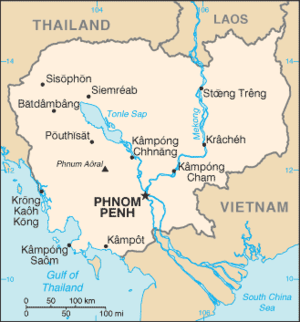
Cambodia, officially the Kingdom of Cambodia, is a country in Southeast Asia that borders Thailand to the west and northwest, Laos to the north and Vietnam to the east and southeast. In the south it faces the Gulf of Thailand. Phnom Penh is the capital and largest city. Siem Reap, a city located near the famed ruins of Angkor Wat is the gateway to the Angkor region, and is Cambodia's main destination for tourism. Battambang, the largest city in western Cambodia, is known for its rice production and Sihanoukville, a coastal city, is the primary sea port.

A fourth international airport in Koh Kong Province was announced in September 2016.[1]

Airports

Airport names shown in bold indicate the airport has scheduled service on commercial airlines.

City served Province ICAO IATA Airport name Coordinates
Ban Lung Ratanakiri VDRK RBE Ratanakiri Airport 13°43′55″N 106°59′01″E / 13.73194°N 106.98361°E / 13.73194; 106.98361 (Ratanakiri Airport (Ban Lung))
Battambang Battambang VDBG BBM Battambang Airport 13°05′44″N 103°13′28″E / 13.09556°N 103.22444°E / 13.09556; 103.22444 (Battambang Airport)
Kampong Cham Kampong Cham VDKC Kampong Cham Airport 12°01′44″N 105°26′28″E / 12.02889°N 105.44111°E / 12.02889; 105.44111 (Kampong Cham Airport)
Kampong Chhnang Kampong Chhnang VDKH KZC Kampong Chhnang Airport 12°15′12″N 104°34′03″E / 12.25333°N 104.56750°E / 12.25333; 104.56750 (Kampong Chhnang Airport)
Kampong Thom Kampong Thom KZK Kampong Thom Airport
Kampot Kampot KMT Kampot Airport 10°37′59″N 104°09′44″E / 10.63306°N 104.16222°E / 10.63306; 104.16222 (Kampot Airport)
Koh Kong Koh Kong VDKK KKZ Koh Kong Airport 11°36′47″N 102°59′51″E / 11.61306°N 102.99750°E / 11.61306; 102.99750 (Koh Kong Airport)
Krakor Pursat VDSY KZD Krakor Airport 12°32′14″N 104°08′54″E / 12.53722°N 104.14833°E / 12.53722; 104.14833 (Krakor Airport)
Kratié Kratié VDKT KTI Kratié Airport 12°29′22″N 106°03′18″E / 12.48944°N 106.05500°E / 12.48944; 106.05500 (Kratié Airport)
Pailin Pailin PAI Pailin Airport
Phnom Penh Phnom Penh VDPP PNH Phnom Penh International Airport 11°32′47″N 104°50′38″E / 11.54639°N 104.84389°E / 11.54639; 104.84389 (Phnom Penh International Airport)
Senmonorom Mondulkiri VDMK MWV Mondulkiri Airport 12°27′45″N 107°11′13″E / 12.46250°N 107.18694°E / 12.46250; 107.18694 (Mondulkiri Airport)
Siem Reap Siem Reap VDSR REP Siem Reap International Airport 13°24′38″N 103°48′46″E / 13.41056°N 103.81278°E / 13.41056; 103.81278 (Siem Reap International Airport)
Sihanoukville Sihanoukville VDSV KOS Sihanoukville International Airport 10°34′46″N 103°38′12″E / 10.57944°N 103.63667°E / 10.57944; 103.63667 (Sihanoukville International Airport)
Stung Treng Stung Treng VDST TNX Stung Treng Airport 13°31′54″N 106°00′52″E / 13.53167°N 106.01444°E / 13.53167; 106.01444 (Stung Treng Airport)
Svay Rieng Svay Rieng SVR Svay Rieng Airport
Thbeng Meanchey Preah Vihear OMY Thbeng Meanchey Airport 13°45′37″N 104°58′18″E / 13.76028°N 104.97167°E / 13.76028; 104.97167 (Thbeng Meanchey Airport)

See also

References

  1. "Coastal project gets nod". The Phnom Penh Post. 23 September 2016. Retrieved 7 October 2016.


This article is issued from Wikipedia - version of the 10/8/2016. The text is available under the Creative Commons Attribution/Share Alike but additional terms may apply for the media files.