| Name |
Address |
Municipality |
PC |
Coordinates |
IDF |
IDP |
IDM |
 |
Image |
|---|
| Acadia Lodge No. 13 A.F. & A.M. |
14 Victoria Street |
Pugwash |
B0K |
45°51′01″N 63°39′43″W / 45.8503°N 63.662°W / 45.8503; -63.662 (Acadia Lodge No. 13 A.F. & A.M.) |
|
10939 |
|
|
 |
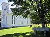
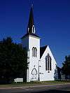
| Advocate United Church |
3680 Highway 209 |
Advocate Harbour |
B0M |
45°20′07″N 64°46′51″W / 45.3352°N 64.7807°W / 45.3352; -64.7807 (Advocate United Church) |
|
|
11874 |
|
|
| Amherst Dominion Public Building |
98 East Victoria Street |
Amherst |
B4H |
45°50′03″N 64°12′46″W / 45.8342°N 64.2128°W / 45.8342; -64.2128 (Amherst Dominion Public Building) |
|
14641 |
|
|
|
| Amherst Point Baptist Church |
908 Southampton Road |
Amherst Point |
B4H |
45°47′54″N 64°15′34″W / 45.7982°N 64.2595°W / 45.7982; -64.2595 (Amherst Point Baptist Church) |
|
|
10996 |
|
|
| Armoury |
|
Amherst |
|
45°50′03″N 64°12′30″W / 45.8341°N 64.2082°W / 45.8341; -64.2082 (Armoury) |
9708 |
|
|
|
|
| The Bank of Montreal Building |
100 Victoria Street |
Amherst |
B4H |
45°50′04″N 64°12′46″W / 45.8344°N 64.2127°W / 45.8344; -64.2127 (The Bank of Montreal Building) |
|
6497 |
|
|
|
| Beaubassin National Historic Site of Canada |
Highway 4 |
Fort Lawrence |
|
45°50′53″N 64°16′00″W / 45.8481°N 64.2666°W / 45.8481; -64.2666 (Beaubassin National Historic Site of Canada) |
13964 |
|
|
|

More images |
| Building 16 |
Nappan Experimental Farm, Highway 302 |
Nappan |
|
45°45′32″N 64°14′21″W / 45.759°N 64.2391°W / 45.759; -64.2391 (Building 16) |
11260 |
|
|
|
|
| Bulmer House |
8740 No 2 Highway |
Great Village |
B0M |
45°24′59″N 63°35′59″W / 45.4163°N 63.5996°W / 45.4163; -63.5996 (Bulmer House) |
|
3684 |
|
|
More images |
| Cannon House |
10215 Highway 209 |
Diligent River |
B0P |
45°24′46″N 64°27′27″W / 45.4127°N 64.4575°W / 45.4127; -64.4575 (Cannon House) |
|
7814 |
|
|
|
| Chapman House National Historic Site of Canada |
Chapman Road |
Fort Lawrence |
B4H |
45°52′29″N 64°14′46″W / 45.8747°N 64.246°W / 45.8747; -64.246 (Chapman House National Historic Site of Canada) |
7568 |
|
|
|
|
| Church of the Good Shepherd |
842 Tidnish Head Road |
Tidnish Cross Roads |
B4H |
45°59′38″N 64°00′38″W / 45.994°N 64.0106°W / 45.994; -64.0106 (Church of the Good Shepherd) |
|
|
11001 |
|
|
| 96 Church Street |
96 Church Street |
Amherst |
|
45°49′52″N 64°12′28″W / 45.8312°N 64.2079°W / 45.8312; -64.2079 (96 Church Street) |
|
|
15306 |
|
|
| 150 Church Street |
150 Church Street |
Amherst |
B4H |
45°49′43″N 64°12′06″W / 45.8285°N 64.2018°W / 45.8285; -64.2018 (150 Church Street) |
|
|
8298 |
|
|
| Civic Building |
4030 Eastern Ave |
Parrsboro |
B0N |
45°24′22″N 64°19′31″W / 45.4062°N 64.3252°W / 45.4062; -64.3252 (Civic Building) |
|
|
7016 |
|
 |
| Davison-Kennedy House |
13440 Highway 6 |
Wallace Bay |
B0K |
45°48′41″N 63°30′06″W / 45.8113°N 63.5016°W / 45.8113; -63.5016 (Davison-Kennedy House) |
|
|
11519 |
|
|
| Dewis House |
3291 Highway 209 |
Advocate Harbour |
B0M |
45°20′40″N 64°47′59″W / 45.3444°N 64.7996°W / 45.3444; -64.7996 (Dewis House) |
|
|
11319 |
|
|
| Fort Lawrence National Historic Site of Canada |
Fort Lawrence Road |
Fort Lawrence |
B4H |
45°50′52″N 64°15′42″W / 45.8478°N 64.2618°W / 45.8478; -64.2618 (Fort Lawrence National Historic Site of Canada) |
13271 |
|
|
|
 |
| Fort Lawrence Terminus |
Fort Lawrence Road; Route 4 |
Fort Lawrence |
B4H |
45°50′24″N 64°16′01″W / 45.8401°N 64.267°W / 45.8401; -64.267 (Fort Lawrence Terminus) |
|
7832 |
|
|
 |
| Hanna House |
5755 Highway 2 |
Lakelands |
B0M |
45°29′18″N 64°21′02″W / 45.4883°N 64.3505°W / 45.4883; -64.3505 (Hanna House) |
|
|
11913 |
|
|
| 30 Hickman Street |
30 Hickman Street |
Amherst |
B4H |
45°49′24″N 64°12′54″W / 45.8234°N 64.215°W / 45.8234; -64.215 (30 Hickman Street) |
|
|
8259 |
|
|
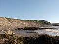
| Joggins Fossil Cliffs |
100 Main St |
Joggins |
B0L |
45°41′31″N 64°26′37″W / 45.6919°N 64.4436°W / 45.6919; -64.4436 (Joggins Fossil Cliffs) |
|
14787 |
|
|
More images |
| Lamp Cabin Building |
31 Industrial Park Drive |
Springhill |
B0M |
45°38′42″N 64°03′52″W / 45.6451°N 64.0645°W / 45.6451; -64.0645 (Lamp Cabin Building) |
|
9809 |
|
|
|
| Layton's General Store |
8724 No.2 Highway |
Great Village |
B0M |
45°24′59″N 63°36′00″W / 45.4163°N 63.5999°W / 45.4163; -63.5999 (Layton's General Store) |
|
3034 |
|
|
|
| Little Red Schoolhouse |
571 Highway 6 |
Amherst |
B4H |
45°50′59″N 64°10′45″W / 45.8496°N 64.1792°W / 45.8496; -64.1792 (Little Red Schoolhouse) |
|
|
11002 |
|
|
| Manning Block |
151 Main Street |
Parrsboro |
B0M |
45°24′12″N 64°19′37″W / 45.4033°N 64.327°W / 45.4033; -64.327 (Manning Block) |
|
6847 |
|
|
|
| Melville United Church Cemetery |
2036 Gulf Shore Road; RR #2 |
Pugwash |
B0M |
45°31′19″N 63°20′09″W / 45.522°N 63.3358°W / 45.522; -63.3358 (Melville United Church Cemetery) |
|
|
11806 |
|
|
| Minudie School Museum |
5518 Barronsfield Road |
Minudie |
B0L |
45°46′32″N 64°20′56″W / 45.7756°N 64.3488°W / 45.7756; -64.3488 (Minudie School Museum) |
|
7723 |
|
|
|
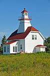
| Mullins Point Upper Range Lighthouse |
North Wallace Road |
North Wallace |
B0K |
45°49′27″N 63°26′37″W / 45.8243°N 63.4435°W / 45.8243; -63.4435 (Mullins Point Upper Range Lighthouse) |
|
7090 |
|
|
 |
| Nappan Experimental Farm, Cereal Forage Building |
Highway 302 |
Nappan |
|
45°45′32″N 64°14′20″W / 45.759°N 64.239°W / 45.759; -64.239 (Nappan Experimental Farm, Cereal Forage Building) |
2010 |
|
|
|
|
| Old Amherst Post Office |
50 Victoria Street East |
Amherst |
B4H |
45°49′59″N 64°12′49″W / 45.8331°N 64.2136°W / 45.8331; -64.2136 (Old Amherst Post Office) |
|
7268 |
8263 |
|
|
| Ottawa House |
1155 Whitehall Road; Partridge Island |
Parrsboro |
B0N |
45°22′31″N 64°19′46″W / 45.3752°N 64.3294°W / 45.3752; -64.3294 (Ottawa House) |
|
13852 |
7019 |
|
 |
| Port Greville Lighthouse |
8334 Highway 209 |
Wards Brook |
B0M |
45°24′51″N 64°33′13″W / 45.4143°N 64.5535°W / 45.4143; -64.5535 (Port Greville Lighthouse) |
|
|
11321 |
|
|
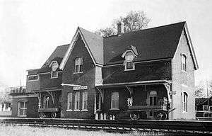
| Pugwash Train Station |
10222 Durham Street |
Pugwash |
B0K |
45°51′00″N 63°39′39″W / 45.85°N 63.6607°W / 45.85; -63.6607 (Pugwash Train Station) |
|
14921 |
11803 |
|
 |
| 1 Ratchford Street |
1 Ratchford Street |
Amherst |
B4H |
45°50′03″N 64°12′40″W / 45.8342°N 64.2111°W / 45.8342; -64.2111 (1 Ratchford Street) |
|
|
8275 |
|
|
| Renwick United Church |
6429 Highway 6 |
Linden |
|
45°52′45″N 63°50′11″W / 45.8791°N 63.8363°W / 45.8791; -63.8363 (Renwick United Church) |
|
|
15223 |
|
|
| River Philip United Church |
2808 Wyvern Road |
River Philip |
B0M |
45°39′38″N 63°54′21″W / 45.6606°N 63.9058°W / 45.6606; -63.9058 (River Philip United Church) |
|
|
11856 |
|
 |
| St. Andrew's Anglican Church |
13611 Highway 6 |
Wallace |
B0K |
45°48′40″N 63°29′41″W / 45.811°N 63.4948°W / 45.811; -63.4948 (St. Andrew's Anglican Church) |
|
|
11850 |
|
|
| St. Denis Church |
5534 Barronsfield Road |
Minudie |
B0L |
45°46′32″N 64°21′00″W / 45.7756°N 64.3499°W / 45.7756; -64.3499 (St. Denis Church) |
|
7264 |
|
|
|
| St. George's Anglican Church |
216 Main Street |
Parrsboro |
B0N |
45°24′17″N 64°19′35″W / 45.4046°N 64.3263°W / 45.4046; -64.3263 (St. George's Anglican Church) |
|
|
7018 |
|
More images |
| St. James United Church |
8729 No. 2 Highway |
Great Village |
B0M |
45°24′57″N 63°36′02″W / 45.4159°N 63.6005°W / 45.4159; -63.6005 (St. James United Church) |
|
7267 |
|
|
|
| Saint Matthew's Presbyterian Church |
3863 No. 307 Highway |
Wallace |
B0K |
45°48′45″N 63°28′24″W / 45.8126°N 63.4733°W / 45.8126; -63.4733 (Saint Matthew's Presbyterian Church) |
|
8086 |
|
|
|
| Amos Thomas Seaman House |
5355 Barronsfield Road |
Minudie |
B0L |
45°46′22″N 64°20′22″W / 45.7729°N 64.3395°W / 45.7729; -64.3395 (Amos Thomas Seaman House) |
|
7815 |
11862 |
|
|
| Lorne Smith House |
11 Highway 302 |
Southampton |
B0M |
45°35′47″N 64°14′54″W / 45.5963°N 64.2483°W / 45.5963; -64.2483 (Lorne Smith House) |
|
|
11317 |
|
|
| Spencer's Island Lighthouse |
Spencer's Beach Road |
Spencer's Island |
B0M |
45°21′14″N 64°42′46″W / 45.354°N 64.7129°W / 45.354; -64.7129 (Spencer's Island Lighthouse) |
|
|
11808 |
|
 |
| Springhill Coal Mining National Historic Site of Canada |
Corner of Industrial Park Dr and Memorial Crescent |
Springhill |
|
45°34′09″N 62°39′27″W / 45.5691°N 62.6574°W / 45.5691; -62.6574 (Springhill Coal Mining National Historic Site of Canada) |
17988 |
|
|
|
 |
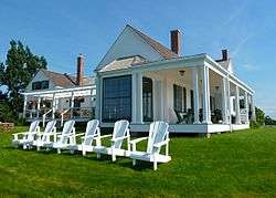
| Thinkers' Lodge National Historic Site of Canada |
247 Water Street |
Pugwash |
B0K |
45°51′12″N 63°39′54″W / 45.8534°N 63.665°W / 45.8534; -63.665 (Thinkers' Lodge National Historic Site of Canada) |
12561 |
|
|
|
 |
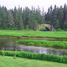
| Tidnish Bridge |
Route 366 |
Tidnish Bridge |
B4H |
45°58′34″N 64°02′37″W / 45.9762°N 64.0437°W / 45.9762; -64.0437 (Tidnish Bridge) |
|
7831 |
|
|
More images |
| Tidnish Dock Site |
Route 366 at Tidnish Cross Roads |
Tidnish |
B4H |
45°59′52″N 64°00′28″W / 45.9978°N 64.0079°W / 45.9978; -64.0079 (Tidnish Dock Site) |
|
7830 |
|
|
|
| Trueman House |
2721 Highway 6 |
Truemanville |
B4H |
45°51′52″N 64°03′00″W / 45.8645°N 64.0499°W / 45.8645; -64.0499 (Trueman House) |
|
|
11493 |
|
|
| Victoria |
177 Victoria Street |
Amherst |
B4H |
45°50′16″N 64°12′22″W / 45.8379°N 64.2062°W / 45.8379; -64.2062 (Victoria) |
|
7289 |
8257 |
|
|
| 54 Victoria Street East |
54 Victoria Street East |
Amherst |
B4H |
45°50′00″N 64°12′47″W / 45.8333°N 64.2131°W / 45.8333; -64.2131 (54 Victoria Street East) |
|
|
8258 |
|
|
| 91 Victoria Street East |
91 Victoria Street East |
Amherst |
B4H |
45°50′03″N 64°12′45″W / 45.8342°N 64.2124°W / 45.8342; -64.2124 (91 Victoria Street East) |
|
|
8256 |
|
|
| 233 Victoria Street East |
233 Victoria Street East |
Amherst |
B4H |
45°50′28″N 64°11′55″W / 45.8412°N 64.1986°W / 45.8412; -64.1986 (233 Victoria Street East) |
|
|
8255 |
|
|
| 27 Victoria Street West |
27 Victoria Street West |
Amherst |
|
45°49′58″N 64°12′48″W / 45.8328°N 64.2133°W / 45.8328; -64.2133 (27 Victoria Street West) |
|
|
15656 |
|
|
| 46 Victoria Street West |
46 Victoria Street West |
Amherst |
B4H |
45°49′40″N 64°12′58″W / 45.8278°N 64.2162°W / 45.8278; -64.2162 (46 Victoria Street West) |
|
|
8254 |
|
|
| Wallace River Railway Swing Bridge |
Route 6 |
Wallace |
B0M |
45°47′33″N 63°31′57″W / 45.7924°N 63.5325°W / 45.7924; -63.5325 (Wallace River Railway Swing Bridge) |
|
6941 |
|
|
|
| Warren Baptist Church |
56 Cross Rd |
Hastings |
B4H |
45°50′41″N 64°07′29″W / 45.8446°N 64.1246°W / 45.8446; -64.1246 (Warren Baptist Church) |
|
|
11195 |
|
|
| Wentworth United Baptist Church |
13755 Highway 4 |
Wentworth |
B0M |
45°38′46″N 63°33′04″W / 45.6461°N 63.5512°W / 45.6461; -63.5512 (Wentworth United Baptist Church) |
|
|
11315 |
|
|
| Wentworth Valley Schoolhouse |
80 Barclay Road |
Wentworth |
B0M |
45°36′21″N 63°33′43″W / 45.6059°N 63.562°W / 45.6059; -63.562 (Wentworth Valley Schoolhouse) |
|
|
11316 |
|
|