List of National Historic Sites of Canada in Nova Scotia
This is a list of National Historic Sites of Canada (French: Lieux historiques nationaux du Canada) in the province of Nova Scotia. There are 88 National Historic Sites designated in Nova Scotia, 26 of which are administered by Parks Canada (identified below by the beaver icon ![]() ).[1][2]
).[1][2]
This list uses names designated by the Historic Sites and Monuments Board of Canada, which may differ from other names for these sites.
National Historic Sites
| Site[1] | Date(s) | Designated | Location | Description | Image |
|---|---|---|---|---|---|
| Acacia Grove / Prescott House [3] | 1809 (completed) | 1969 | Starr's Point 45°6′38″N 64°22′44″W / 45.11056°N 64.37889°W |
A house on an extensive property in the Annapolis Valley, built for horticulturalist Charles Ramage Prescott; a noted example of Georgian architecture in Canada |  |
| Admiralty House [4] | 1819 (completed) | 1978 | Halifax 44°39′34″N 63°35′34″W / 44.65944°N 63.59278°W |
An austere two-storey stone mansion set within the Stadacona site of CFB Halifax which served as the home of Commander-in-Chief of the Royal Navy’s North American station from 1819 until 1904 | 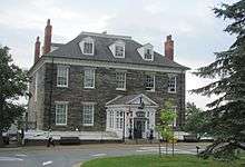 |
| Africville [5] | 1964 (relocation commenced) | 1996 | Halifax 44°40′28″N 63°37′7″W / 44.67444°N 63.61861°W |
A Black Nova Scotian community cleared by the municipality in the 1960s in the name of urban renewal; the community was representative of Black settlements in the province and became an enduring symbol of the need for vigilance in defense of Black communities and institutions | 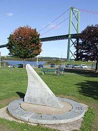 |
| Akins House [6] | 1815 (c.) (completed) | 1965 | Halifax 44°39′12″N 63°34′55″W / 44.65333°N 63.58194°W |
A one-and-a-half-storey wood-shingled house originally built for Thomas Beamish Akins, surviving virtually in its original condition; one of the few remaining early 19th-century houses in Halifax and one of the oldest houses in the city | |
| Alexander Graham Bell |
1954 (museum completed) | 1952 | Baddeck 46°6′10″N 60°44′45″W / 46.10278°N 60.74583°W |
A museum containing Alexander Graham Bell memorabilia, located on a 10-hectare (25-acre) property overlooking Bras d'Or Lake and Bell's summer estate at Beinn Bhreagh |  |
| Annapolis County Court House [8] | 1837 (completed) | 1991 | Annapolis Royal 44°44′31″N 65°30′58″W / 44.74194°N 65.51611°W |
One of the oldest court houses in Canada still in original use, and a noted example of Palladian architecture in this country |  |
| Annapolis Royal Historic District [9] | 1605 (established) | 1994 | Annapolis Royal 44°44′30″N 65°30′51″W / 44.74167°N 65.51417°W |
A historic core containing commercial, military, and residential buildings from the 18th to early 20th centuries, located at the centre of the original 17th-century Acadian settlement; the site of several pivotal events during the early years of the colonisation of Canada |  |
| Antigonish County Court House [10] | 1855 (completed) | 1981 | Antigonish 45°37′24″N 61°59′16″W / 45.62333°N 61.98778°W |
A wood-frame building with Greek Revival front facade and a stone jail attached at the rear; one of the best examples in Nova Scotia of mid-19th century Maritime court houses, which were typically simple frame buildings with classicized ornamental details | |
| Argyle Township Court House and Jail [11] | 1805 (completed) | 2005 | Tusket 43°51′18″N 65°58′28″W / 43.85500°N 65.97444°W |
A two-storey wooden building constructed in the colonial meeting house style, now serving as a museum; the oldest known surviving combined court house and jail | 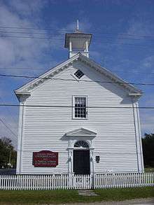 |
| Beaubassin |
1672 (established) | 2005 | Fort Lawrence 45°50′54.58″N 64°16′0.48″W / 45.8484944°N 64.2668000°W |
An archaeological site with remains from a major Acadian settlement that played a pivotal role in the 17th and 18th century struggle between the British and French for the region; the site also contains the Fort Lawrence NHS |  |
| Bedford Petroglyphs [13] | 1994 | Halifax 44°43′47″N 63°40′5″W / 44.72972°N 63.66806°W |
Spiritually significant petroglyph site | ||
| Black-Binney House [14] | 1819 (completed) | 1965 | Halifax 44°38′38″N 63°34′17″W / 44.64389°N 63.57139°W |
A house reflective of the Palladian-inspired residences common during the late 18th and early 19th centuries in Eastern Canada; notable residents include John Black, James Boyle Uniacke and Hibbert Binney | |
| Bloody Creek |
1711, 1757 (battles) | 1930 | Bridgetown 44°49′20″N 65°18′33″W / 44.82222°N 65.30917°W |
Site of two battles, in 1711 and 1757, between British forces and allied French and aboriginal forces over control of Acadia; a cairn marks the site of the 1757 battle |  |
| Canso Islands |
1700s (commencement of long-term European occupation) | 1925 | Canso 45°20′39.65″N 60°58′16.33″W / 45.3443472°N 60.9712028°W |
A group of islands which served as an important fishing base for the French in the 16th century and the British during the 18th century; the staging point for the 1745 expedition led by William Pepperrell and Peter Warren against Louisbourg | |
| Cast Iron Façade / Coomb's Old English Shoe Store [17] | 1860 (completed) | 1981 | Halifax 44°38′59″N 63°34′29″W / 44.64972°N 63.57472°W |
A mid-19th-century commercial building with a cast-iron facade; one of the first cast-iron-front structures in Canada and the only building in Halifax known to have a facade composed entirely of cast iron | |
| Chapel Island [18] | 2003 | Chapel Island First Nation 45°43′0″N 60°46′57″W / 45.71667°N 60.78250°W |
An island which for centuries has been an important gathering place, location for government and site of spiritual significance for the Mi'kmaq people | 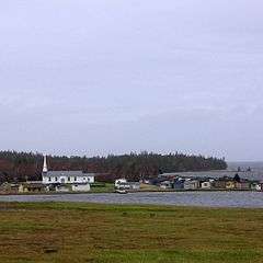 | |
| Chapman House [19] | 1780 (completed) | 1968 | Fort Lawrence 45°52′29″N 64°14′46″W / 45.87472°N 64.24611°W |
A two-storey, red-brick Georgian house; representative of prosperous 18th-century Maritimes farmhouses | |
| Charles Fort |
1629 (established) | 1951 | Annapolis Royal 44°44′26.88″N 65°31′11.67″W / 44.7408000°N 65.5199083°W |
The site of William Alexander's former settlement, intended to establish the colony of "Nova Scotia"; occupied by Scottish colonists for 3 years, when the territory was restored to France | |
| Covenanters' Church [21] | 1811 (completed) | 1976 | Grand-Pré 45°6′0″N 64°18′18″W / 45.10000°N 64.30500°W |
A simple frame and rectangular Presbyterian church, representative of the 18th-century New England meeting house style; also a component of the Grand-Pré Rural Historic District NHS | 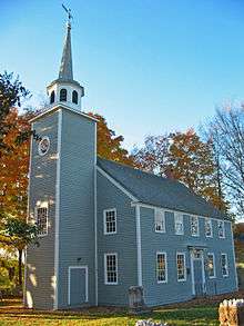 |
| D'Anville's Encampment |
1746 (encampment) | 1925 | Halifax 44°40′28.98″N 63°38′47.57″W / 44.6747167°N 63.6465472°W |
The site where Duc d’Anville's forces camped along the shore on a failed expedition from France to recover Acadia | 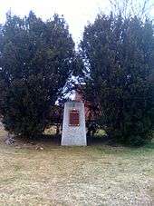 |
| Debert Palaeo-Indian Site [23] | 1974 | Debert 45°24′59″N 63°25′24″W / 45.41639°N 63.42333°W |
The oldest archaeological site in Nova Scotia, and one of the most important Paleo-Indian sites in the province, with artifacts dating from 10,600 to 13,000 years ago | ||
| Fernwood [24] | 1860 (c.) (completed) | 1990 | Halifax 44°37′37″N 63°34′55″W / 44.62694°N 63.58194°W |
A house on a large landscaped property; a noted example of a Gothic Revival villa in Canada | 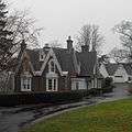 |
| Fort Anne |
1629 (established) | 1920 | Annapolis Royal 44°44′28.47″N 65°31′6.72″W / 44.7412417°N 65.5185333°W |
The remains of a fort that played an important role in early European colonization, settlement and government in Acadia and Nova Scotia, and in the struggle between Britain and France for the area | 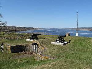 |
| Fort Edward |
1750 (established) | 1920 | Windsor 44°59′43.43″N 64°7′57.69″W / 44.9953972°N 64.1326917°W |
A fort that played an important role in the Seven Years' War, the expulsion of the Acadians, and the defence of Canada during the American Revolutionary War and the War of 1812; today comprises a wooden blockhouse and remnants of buildings and landscape features from the 18th-century fortifications. |  |
| Fort Lawrence |
1750 (established) | 1923 | Fort Lawrence 45°50′52″N 64°15′42″W / 45.84778°N 64.26167°W |
The archaeological remains of a fort erected in 1750 by the British to defend the Isthmus of Chignecto and abandoned in 1755 after the capture of Fort Beauséjour |  |
| Fort McNab |
1892 (completed) | 1965 | Halifax 44°36′0″N 63°31′0″W / 44.60000°N 63.51667°W |
The remnants of defensive works constructed to defend Halifax when it was one of the principal naval stations of the British Empire; reflective of significant changes in defence technology in the late 19th century | 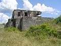 |
| Fort St. Louis [29] | 1623 (established) | 1931 | Port La Tour 43°29′42″N 65°28′13″W / 43.49500°N 65.47028°W |
During the Scottish occupation of Port Royal from 1629 to 1632, this fort was France's only foothold in Acadia | |
| Fort Sainte Marie de Grace |
1632 (established) | 1924 | LaHave, Nova Scotia 44°17′17.93″N 64°21′4.86″W / 44.2883139°N 64.3513500°W |
The site where Isaac de Razilly built a fort, a settlement and the capital of the colony of Acadia after the Treaty of St. Germain-en-Laye returned the colony to France in 1632 | |
| Fortress of Louisbourg |
1713 (establishment) | 1920 | Louisbourg 45°53′32.58″N 59°59′10.36″W / 45.8923833°N 59.9862111°W |
The largest reconstructed 18th-century French fortified town in North America; the fortress played a key role in the struggle between the French and British empires between 1713 and 1768 |  |
| Georges Island |
1749 (first defence works) | 1965 | Halifax 44°38′27″N 63°33′35″W / 44.64083°N 63.55972°W |
An island located in the middle of one of the finest natural harbours in the world; played a key role in the "Halifax Defence Complex" and protected one of the British Empire's principal naval stations during the 18th and 19th centuries | 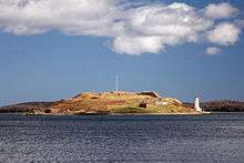 |
| Government House [33] | 1805 (completed) | 1982 | Halifax 44°38′36″N 63°34′17″W / 44.64333°N 63.57139°W |
Government House has served as an official residence for more than 175 years and is one of the oldest official residences in Canada | .jpg) |
| Grand-Pré |
1682 (first settlement of Acadians) | 1982 | Grand-Pré 45°6′34″N 64°18′37″W / 45.10944°N 64.31028°W |
A centre of Acadian settlement and culture from 1682 until 1775; the site served as the British headquarters for the 1755–1763 deportation of the Acadians from Nova Scotia |  |
| Grand-Pré Rural Historic District [35] | 1682 (first settlement of Acadians) | 1995 | Kings County 45°6′40″N 64°18′11″W / 45.11111°N 64.30306°W |
A rural cultural landscape surrounding the villages of Grand-Pré and Hortonville featuring one of the oldest land occupation and use patterns of European origin in Canada; representative of the adaptation of the first Acadian settlers to the conditions of North America | |
| Granville Block [36] | 1860-1904 (completion dates) | 2007 | Halifax 44°38′59″N 63°34′28″W / 44.64972°N 63.57444°W |
A complex of 19 buildings, primarily four to five storeys in height, constructed in the years after a large fire in 1859; the rehabilitation of this block in the 1970s was an early success of the heritage preservation movement, and the block now accommodates NSCAD University | 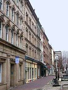 |
| Grassy Island Fort |
1720 (first small redoubt built by the British) | 1962 | Canso 45°20′14.4″N 60°58′23.09″W / 45.337333°N 60.9730806°W |
The remains of early 18th-century British fortifications (a 1720 redoubt, 1723-24 fort, and a 1745 blockhouse); part of the larger Canso Islands NHS | 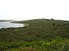 |
| Halifax Citadel |
1749 (established), 1828 (present fort commenced) | 1935 | Halifax 44°38′50.63″N 63°34′48.87″W / 44.6473972°N 63.5802417°W |
A stone fortress built to defend what was one of the British Empire's four principal naval stations during the 18th and 19th centuries; a key element of the unique complex of shore defences in Halifax | 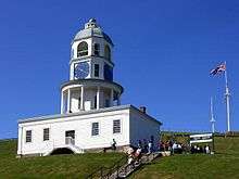 |
| Halifax City Hall [39] | 1890 (completed) | 1984 | Halifax 44°38′56″N 63°34′31″W / 44.64889°N 63.57528°W |
A three-storey municipal building with a seven-storey clock tower, prominently located on the Grand Parade; symbolic of the city halls built in the l9th century in medium-sized Canadian cities |  |
| Halifax Court House [40] | 1860 (completed) | 1969 | Halifax 44°38′37″N 63°34′25″W / 44.64361°N 63.57361°W |
An imposing sandstone court house built in the neoclassical style with Italianate detailing; representative of the judicial system of Nova Scotia | 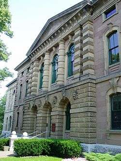 |
| Halifax Drill Hall [41] | 1899 (completed) | 1989 | Halifax 44°39′6″N 63°35′13″W / 44.65167°N 63.58694°W |
Richardsonian Romanesque drill hall designed by Thomas Fuller; representative of the second evolutionary stage in drill hall construction in Canada (1872–1895) | 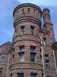 |
| Halifax Dockyard [42] | 1758 (established) | 1923 | Halifax 44°39′31″N 63°35′1″W / 44.65861°N 63.58361°W |
Created in 1758 under the supervision of Captain James Cook, it was the earliest Royal Navy dockyard in North America; still in use by the Royal Canadian Navy | 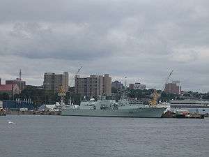 |
| Halifax Public Gardens [43] | 1874 (established) | 1983 | Halifax 44°38′34″N 63°34′56″W / 44.64278°N 63.58222°W |
A rare surviving example of a Victorian public garden in Canada; it continues to serve as a public park, with the original landscape design and planting traditions remaining essentially intact | 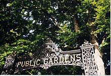 |
| Halifax Waterfront Buildings [44] | 1815 to 1905 (constructed) | 1963 | Halifax 44°39′1″N 63°34′23″W / 44.65028°N 63.57306°W |
A group of restored stone and wooden warehouses on the waterfront and adaptively reused for offices, shops and restaurants; the most significant pre-Confederation complex of maritime commercial buildings in Canada | |
| Halifax WWII Coastal Defences [45] | 1939-45 (period of service) | 1994 | Halifax 44°35′45″N 63°33′4″W / 44.59583°N 63.55111°W |
Halifax was Canada's most heavily defended port during the Second World War and served as the main Allied convoy assembly point during the Battle of the Atlantic |  |
| Henry House [46] | 1834 (completed) | 1969 | Halifax 44°38′25″N 63°34′15″W / 44.64028°N 63.57083°W |
A two-and-a-half-storey stone house representative of the style of residences built for the elite in early 19th-century British North America; the home of William Alexander Henry, a Father of Confederation and justice of the Supreme Court of Canada | 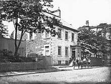 |
| HMCS Sackville [47] | 1941 (entered service) | 1988 | Halifax 44°38′51″N 63°34′9″W / 44.64750°N 63.56917°W |
One of the last Flower-class corvettes known to exist, a class of ship which played a key role in the Battle of the Atlantic |  |
| Hydrostone District [48] | 1917 (established) | 1993 | Halifax 44°39′48″N 63°36′5″W / 44.66333°N 63.60139°W |
An excellent example of an English-style garden suburb in Canada; the country's first public housing project, planned by Thomas Adams and designed by Ross and Macdonald |  |
| Jonathan McCully House [49] | 1857 (completed) | 1975 | Halifax 44°39′26″N 63°35′16″W / 44.65722°N 63.58778°W |
Italianate house which served as the residence of Jonathan McCully, a Father of Confederation, between 1863 and 1877 | |
| Kejimkujik |
1994 | Kejimkujik National Park 44°22′46.42″N 65°18′24.67″W / 44.3795611°N 65.3068528°W |
Coincident with the entire area of Kejimkujik National Park (except the seaside unit), this is a cultural landscape 404 square kilometres (156 sq mi) in size, in which petroglyph sites, habitation sites, fishing and hunting sites, travel routes and burial grounds attest to Mi’kmaq occupancy of this area for thousands of years | ||
| King's College [51] | 1789 (established) | 1923 | Windsor 44°58′58″N 64°8′9″W / 44.98278°N 64.13583°W |
The first university to be established in the Dominions of the British Empire; the original site of the oldest university in what was to become Canada (campus now located in Halifax) | 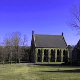 |
| Knaut-Rhuland House [52] | 1793 (completed) | 2002 | Lunenburg 44°22′36.49″N 64°18′32.97″W / 44.3768028°N 64.3091583°W |
A clapboard wood-frame house with neoclassical detailing; an early example of British classicism in Canada, a style which flourished in the country in the years that followed |  |
| Ladies' Seminary [53] | 1878 (completed) | 1997 | Wolfville 45°5′20″N 64°21′57″W / 45.08889°N 64.36583°W |
A Second Empire style-building located on the Acadia University campus; constructed in 1878 as a home for women attending the university, it is Canada's oldest facility associated with the higher education of women | |
| Little Dutch (Deutsch) Church [54] | 1752 (land set aside for German community) | 1997 | Halifax 44°39′21″N 63°35′8″W / 44.65583°N 63.58556°W |
A small wooden church surrounded by an 18th-century burying ground and a stone wall; the oldest known surviving church in Canada associated with the German Canadian community |  |
| Liverpool Town Hall [55] | 1902 (completed) | 1984 | Queens 44°2′20″N 64°42′55″W / 44.03889°N 64.71528°W |
A former town hall now serving as a museum and theatre; its restrained classical detailing and wooden construction are rare for town halls of this scale constructed in the 20th century in Canada | 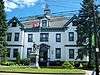 |
| Lunenburg Academy [56] | 1895 (completed) | 1983 | Lunenburg 44°22′48″N 64°18′50″W / 44.38000°N 64.31389°W |
A highly visible Second Empire style-building located atop Gallows Hill; a rare surviving academy building, representative of a significant evolution in Nova Scotia's education system in the 19th century when publicly funded county academies were introduced to provide high-quality secondary education | 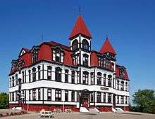 |
| Marconi National Historic Site |
1902 (first transatlantic radio transmission) | 1939 | Glace Bay 46°12′42″N 59°57′8″W / 46.21167°N 59.95222°W |
The isolated site where Guglielmo Marconi received the first transatlantic radio telegraph message; comprises the remains of two telegraph towers that once supported Marconi’s antennae and the foundation walls of his receiving room and powerhouse | |
| Marconi Wireless Station [58] | 1905 (established) | 1983 | Cape Breton Regional Municipality 46°9′17″N 59°56′44″W / 46.15472°N 59.94556°W |
A 350-hectare (860-acre) site containing the foundations of aerial towers and three abandoned buildings; location of the wireless station which, along with a sister station in Ireland, was the first to provide regular public intercontinental radio service commencing in 1908 | 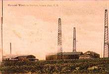 |
| Melanson Settlement |
1664 (established) | 1987 | Lower Granville 44°42′41″N 65°36′40″W / 44.71139°N 65.61111°W |
The remains (a dyked terrace and subsurface archaeological resources) of a pre-expulsion Acadian village in the salt marshes of the Annapolis River; representative of Acadian settlements and their unique form of agriculture along the Dauphin (now Annapolis) River | |
| Melville Island and Deadman's Island[60] | 1790s-1856 and 1909-1939 |
2016 | Halifax 44°38′06″N 63°36′50″W / 44.635°N 63.614°W |
POW and military prison, medical facility, quarantine and immigration station | |
| Nova Scotia Coal Fields (Sydney) [61] | 1998 | Sydney 46°14′32″N 60°3′41″W / 46.24222°N 60.06139°W |
Surviving clusters of in situ resources associated with the fields and the coal industry | ||
| Nova Scotia Coal Fields (Stellarton) [62] | 1998 | Stellarton 45°34′5″N 62°39′27″W / 45.56806°N 62.65750°W |
Surviving clusters of in situ resources associated with the fields and the coal industry | ||
| Old Barrington Meeting House [63] | 1765 (completed) | 1966 | Barrington Head 43°34′0″N 65°34′47″W / 43.56667°N 65.57972°W |
Wood frame building erected by settlers from New England; one of the oldest surviving buildings in English-speaking Canada, and a good example of a New England-style colonial meeting house | |
| Old Burying Ground [64] | 1749 (establishment) | 1991 | Halifax 44°38′36.24″N 63°34′22.08″W / 44.6434000°N 63.5728000°W |
A 0.91-hectare (2.2-acre) early graveyard surrounded by a stone wall and decorative iron fence; a unique concentration of gravestone art, symbolizing the cultural traditions of early British North America |  |
| Old Town Lunenburg Historic District [65] | 1753 (established) | 1991 | Lunenburg 44°22′40″N 64°18′35″W / 44.37778°N 64.30972°W |
The core area of the town and a well-preserved example of 18th-century colonization and settlement patterns; a World Heritage Site, and one of the earliest and most intact British model plans in Canada | |
| Pictou Academy [66] | 1818 (established) | 1937 | Pictou 45°40′36″N 62°42′54″W / 45.67667°N 62.71500°W |
The original site of the Pictou Academy, today marked by a cairn; founded by Thomas McCulloch, the Academy introduced nonsectarian education to the Maritimes | |
| Pictou Railway Station (Intercolonial) [67] | 1904 (completed) | 1976 | Pictou 45°40′33″N 62°42′21″W / 45.67583°N 62.70583°W |
An eclectic former passenger terminal with Châteauesque, Elizabethan and Palladian elements; representative of the Intercolonial Railway, a line which forged a link between the Maritimes and Central Canada |  |
| Pier 21 [68] | 1928 (completed), 1944 (rebuilt) | 1997 | Halifax 44°38′18.04″N 63°33′54.72″W / 44.6383444°N 63.5652000°W |
An ocean passenger terminal which witnessed the massive stream of post Second World War immigration to Canada from Canada, including the arrival of war brides; the last intact example of its type, and the embodiment of early 20th-century Canadian immigration |  |
| Port-Royal |
1605 (established), 1939 (reconstruction) | 1923 | Port Royal 44°42′41″N 65°36′34″W / 44.71146°N 65.60947°W |
A historic reconstruction of an early 17th-century French fort; symbolic of the legacy of the local Acadian and Mi'kmaq peoples in 1605-1613, and a milestone in the 20th-century Canadian heritage movement |  |
| Prince of Wales Tower |
1799 (completed) | 1943 | Halifax 44°37′17.6″N 63°34′11.09″W / 44.621556°N 63.5697472°W |
A large martello tower which played a significant role in the development of Halifax as one of the four principal naval stations of the British Empire during the 18th and 19th centuries | 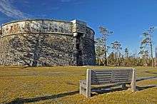 |
| Province House [71] | 1819 (completed) | 1993 | Halifax 44°38′52.81″N 63°34′24.71″W / 44.6480028°N 63.5735306°W |
The longest serving legislative building in Canada and one of the best examples of Palladian architecture in the country; the birthplace of responsible government and freedom of the press in Canada | .jpg) |
| Royal Battery |
1728 (completed) | 1952 | Louisbourg 45°54′33.67″N 59°58′49.73″W / 45.9093528°N 59.9804806°W |
An archaeological site where the outline of the battery’s ditch, glacis and tower mounds are still evident; built by the French as part of the defences of Louisbourg harbour, the battery played a significant role in the 1745 and 1758 sieges of Louisbourg | |
| S.S. Acadia [73] | 1913 (launched) | 1976 | Halifax 44°38′53″N 63°34′12″W / 44.64806°N 63.57000°W |
A steel, purpose-built hydrographic vessel launched in 1913 and now berthed at a Halifax wharf; a pioneering oceanography research ship which took a lead role in charting Hudson Bay | 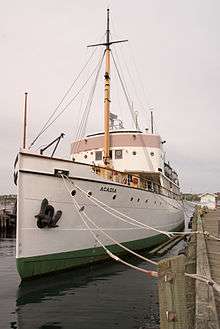 |
| Sainte-Anne / Port Dauphin [74] | 1629 (established) | 1929 | Englishtown 46°16′53″N 60°32′38″W / 46.28139°N 60.54389°W |
Founded by Captain Charles Daniel as a Jesuit mission and later a naval base, its importance declined with the choice of Louisbourg as the capital in 1719 | |
| Sinclair Inn / Farmer's Hotel [75] | 1710 (earliest elements) | 1983 | Annapolis Royal 44°44′41″N 65°31′10″W / 44.74472°N 65.51944°W |
A wooden former hotel which evolved with the amalgamation of at least two buildings, one dating from the Acadian era; the building stands as a composite of three centuries of materials, construction techniques and architectural styles | |
| Sir Frederick Borden Residence [76] | 1864 (completed), 1902 (renovated in Queen Anne style) | 1990 | Canning 44°44′41″N 65°31′10″W / 44.74472°N 65.51944°W |
Former home of Frederick William Borden, located in a park-like setting; a good example of Queen Anne style architecture in domestic buildings | |
| Springhill Coal Mining [77] | 1873 (commencement of coal mining) | 1998 | Springhill 45°38′41″N 64°3′55″W / 45.64472°N 64.06528°W |
A former coalfield with surface and underground mining features that are unique to Nova Scotia; at one time one of Canada’s most commercially important coalfields | 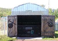 |
| St. George's Anglican Church / Round Church [78] | 1812 (completed) | 1983 | Halifax 44°39′12.55″N 63°34′58.79″W / 44.6534861°N 63.5829972°W |
A cylindrical wooden church associated with the early history of Halifax; an excellent example of Palladian architecture in Canada | .jpg) |
| St. John's Anglican Church [79] | 1763 (completed) | 1994 | Lunenburg 44°22′41″N 64°18′41″W / 44.37806°N 64.31139°W |
A Carpenter Gothic church in the heart of Lunenburg; played an important role in the establishment of British authority and of the Church of England in 18th-century Nova Scotia |  |
| St. Mary's Basilica [80] | 1820 (established) | 1997 | Halifax 44°38′40.07″N 63°34′24.07″W / 44.6444639°N 63.5733528°W |
A large Gothic Revival church associated with individuals and events which played a central role in the emancipation of Roman Catholics in Nova Scotia and in Canada | 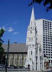 |
| St. Paul's Anglican Church [81] | 1750 (completed) | 1981 | Halifax 44°38′51″N 63°34′29″W / 44.64750°N 63.57472°W |
A small wooden church with a gable roof and central steeple; the first building erected in Canada in the Palladian style, and the first church outside Great Britain to be designated an Anglican cathedral | 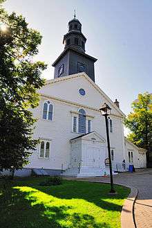 |
| St. Peter's |
1630 (established) | 1929 | St. Peter's 45°39′18″N 60°52′10″W / 45.65500°N 60.86944°W |
An archaeological site with resources related to 17th- and 18th- century Mi’kmaq and Acadian communities; the site of Fort Saint-Pierre, a 17th-century fortified trading post, and Port-Toulouse, a French community established in 1713 | |
| St. Peters Canal |
1869 (completed) | 1929 | Halifax 45°39′12.27″N 60°52′9.56″W / 45.6534083°N 60.8693222°W |
A canal that connects Bras d'Or Lake with St. Peter’s Bay on the Atlantic Ocean; a cultural landscape associated with the construction and operation of the canal | 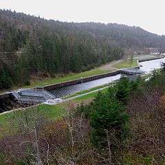 |
| Sydney WWII Coastal Defences [84] | 1939-45 | 1994 | Sydney 46°14′39″N 60°12′41″W / 46.24417°N 60.21139°W |
As a safe port protected by seven coastal gun batteries during the Second World War, Sydney played an important role in the efforts of the RCN and the RCAF to keep open the vital North Atlantic supply routes | |
| Thinkers' Lodge [85] | 1957 (conference) | 2008 | Pugwash 45°51′13″N 63°39′57″W / 45.85361°N 63.66583°W |
The birthplace at the height of the Cold War of the Pugwash movement, a transnational organization for nuclear disarmament and world peace | 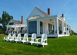 |
| Trinity Anglican Church [86] | 1878 (completed) | 1990 | Digby 44°37′13″N 65°45′26″W / 44.62028°N 65.75722°W |
A good example of the work of architect Stephen C. Earle and of a church in Canada built in the American Ecclesiological Gothic Revival tradition | _05.jpg) |
| Truro Post Office [87] | 1886 (completed) | 1983 | Truro 45°21′55″N 63°16′50″W / 45.36528°N 63.28056°W |
A good example of the post offices erected by the federal Department of Public Works in smaller urban centres throughout the country during Thomas Fuller’s term as Dominion Chief Architect | |
| Wolfe's Landing |
1758 (landing) | 1929 | Cape Breton Regional Municipality 45°52′45″N 60°3′18″W / 45.87917°N 60.05500°W |
During the Seven Years' War, the site where British forces in James Wolfe's brigade launched their successful attack on the French forces at the Fortress of Lousibourg | |
| York Redoubt |
1793 (established) | 1962 | Halifax 44°35′48″N 63°33′09″W / 44.596583°N 63.552439°W |
Major seaward defences of Halifax Harbour from the American Revolutionary War until the Second World War; illustrates the historical evolution of the Halifax Harbour defence system | 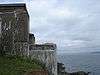 |
See also
| Wikimedia Commons has media related to National Historic Sites of Canada in Nova Scotia. |
References
- 1 2 "Nova Scotia". Directory of Federal Heritage Designations. Parks Canada. Retrieved 21 August 2012.
- ↑ Nova Scotia, National Historic Sites of Canada - administered by Parks Canada
- ↑ Acacia Grove / Prescott House. Canadian Register of Historic Places. Retrieved 22 August 2012.
- ↑ Admiralty House. Canadian Register of Historic Places. Retrieved 22 August 2012.
- ↑ Africville. Canadian Register of Historic Places. Retrieved 25 August 2012.
- ↑ Akins House. Canadian Register of Historic Places. Retrieved 25 August 2012.
- ↑ Alexander Graham Bell. Canadian Register of Historic Places. Retrieved 25 August 2012.
- ↑ Annapolis County Court House. Canadian Register of Historic Places. Retrieved 25 August 2012.
- ↑ Annapolis Royal Historic District. Canadian Register of Historic Places. Retrieved 25 August 2012.
- ↑ Antigonish County Court House. Canadian Register of Historic Places. Retrieved 26 August 2012.
- ↑ Argyle Township Court House and Jail. Canadian Register of Historic Places. Retrieved 26 August 2012.
- ↑ Beaubassin. Canadian Register of Historic Places. Retrieved 26 August 2012.
- ↑ Bedford Petroglyphs. Directory of Federal Heritage Designations. Parks Canada. Retrieved 26 August 2012.
- ↑ Black-Binney House. Canadian Register of Historic Places. Retrieved 26 August 2012.
- ↑ Bloody Creek. Directory of Federal Heritage Designations. Parks Canada. Retrieved 26 August 2012.
- ↑ Canso Islands. Canadian Register of Historic Places. Retrieved 26 August 2012.
- ↑ Cast Iron Façade / Coomb's Old English Shoe Store. Canadian Register of Historic Places. Retrieved 26 August 2012.
- ↑ Chapel Island. Canadian Register of Historic Places. Retrieved 26 August 2012.
- ↑ Chapman House. Canadian Register of Historic Places. Retrieved 29 September 2012.
- ↑ Charles Fort. Canadian Register of Historic Places. Retrieved 29 September 2012.
- ↑ Covenanters' Church. Canadian Register of Historic Places. Retrieved 29 September 2012.
- ↑ D'Anville's Encampment. Canadian Register of Historic Places. Retrieved 30 September 2012.
- ↑ Debert Palaeo-Indian Site. Canadian Register of Historic Places. Retrieved 30 September 2012.
- ↑ Fernwood. Canadian Register of Historic Places. Retrieved 30 September 2012.
- ↑ Fort Anne. Canadian Register of Historic Places. Retrieved 30 September 2012.
- ↑ Fort Edward. Canadian Register of Historic Places. Retrieved 30 September 2012.
- ↑ Fort Lawrence. Canadian Register of Historic Places. Retrieved 2 February 2013.
- ↑ Fort McNab. Canadian Register of Historic Places. Retrieved 2 February 2013.
- ↑ Fort St. Louis. Directory of Federal Heritage Designations. Parks Canada. Retrieved 2 February 2013.
- ↑ Fort Sainte Marie de Grace. Canadian Register of Historic Places. Retrieved 2 February 2013.
- ↑ Fortress of Louisbourg. Canadian Register of Historic Places. Retrieved 2 February 2013.
- ↑ Georges Island. Canadian Register of Historic Places. Retrieved 3 February 2013.
- ↑ Government House. Canadian Register of Historic Places. Retrieved 3 February 2013.
- ↑ Grand-Pré. Canadian Register of Historic Places. Retrieved 3 February 2013.
- ↑ Grand-Pré Rural Historic District. Canadian Register of Historic Places. Retrieved 3 February 2013.
- ↑ Granville Block. Canadian Register of Historic Places. Retrieved 7 February 2013.
- ↑ Grassy Island Fort. Canadian Register of Historic Places. Retrieved 7 February 2013.
- ↑ Halifax Citadel. Canadian Register of Historic Places. Retrieved 9 February 2013.
- ↑ Halifax City Hall. Canadian Register of Historic Places. Retrieved 9 February 2013.
- ↑ Halifax Court House. Canadian Register of Historic Places. Retrieved 9 February 2013.
- ↑ Halifax Armoury. Canadian Register of Historic Places. Retrieved 9 February 2013.
- ↑ Halifax Dockyard. Canadian Register of Historic Places. Retrieved 9 March 2013.
- ↑ Halifax Public Gardens. Canadian Register of Historic Places. Retrieved 9 March 2013.
- ↑ Halifax Waterfront Buildings. Canadian Register of Historic Places. Retrieved 9 March 2013.
- ↑ Halifax WWII Coastal Defences. Directory of Federal Heritage Designations. Parks Canada. Retrieved 9 March 2013.
- ↑ Henry House. Canadian Register of Historic Places. Retrieved 9 March 2013.
- ↑ HMCS Sackville. Canadian Register of Historic Places. Retrieved 10 March 2013.
- ↑ Hydrostone District. Canadian Register of Historic Places. Retrieved 10 March 2013.
- ↑ Jonathan McCully House. Canadian Register of Historic Places. Retrieved 10 March 2013.
- ↑ Kejimkujik. Canadian Register of Historic Places. Retrieved 10 March 2013.
- ↑ King's College. Canadian Register of Historic Places. Retrieved 10 March 2013.
- ↑ Knaut-Rhuland House. Canadian Register of Historic Places. Retrieved 10 March 2013.
- ↑ Ladies' Seminary. Canadian Register of Historic Places. Retrieved 24 March 2013.
- ↑ Little Dutch (Deutsch) Church. Canadian Register of Historic Places. Retrieved 24 March 2013.
- ↑ Liverpool Town Hall. Canadian Register of Historic Places. Retrieved 24 March 2013.
- ↑ Lunenburg Academy. Canadian Register of Historic Places. Retrieved 24 March 2013.
- ↑ Marconi National Historic Site of Canada. Canadian Register of Historic Places. Retrieved 24 March 2013.
- ↑ Marconi Wireless Station. Canadian Register of Historic Places. Retrieved 24 March 2013.
- ↑ Melanson Settlement. Canadian Register of Historic Places. Retrieved 13 April 2013.
- ↑ Melville Island and Deadman's Island, Halifax, Nova Scotia, Parks Canada backgrounder, Feb. 15, 2016
- ↑ Nova Scotia Coal Fields (Sydney). Directory of Federal Heritage Designations. Parks Canada. Retrieved 13 April 2013.
- ↑ Nova Scotia Coal Fields (Stellarton). Directory of Federal Heritage Designations. Parks Canada. Retrieved 13 April 2013.
- ↑ Old Barrington Meeting House. Canadian Register of Historic Places. Retrieved 13 April 2013.
- ↑ Old Burying Ground. Canadian Register of Historic Places. Retrieved 13 April 2013.
- ↑ Old Town Lunenburg Historic District. Canadian Register of Historic Places. Retrieved 13 April 2013.
- ↑ Pictou Academy. Canadian Register of Historic Places. Retrieved 13 April 2013.
- ↑ Pictou Railway Station (Intercolonial). Canadian Register of Historic Places. Retrieved 13 April 2013.
- ↑ Pier 21. Canadian Register of Historic Places. Retrieved 13 April 2013.
- ↑ Port-Royal. Canadian Register of Historic Places. Retrieved 13 April 2013.
- ↑ Prince of Wales Tower. Canadian Register of Historic Places. Retrieved 13 April 2013.
- ↑ Province House. Canadian Register of Historic Places. Retrieved 14 April 2013.
- ↑ Royal Battery. Canadian Register of Historic Places. Retrieved 14 April 2013.
- ↑ S.S. Acadia. Canadian Register of Historic Places. Retrieved 26 August 2012.
- ↑ Sainte-Anne / Port Dauphin. Directory of Federal Heritage Designations. Parks Canada. Retrieved 14 April 2013.
- ↑ Sinclair Inn / Farmer's Hotel. Canadian Register of Historic Places. Retrieved 15 April 2013.
- ↑ Sir Frederick Borden Residence. Canadian Register of Historic Places. Retrieved 15 April 2013.
- ↑ Springhill Coal Mining. Canadian Register of Historic Places. Retrieved 15 April 2013.
- ↑ St. George's Anglican Church / Round Church. Canadian Register of Historic Places. Retrieved 15 April 2013.
- ↑ St. John's Anglican Church. Canadian Register of Historic Places. Retrieved 15 April 2013.
- ↑ St. Mary's Basilica. Canadian Register of Historic Places. Retrieved 15 April 2013.
- ↑ St. Paul's Anglican Church. Canadian Register of Historic Places. Retrieved 16 April 2013.
- ↑ St. Peter's. Canadian Register of Historic Places. Retrieved 16 April 2013.
- ↑ St. Peters Canal. Canadian Register of Historic Places. Retrieved 16 April 2013.
- ↑ Sydney WWII Coastal Defences. Directory of Federal Heritage Designations. Parks Canada. Retrieved 16 April 2013.
- ↑ Thinkers' Lodge. Canadian Register of Historic Places. Retrieved 17 April 2013.
- ↑ Trinity Anglican Church. Canadian Register of Historic Places. Retrieved 17 April 2013.
- ↑ Truro Post Office. Canadian Register of Historic Places. Retrieved 17 April 2013.
- ↑ Wolfe's Landing. Canadian Register of Historic Places. Retrieved 17 April 2013.
- ↑ York Redoubt. Canadian Register of Historic Places. Retrieved 17 April 2013.
| Provinces | |
|---|---|
| Territories | |
| Other countries | |
| |
This article is issued from Wikipedia - version of the 9/26/2016. The text is available under the Creative Commons Attribution/Share Alike but additional terms may apply for the media files.