Lohara Tahsil
| Lohara Tahsil लोहारा तालुका | |
|---|---|
| tehsil | |
 Lohara Tahsil Location in Maharashtra, India | |
| Coordinates: 17°59′N 076°21′E / 17.983°N 76.350°ECoordinates: 17°59′N 076°21′E / 17.983°N 76.350°E | |
| Country |
|
| State | Maharashtra |
| District | Osmanabad |
| Population (2011) | |
| • Total | 116,913 |
| Languages | |
| • Official | Marathi |
| Time zone | IST (UTC+5:30) |
| PIN | 413608 |
| Lok Sabha constituency | Osmanabad |
| Vidhan Sabha constituency | Umarga (SC)[1] |
Lohara Tahsil (लोहारा तालुका) is a tahsil/taluka (subdistrict) in Osmanabad district, Maharashtra on the Deccan Plateau of India. Lohara Bk. is the administrative headquarters of the tahsil. There are forty-five panchayat villages in Lohara Taluka.[2]
Demographics
In the 2001 Indian census, Lohara Tahsil recorded 110,163 inhabitants of which 56,629 (51.4%) were male and 53,534 (48.6%) were female, for a gender ratio of 945 females per thousand males.[3]
In the 2011 census, Lohara Tahsil had 116,913 inhabitants[4] and a gender ratio of 930 females per thousand males.[5] The tahsil was 100% rural.[4] The literacy rate in 2011 was 74.83% overall in Lohara Tahsil, with a rate of 83.84% for males and 65.22% for females.[6] In 2011 in Lohara Tahsil, 11.26% of the population was 0 to 6 years of age.[4]
References
- ↑ "Assembly Constituencies-Post delimitation: Maharashtra: Osmanabad District" (PDF). National Informatics Centre, Government of India.
- ↑ "Reports of National Panchayat Directory: Village Panchayat Names of Lohara, Osmanabad, Maharashtra". Ministry of Panchayati Raj, Government of India.
- ↑ "Census 2001 Population Finder: Maharashtra: Osmanabad: Lohara". Office of The Registrar General & Census Commissioner, Ministry of Home Affairs, Government of India.
- 1 2 3 "Population, Child Population in the age-group 0-6 and Literates by residence and sex, State, Districts, Tahsils 2011: Maharashtra" (PDF). Press Information Bureau, Mumbai. p. 41.
- ↑ "Sex ratio of Population and Child Population in the age-group 0-6, State, Districts, Tahsils 2011: Maharashtra" (PDF). Press Information Bureau, Mumbai. p. 8.
- ↑ "Literacy rates by residence and sex, State, Districts, Tahsils 2011: Maharashtra" (PDF). Press Information Bureau, Mumbai. p. 17.
Osmanabad district topics | ||
|---|---|---|
| History | 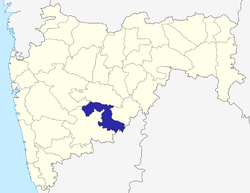 | |
| Cities and towns | ||
| Monuments | ||
| Lok Sabha constituencies | ||
| Vidhan Sabha constituencies | ||