Kalamb, Osmanabad
| Kalamb Kallam | |
|---|---|
| town | |
 Kalamb Location in Maharashtra, India | |
| Coordinates: 18°34′27″N 76°01′18″E / 18.57417°N 76.02167°ECoordinates: 18°34′27″N 76°01′18″E / 18.57417°N 76.02167°E | |
| Country |
|
| State | Maharashtra |
| District | Osmanabad |
| Elevation | 628 m (2,060 ft) |
| Population (2001) | |
| • Total | 23,022 |
| Languages | |
| • Official | Marathi |
| Time zone | IST (UTC+5:30) |
| PIN | 413507 |
| Telephone code | 02473 |
| ISO 3166 code | IN-MH |
| Vehicle registration | MH25 |
| Website |
maharashtra |
Kalamb (Kallam) is a town with a municipal council in Osmanabad district in the Indian state of Maharashtra. Administratively it is part of and headquarters for the Kalamb Tahsil.
Geography
Kalamb is located on the right (south) bank of the Manjira River, just west of the Manjira Dam Reservoir. It has an elevation of 647 metres (2,123 ft).
Demographics
In the 2011 India census, Kalamb had a population of 25,713.[1] Males constituted 52.6% of the population and females 47.4%.[1] Kalamb had an average literacy rate of 73.7%, higher than the national average of 64%: male literacy was 78%, and female literacy was 68%. In 2011 in Kalamb, 13.7% of the population was under 6 years of age.[2]
Politics
Local MLA is Mr. Ranajagjitsinha Patil, NCP
Economy
In Kalamb is primarily an agriculture market town, but it has a small textile industry.
See also
References
- 1 2 "Census 2011 Population Finder: Maharashtra: Osmanabad: Kalamb: Kalamb". Office of The Registrar General & Census Commissioner, Ministry of Home Affairs, Government of India.
- ↑ "Census of India 2001: Data from the 2001 Census, including cities, villages and towns (Provisional)". Census Commission of India. Archived from the original on 2004-06-16. Retrieved 2008-11-01.
Osmanabad district topics | ||
|---|---|---|
| History | 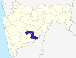 | |
| Cities and towns | ||
| Monuments | ||
| Lok Sabha constituencies | ||
| Vidhan Sabha constituencies | ||