Loretto, Kentucky
| Loretto, Kentucky | |
|---|---|
| City | |
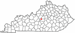 Location of Loretto, Kentucky | |
| Coordinates: 37°38′8″N 85°23′12″W / 37.63556°N 85.38667°WCoordinates: 37°38′8″N 85°23′12″W / 37.63556°N 85.38667°W | |
| Country | United States |
| State | Kentucky |
| County | Marion |
| Incorporated | 1866 |
| Named for | a local Catholic sisterhood |
| Area | |
| • Total | 3.5 sq mi (9 km2) |
| • Land | 3.5 sq mi (9 km2) |
| • Water | 0.0 sq mi (0 km2) |
| Elevation | 738 ft (225 m) |
| Population (2000) | |
| • Total | 623 |
| • Density | 177.2/sq mi (68.4/km2) |
| Time zone | Eastern (EST) (UTC-5) |
| • Summer (DST) | EDT (UTC-4) |
| ZIP code | 40037 |
| Area code(s) | 270 & 364 |
| FIPS code | 21-47710 |
| GNIS feature ID | 0497170 |
Loretto is a 6th-class city in Marion County, Kentucky, United States. The population was 623 at the 2000 census.
It is best known as the home of the Maker's Mark bourbon distillery.
History
The city takes its name from the Sisters of Loretto, a Catholic congregation founded in 1812 at nearby St. Mary's. The sisters themselves were named for Loreto in Italy, the site of the Basilica della Santa Casa which supposedly contains the original home of the Virgin Mary.
The sisters began a school at the site to educate the frontier children. By 1833, the community was large enough for its own post office.[1] It was formally incorporated in 1866.[2]
Geography
Loretto is located at 37°38′8″N 85°23′12″W / 37.63556°N 85.38667°W (37.635576, -85.386601).[3] According to the United States Census Bureau, the city has a total area of 3.5 square miles (9.1 km2), all land.
Demographics
| Historical population | |||
|---|---|---|---|
| Census | Pop. | %± | |
| 1870 | 42 | — | |
| 1880 | 129 | 207.1% | |
| 1970 | 985 | — | |
| 1980 | 954 | −3.1% | |
| 1990 | 820 | −14.0% | |
| 2000 | 623 | −24.0% | |
| 2010 | 713 | 14.4% | |
| Est. 2015 | 722 | [4] | 1.3% |
As of the census[6] of 2000, there were 623 people, 252 households, and 172 families residing in the city. The population density was 177.2 per square mile (68.4/km2). There were 269 housing units at an average density of 76.5 per square mile (29.5/km2). The racial makeup of the city was 99.52% White, and 0.48% from two or more races. Hispanic or Latino of any race were 0.16% of the population.
There were 252 households out of which 28.2% had children under the age of 18 living with them, 53.2% were married couples living together, 11.5% had a female householder with no husband present, and 31.7% were non-families. 29.0% of all households were made up of individuals and 15.5% had someone living alone who was 65 years of age or older. The average household size was 2.47 and the average family size was 3.01.
24.7% of the population was under the age of 18, 9.0% from 18 to 24, 27.4% from 25 to 44, 24.7% from 45 to 64, and 14.1% who were 65 years of age or older. The median age was 36 years. For every 100 females there were 103.6 males. For every 100 females age 18 and over, there were 97.1 males.
The median income for a household in the city was $30,000, and the median income for a family was $34,792. Males had a median income of $28,750 versus $20,972 for females. The per capita income for the city was $12,854. About 10.8% of families and 12.9% of the population were below the poverty line, including 14.6% of those under age 18 and 10.5% of those age 65 or over.
References
- ↑ Rennick, Robert. Kentucky Place Names, p. 178. University Press of Kentucky (Lexington), 1987. Accessed 1 Aug 2013.
- ↑ Commonwealth of Kentucky. Office of the Secretary of State. Land Office. "Loretto, Kentucky". Accessed 1 Aug 2013.
- ↑ "US Gazetteer files: 2010, 2000, and 1990". United States Census Bureau. 2011-02-12. Retrieved 2011-04-23.
- ↑ "Annual Estimates of the Resident Population for Incorporated Places: April 1, 2010 to July 1, 2015". Retrieved July 2, 2016.
- ↑ "Census of Population and Housing". Census.gov. Retrieved June 4, 2015.
- ↑ "American FactFinder". United States Census Bureau. Retrieved 2008-01-31.
Municipalities and communities of Marion County, Kentucky, United States | ||
|---|---|---|
| Cities | 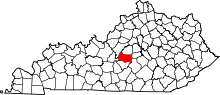 | |
| Unincorporated communities | ||