Los Banos, California
| Los Banos | |
|---|---|
| City | |
| City of Los Banos | |
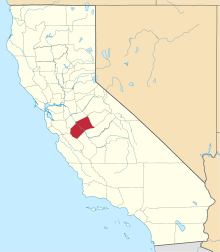
 Location in Merced County and the state of California | |
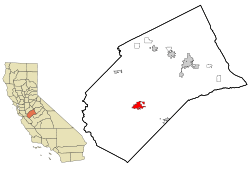
 Los Banos Location in the United States | |
| Coordinates: 37°03′30″N 120°51′00″W / 37.05833°N 120.85000°WCoordinates: 37°03′30″N 120°51′00″W / 37.05833°N 120.85000°W | |
| Country |
|
| State |
|
| County | Merced |
| Incorporated | May 8, 1907[1] |
| Government | |
| • Mayor | Mike Villalta[2] |
| Area[3] | |
| • Total | 10.117 sq mi (26.203 km2) |
| • Land | 9.993 sq mi (25.882 km2) |
| • Water | 0.124 sq mi (0.321 km2) 1.22% |
| Elevation[4] | 118 ft (36 m) |
| Population (April 1, 2010)[5] | |
| • Total | 35,972 |
| • Estimate (2013)[5] | 36,822 |
| • Density | 3,600/sq mi (1,400/km2) |
| Time zone | Pacific (UTC-8) |
| • Summer (DST) | PDT (UTC-7) |
| ZIP code | 93635 |
| Area code | 209 |
| FIPS code | 06-44028 |
| GNIS feature IDs | 277547, 2410878 |
| Website |
www |
Los Banos (/loʊsˈbænoʊs/ lohs-BAN-ohs) is a city in Merced County, central California. It is located in the San Joaquin Valley, near the junction of State Route 152 and Interstate 5.
The population was 35,972 at the 2010 census, up from 25,869 at the 2000 census. The city is served by Los Banos Municipal Airport for air transport access.
Etymology
The name Los Banos is from Spanish los baños "the baths".[6] It is named after a spring that feeds natural wetlands in the western San Joaquín Valley.[7] Its official spelling, reflected in the name of its post office, omits the tilde of the ñ.[8]
Geography
Los Banos is located on the west side of the San Joaquin Valley, 26 miles (42 km) southwest of Merced,[9] at approximately 118 ft (36 m) elevation.[4] Its coordinates are 37°03′30″N 120°51′00″W / 37.05833°N 120.85000°W.[4] The city is at the intersection of California State Route 152 and California State Route 165. To the west is Interstate 5, which runs north-to-south between the Bay Area and Los Angeles, the San Luis Reservoir, and the Diablo Range.
According to the United States Census Bureau, the city has a total area of 10.1 square miles (26 km2), of which 10.0 square miles (26 km2) is land and 0.1 square miles (0.26 km2) (1.22%) is water.

Los Banos sits on the southwestern edge of extensive national and state game refuges; wetlands that support waterfowl and other wildlife habitat along a stretch of the San Joaquin river that still carries water and the Grasslands Ecological Area, home to rare California Grasslands habitat. The San Luis National Wildlife Refuge Complex includes San Luis National Wildlife Refuge which includes the Kesterson Unit, East Bear Creek, West Bear Creek and the Blue Goose Unit. Nearby are the Merced National Wildlife Refuge and the San Joaquin River National Wildlife Refuge. Fishers, hunters, birdwatchers and other recreational users flock to Los Banos year round.
Climate
Los Banos has a Mediterranean climate with cool winters and hot summers. Most of the precipitation falls in the winter months. Gusty winds are common in the late afternoon, especially in the vicinity of nearby Pacheco Pass.
There is an average of 96.9 days with highs of 90 °F (32 °C) or higher, and an average of 29.4 days with lows of 32 °F (0 °C) or lower. The record high temperature of 116 °F (47 °C) was on July 25, 1931. A record low temperature of 14 °F (−10 °C) was on January 11, 1949, and again on December 22, 1990.
The average annual rainfall is 9.95 inches (25.3 cm). There is an average of 46 days with measurable precipitation. The wettest year recorded was 1998 with 21.08 inches (53.5 cm) and the driest year was 1947 with 4.61 inches (11.7 cm). The most rainfall in one month was 8.08 inches (20.5 cm) in March 1998. The most rainfall in 24 hours was 2.40 inches (6.1 cm) on January 18, 1914. Although snow is rare, 3 in (7.6 cm) fell in January 1916 and 1.5 inches (3.8 cm) fell in January 1962.[10]
| Los Banos | ||||||||||||||||||||||||||||||||||||||||||||||||||||||||||||
|---|---|---|---|---|---|---|---|---|---|---|---|---|---|---|---|---|---|---|---|---|---|---|---|---|---|---|---|---|---|---|---|---|---|---|---|---|---|---|---|---|---|---|---|---|---|---|---|---|---|---|---|---|---|---|---|---|---|---|---|---|
| Climate chart (explanation) | ||||||||||||||||||||||||||||||||||||||||||||||||||||||||||||
| ||||||||||||||||||||||||||||||||||||||||||||||||||||||||||||
| ||||||||||||||||||||||||||||||||||||||||||||||||||||||||||||
Demographics
| Historical population | |||
|---|---|---|---|
| Census | Pop. | %± | |
| 1910 | 745 | — | |
| 1920 | 1,276 | 71.3% | |
| 1930 | 1,875 | 46.9% | |
| 1940 | 2,214 | 18.1% | |
| 1950 | 3,868 | 74.7% | |
| 1960 | 5,272 | 36.3% | |
| 1970 | 9,188 | 74.3% | |
| 1980 | 10,341 | 12.5% | |
| 1990 | 14,519 | 40.4% | |
| 2000 | 25,869 | 78.2% | |
| 2010 | 35,972 | 39.1% | |
| Est. 2015 | 37,457 | [11] | 4.1% |
2010
The 2010 United States Census[13] reported that Los Banos had a population of 35,972. The population density was 3,555.6 people per square mile (1,372.8/km²). The racial makeup of Los Banos was 20,846 (58.0%) White, 1,354 (3.8%) African American, 512 (1.4%) Native American, 1,162 (3.2%) Asian, 134 (0.4%) Pacific Islander, 10,123 (28.1%) from other races, and 1,841 (5.1%) from two or more races. Hispanic or Latino of any race were 23,346 persons (64.9%).
The Census reported that 35,791 people (99.5% of the population) lived in households, 103 (0.3%) lived in non-institutionalized group quarters, and 78 (0.2%) were institutionalized.
There were 10,259 households, out of which 5,451 (53.1%) had children under the age of 18 living in them, 6,018 (58.7%) were opposite-sex married couples living together, 1,474 (14.4%) had a female householder with no husband present, 838 (8.2%) had a male householder with no wife present. There were 791 (7.7%) unmarried opposite-sex partnerships, and 78 (0.8%) same-sex married couples or partnerships. 1,551 households (15.1%) were made up of individuals and 653 (6.4%) had someone living alone who was 65 years of age or older. The average household size was 3.49. There were 8,330 families (81.2% of all households); the average family size was 3.84.
The population was spread out with 12,102 people (33.6%) under the age of 18, 3,703 people (10.3%) aged 18 to 24, 9,596 people (26.7%) aged 25 to 44, 7,494 people (20.8%) aged 45 to 64, and 3,077 people (8.6%) who were 65 years of age or older. The median age was 29.8 years. For every 100 females there were 99.2 males. For every 100 females age 18 and over, there were 96.0 males.
There were 11,375 housing units at an average density of 1,124.4 per square mile (434.1/km²), of which 6,197 (60.4%) were owner-occupied, and 4,062 (39.6%) were occupied by renters. The homeowner vacancy rate was 4.1%; the rental vacancy rate was 8.4%. 20,687 people (57.5% of the population) lived in owner-occupied housing units and 15,104 people (42.0%) lived in rental housing units.
2000
As of the census[14] of 2000, there were 25,869 people, 7,721 households, and 6,223 families residing in the city. The population density was 3,218.7 people per square mile (1,242.3/km²). There were 8,049 housing units at an average density of 1,001.5 per square mile (386.5/km²). The racial makeup of the city was 58.61% White, 4.25% African American, 1.35% Native American, 2.34% Asian, 0.33% Pacific Islander, 26.90% from other races, and 6.21% from two or more races. Hispanic or Latino of any race were 50.44% of the population.
There were 7,721 households out of which 48.9% had children under the age of 18 living with them, 62.5% were married couples living together, 12.4% had a female householder with no husband present, and 19.4% were non-families. 15.8% of all households were made up of individuals and 7.0% had someone living alone who was 65 years of age or older. The average household size was 3.33 and the average family size was 3.69.
In the city the population was spread out with 35.1% under the age of 18, 8.9% from 18 to 24, 29.9% from 25 to 44, 16.8% from 45 to 64, and 9.3% who were 65 years of age or older. The median age was 30 years. For every 100 females there were 99.0 males. For every 100 females age 18 and over, there were 96.0 males.
The median income for a household in the city was $43,690, and the median income for a family was $45,304. Males had a median income of $38,294 versus $27,994 for females. The per capita income for the city was $15,582. About 9.8% of families and 12.1% of the population were below the poverty line, including 13.9% of those under age 18 and 9.8% of those age 65 or over.
Government
In the California State Legislature, Los Banos is in the 12th Senate District, represented by Republican Anthony Cannella, and in the 21st Assembly District, represented by Democrat Adam Gray.[15]
In the United States House of Representatives, Los Banos is in California's 16th congressional district, which has a Cook PVI of D +7[16] and is represented by Democrat Jim Costa.[17]
Mike Villalta is the mayor.[2]
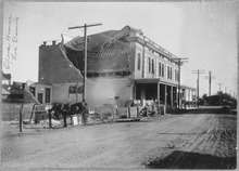
History and culture
The Los Banos area was initially settled, according to Mexican land grant records, back in the 1840s. The first white settler in the area was Uriah Wood, who built his two-room cabin in 1859.[18] The original site of Los Banos was located several miles from the current town center, about a mile and half west of the railroad near present-day Volta. The town was essentially a trading post and received its name when the Post Office was established and the Post Office Department designated the office "Los Banos" after the nearby creek. When the railroad arrived, Los Banos relocated to its present-day site.[19] The first post office opened in 1873.[9]
Land and water rights were important to early Los Banos residents, but those rights were recognized only when the land and deed were registered. Sometimes those rights depended on fleet footedness, as it did in the "race" between Los Banos residents Uriah Wood and Henry Miller. Wood, whose homestead was located off of Badger Flat Road, raced Miller to the land office in Stockton to insure his claim to the land would be recognized. After crossing the San Joaquin River, Wood paid the ferryman $5 to hold the boat on the east side of the river to insure he would gain sufficient distance from Miller to insure he would reach the land office first. Wood succeeded and the seven sections that he registered cost him only 45¢ an acre.[19]
The centerpiece of downtown Los Banos is the newly created Miller Plaza, honoring early California rancher, Henry Miller. The 10-acre (4.0 ha) half-oval public plaza features a monumental scale bronze arrangement of Miller with cattle. At one time in the late nineteenth century, Miller was the largest land owner in the United States. The success of his business monopolized the California agricultural industry, funneling resources and supplies to create his prosperous company. Centered around cattle farming, the Miller and Lux Corporation ultimately transformed the San Joaquin Valley into what can be considered as a precursor to corporate farming and turning independent farmers into wageworkers.[20] His company, the Miller & Lux Corporation, was headquartered in Los Banos on a site currently housing the Mexican restaurant España's and the Canal Farm Inn.
Los Banos has a long history of Portuguese and Spanish immigrants, as do many of the nearby towns on the west side of the San Joaquin Valley. This is reflected both in local restaurants and in several festivals and parades that take place during the year. There is also a significant community of Basques. Los Banos is locally known for its annual May Day Fair during the first week of May.
Los Banos is home to The Randall Fawcett House which is a Frank Lloyd Wright designed Usonian home.[21]
A member of the Manson family, Susan Atkins attended Los Banos High School, before joining the family.
Since the 1980s, the city's population has changed with a continuing influx of people who work in the San Jose/Silicon Valley area but seek more affordable housing and slower pace of semi-rural life, a pattern seen in many other small towns within commuting distance of Silicon Valley.
Education
K-12 education is provided by the Los Banos Unified School District. In addition, the Los Banos Campus of Merced College has served community college students since 2007.
Economy
Top employers
According to the City's 2011 Basic Financial Statements,[22] the top employers in the city are:
| # | Employer | # of Employees |
|---|---|---|
| 1 | Los Banos Unified School District | 843 |
| 2 | Memorial Hospital Los Banos | 278 |
| 3 | Walmart | 150 |
| 4 | City of Los Banos | 149 |
| 5 | Kagome | 140 |
| 6 | Target | 120 |
| 7 | The Home Depot | 80 |
| 8 | California Dairies | 70 |
| 9 | ||
Notable people
- Tony Coelho — 21st U.S. House of Representatives Majority Whip.[23]
- Ben Guintini — professional baseball player
- Frank Lima — street performer known as "The Great Morgani"
- Lance Mitchell — professional football player[24]
- Sam Pereira — poet
- Dan Whitehurst — Mayor of Fresno, California from 1977 to 1985[25]
- Logan Whitehurst — musician
- Bethany Mota - YouTube Video Blogger
Olivia De havilland - Academy Award Winning actress (Internet Movie Data Base) Joan Fontaine - younger sister of De havilland and also an Academy Award winner (Internet Movie Data Base)
References
- ↑ "California Cities by Incorporation Date" (Word). California Association of Local Agency Formation Commissions. Retrieved August 25, 2014.
- 1 2 "Mayor & City Council Members". City of Los Banos. Retrieved November 23, 2014.
- ↑ "2010 Census Gazetteer Files – Places – California". United States Census Bureau. Retrieved March 26, 2015.
- 1 2 3 "Los Banos". Geographic Names Information System. United States Geological Survey.
- 1 2 "Los Banos (city) QuickFacts". United States Census Bureau. Retrieved March 18, 2015.
- ↑ Gannett, Henry (1905). The Origin of Certain Place Names in the United States. U.S. Government Printing Office. p. 190.
- ↑ http://www.losbanos.org/index.php?option=com_content&view=article&id=2&Itemid=125
- ↑ "The City We Serve: Los Banos". Los Banos Chamber of Commerce. Retrieved 26 December 2015.
- 1 2 Durham, David L. (1998). California's Geographic Names: A Gazetteer of Historic and Modern Names of the State. Clovis, Calif.: Word Dancer Press. p. 796. ISBN 1-884995-14-4.
- 1 2 Western Regional Climate Center—Los Banos
- ↑ "Annual Estimates of the Resident Population for Incorporated Places: April 1, 2010 to July 1, 2015". Retrieved July 2, 2016.
- ↑ "Census of Population and Housing". Census.gov. Retrieved June 4, 2015.
- ↑ "2010 Census Interactive Population Search: CA - Los Banos city". U.S. Census Bureau. Retrieved July 12, 2014.
- ↑ "American FactFinder". United States Census Bureau. Retrieved 2008-01-31.
- ↑ "Statewide Database". UC Regents. Retrieved November 23, 2014.
- ↑ "Partisan Voting Index" (PDF). Cook Political. Retrieved 2013-10-24.
- ↑ "California's 16th Congressional District - Representatives & District Map". Civic Impulse, LLC.
- ↑ Uriah Wood First White Settler in LB, Los Banos Enterprise, 7-16 1964 p D-4
- 1 2 Merced County, California Archives History — Books ... Early Days On The West Side (1925) Chapter XII
- ↑ Henry Miller Papers Collection, "Correspondance to Superintendant Turner," 18 July 1912, Special Collections, Henry Madden Library, California State University Fresno
- ↑ "Frank Lloyd Wright Fawcett House". Swipelife. March 17, 2009.
- ↑ City of Fresno, California Comprehensive Annual Financial Report, for the Year ended June 30, 2011
- ↑ "Biographical Directory of the United States Congress".
- ↑ "Lance Mitchell". Sports Reference LLC.
- ↑ "Full Biography for Daniel K. Whitehurst". Smart Voter. League of Women Voters. February 4, 2000.
External links
| Wikimedia Commons has media related to Los Banos, California. |
- Official website
- Losbanosenterprise.com: "Los Banos Enterprise" — local online newspaper.
- OurLosBanos.com: "Our Los Banos Magazine"
- Fws.gov: — San Luis National Wildlife Refuge