Lost Trail Pass
| Lost Trail Pass | |
|---|---|
 Lost Trail Location in Idaho, on the border with Montana | |
| Elevation | 7,014 ft (2,138 m) |
| Traversed by |
|
| Location |
Lemhi County, Idaho / Ravalli County, Montana, United States |
| Range |
Bitterroot Mountains, Bitterroot Range, Rocky Mountains |
| Coordinates | 45°41.6′N 113°56.9′W / 45.6933°N 113.9483°WCoordinates: 45°41.6′N 113°56.9′W / 45.6933°N 113.9483°W |
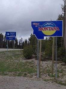
Lost Trail Pass is a mountain pass in the Rocky Mountains of the United States, on the border of Idaho and Montana in the Bitterroot Mountains. The pass is at an elevation of 7014 feet (2138 m) above sea level and is traversed by U.S. Highway 93. The pass is about a half-mile (1 km) west of the continental divide, which retreats eastward at this point, inside Montana along the Ravalli-Beaverhead county border, toward Butte.
South of the pass in Idaho is the North Fork of the Salmon River, which descends with US-93 to North Fork to join the main Salmon River. In Montana, US-93 drops northward into the Bitterroot River Valley, and gradually descends towards Hamilton, Lolo, and Missoula.
Lewis and Clark crossed the divide between Lemhi County (Idaho) and Ravalli County (Montana) approximately 1.3 miles northwest of Lost Trail Pass on September 4, 1805 to enter the Bitterroot Valley. They later rested for a few days at Traveler's Rest, near present-day Lolo, in preparation for their crossing over the Bitterroots at Lolo Pass, back into present-day Idaho, following the Lolo Trail, north of US-12.
The Lost Trail Powder Mountain ski area is at the pass, immediately west of US-93.
References
External links
- Idaho Transportation Dept. - webcam - Lost Trail Pass
- Lost Trail.com - Lost Trail Powder Mountain ski area - official site