Lemhi County, Idaho
| Lemhi County, Idaho | ||
|---|---|---|
| ||
 Location in the U.S. state of Idaho | ||
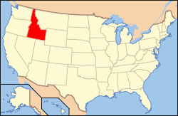 Idaho's location in the U.S. | ||
| Founded | January 9, 1869 | |
| Named for | Fort Lemhi | |
| Seat | Salmon | |
| Largest city | Salmon | |
| Area | ||
| • Total | 4,569 sq mi (11,834 km2) | |
| • Land | 4,563 sq mi (11,818 km2) | |
| • Water | 5.4 sq mi (14 km2), 0.1% | |
| Population | ||
| • (2010) | 7,936 | |
| • Density | 1.7/sq mi (1/km²) | |
| Congressional district | 2nd | |
| Time zone | Mountain: UTC-7/-6 | |
| Website |
www | |

Lemhi County is a county located in the U.S. state of Idaho. As of the 2010 census, the population was 7,936.[1] The largest city and county seat is Salmon.[2] The county was established in 1869, named after Fort Lemhi (or Limhi), a remote Mormon missionary settlement from 1855–58 in Bannock and Shoshone territory.[3]
Traffic signals
Geography
According to the U.S. Census Bureau, the county has a total area of 4,569 square miles (11,830 km2), of which 4,563 square miles (11,820 km2) is land and 5.4 square miles (14 km2) (0.1%) is water.[4] It is the fourth-largest county in Idaho by area. The highest point is Bell Mountain at 11,612 ft (3,539 m) above sea level, and the lowest point is the Salmon River as it exits on the county's western border with Idaho County at approximately 3,000 feet (914 m). The river cuts through the center of Lemhi County before turning west. The county's eastern border with Beaverhead County, Montana, is the continental divide.
Adjacent counties
- Idaho County – northwest
- Valley County – west
- Custer County – south
- Butte County – south
- Clark County – east
- Beaverhead County, Montana – northeast
- Ravalli County, Montana – north
National protected areas
- Challis National Forest (part)
- Salmon National Forest (part)
- Targhee National Forest (part)
- Frank Church—River of No Return Wilderness (part)
Demographics
| Historical population | |||
|---|---|---|---|
| Census | Pop. | %± | |
| 1870 | 988 | — | |
| 1880 | 2,230 | 125.7% | |
| 1890 | 1,915 | −14.1% | |
| 1900 | 3,446 | 79.9% | |
| 1910 | 4,786 | 38.9% | |
| 1920 | 5,164 | 7.9% | |
| 1930 | 4,643 | −10.1% | |
| 1940 | 6,521 | 40.4% | |
| 1950 | 6,278 | −3.7% | |
| 1960 | 5,816 | −7.4% | |
| 1970 | 5,566 | −4.3% | |
| 1980 | 7,460 | 34.0% | |
| 1990 | 6,899 | −7.5% | |
| 2000 | 7,806 | 13.1% | |
| 2010 | 7,936 | 1.7% | |
| Est. 2015 | 7,735 | [5] | −2.5% |
| U.S. Decennial Census[6] 1790–1960[7] 1900–1990[8] 1990–2000[9] 2010–2013[1] | |||
2000 census
As of the census[10] of 2000, there were 7,806 people, 3,275 households, and 2,217 families residing in the county. The population density was 2 people per square mile (1/km²). There were 4,154 housing units at an average density of 1 per square mile (0/km²). The racial makeup of the county was 96.63% White, 0.10% Black or African American, 0.60% Native American, 0.18% Asian, 0.04% Pacific Islander, 0.77% from other races, and 1.68% from two or more races. 2.18% of the population were Hispanic or Latino of any race. 19.5% were of German, 18.0% English, 11.4% American and 6.5% Irish ancestry according to Census 2000.
There were 3,275 households out of which 28.60% had children under the age of 18 living with them, 57.80% were married couples living together, 6.90% had a female householder with no husband present, and 32.30% were non-families. 27.70% of all households were made up of individuals and 12.40% had someone living alone who was 65 years of age or older. The average household size was 2.38 and the average family size was 2.91.
In the county the population was spread out with 25.50% under the age of 18, 5.50% from 18 to 24, 22.70% from 25 to 44, 29.50% from 45 to 64, and 16.80% who were 65 years of age or older. The median age was 43 years. For every 100 females there were 99.20 males. For every 100 females age 18 and over, there were 97.50 males.
The median income for a household in the county was $30,185, and the median income for a family was $35,261. Males had a median income of $30,558 versus $18,289 for females. The per capita income for the county was $16,037. About 10.60% of families and 15.30% of the population were below the poverty line, including 19.80% of those under age 18 and 10.30% of those age 65 or over.
2010 census
As of the 2010 United States Census, there were 7,936 people, 3,576 households, and 2,267 families residing in the county.[11] The population density was 1.7 inhabitants per square mile (0.66/km2). There were 4,729 housing units at an average density of 1.0 per square mile (0.39/km2).[12] The racial makeup of the county was 96.4% white, 0.7% American Indian, 0.4% Asian, 0.2% black or African American, 0.6% from other races, and 1.6% from two or more races. Those of Hispanic or Latino origin made up 2.3% of the population.[11] In terms of ancestry, 25.9% were German, 22.4% were English, 13.0% were Irish, 9.9% were American, and 6.2% were Swedish.[13]
Of the 3,576 households, 22.9% had children under the age of 18 living with them, 52.7% were married couples living together, 6.9% had a female householder with no husband present, 36.6% were non-families, and 31.7% of all households were made up of individuals. The average household size was 2.20 and the average family size was 2.74. The median age was 49.7 years.[11]
The median income for a household in the county was $36,411 and the median income for a family was $49,119. Males had a median income of $37,763 versus $21,233 for females. The per capita income for the county was $21,699. About 13.0% of families and 20.0% of the population were below the poverty line, including 36.3% of those under age 18 and 8.3% of those age 65 or over.[14]
Communities
Cities
Unincorporated communities
See also
References
- 1 2 "State & County QuickFacts". United States Census Bureau. Retrieved July 1, 2014.
- ↑ "Find a County". National Association of Counties. Retrieved 2011-06-07.
- ↑ "Idaho for the Curious", by Cort Conley, ©1982, ISBN 0-9603566-3-0, p.214-216
- ↑ "US Gazetteer files: 2010, 2000, and 1990". United States Census Bureau. 2011-02-12. Retrieved 2011-04-23.
- ↑ "County Totals Dataset: Population, Population Change and Estimated Components of Population Change: April 1, 2010 to July 1, 2015". Retrieved July 2, 2016.
- ↑ "U.S. Decennial Census". United States Census Bureau. Retrieved July 1, 2014.
- ↑ "Historical Census Browser". University of Virginia Library. Retrieved July 1, 2014.
- ↑ "Population of Counties by Decennial Census: 1900 to 1990". United States Census Bureau. Retrieved July 1, 2014.
- ↑ "Census 2000 PHC-T-4. Ranking Tables for Counties: 1990 and 2000" (PDF). United States Census Bureau. Retrieved July 1, 2014.
- ↑ "American FactFinder". United States Census Bureau. Retrieved 2008-01-31.
- 1 2 3 "DP-1 Profile of General Population and Housing Characteristics: 2010 Demographic Profile Data". United States Census Bureau. Retrieved 2016-01-09.
- ↑ "Population, Housing Units, Area, and Density: 2010 – County". United States Census Bureau. Retrieved 2016-01-09.
- ↑ "DP02 SELECTED SOCIAL CHARACTERISTICS IN THE UNITED STATES – 2006–2010 American Community Survey 5-Year Estimates". United States Census Bureau. Retrieved 2016-01-09.
- ↑ "DP03 SELECTED ECONOMIC CHARACTERISTICS – 2006–2010 American Community Survey 5-Year Estimates". United States Census Bureau. Retrieved 2016-01-09.
 |
Ravalli County, Montana and Beaverhead County, Montana | Beaverhead County, Montana | | |
| Idaho County and Valley County | |
Clark County | ||
| ||||
| | ||||
| Custer County and Butte County |
Municipalities and communities of Lemhi County, Idaho, United States | ||
|---|---|---|
| Cities | ||
| Unincorporated communities | ||
Coordinates: 44°58′N 113°57′W / 44.96°N 113.95°W