Lumpkin County, Georgia
| Lumpkin County, Georgia | |
|---|---|
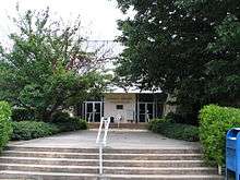 Lumpkin County Courthouse in Dahlonega | |
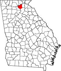 Location in the U.S. state of Georgia | |
 Georgia's location in the U.S. | |
| Founded | December 3, 1832 |
| Named for | Wilson Lumpkin |
| Seat | Dahlonega |
| Largest city | Dahlonega |
| Area | |
| • Total | 284 sq mi (736 km2) |
| • Land | 283 sq mi (733 km2) |
| • Water | 1.3 sq mi (3 km2), 0.4% |
| Population (est.) | |
| • (2015) | 31,408 |
| • Density | 106/sq mi (41/km²) |
| Congressional district | 9th |
| Time zone | Eastern: UTC-5/-4 |
| Website |
www |
Lumpkin County is a county located in the north central portion of the U.S. state of Georgia. As of the 2010 census, the population was 29,966.[1] Its county seat is Dahlonega.[2]
History
Lumpkin County was created on December 3, 1832. The county was named for former governor of Georgia, Wilson Lumpkin.[3] Lumpkin's daughter, Martha Wilson Lumpkin Compton, was the source for the town named Marthasville, the early-1840s predecessor of Atlanta.
Gold was discovered in the county near Auraria in the 1830s, and the U.S. government had a mint in Dahlonega for over twenty years, as a result, until the Civil War. Gold from the county was later used on the dome of the current state capitol building.
Agriculture and agritourism are top business industries. Since the mid-1990s, Lumpkin County has been recognized as "The Heart of Georgia Wine Country." The county features multiple [vineyards]] and five licensed wineries that attract many tourists. In 2015, Senator Steve Gooch introduced Georgia Senate Resolution 125 officially recognizing Lumpkin County as the Wine Tasting Room Capital of Georgia.
The historic Dahlonega Square is also a popular destination, with gift shops, restaurants, art galleries and artists' studios and additional tasting rooms.
Lumpkin county is the home of the U.S. Army's Camp Frank D. Merrill, the home of the 5th Ranger Training Battalion of the U.S. Army Ranger School's mountain Phase. Camp Frank D. Merrill is located in the Northern end of the County, within the Blue Ridge Wildlife Management Area of the Chattahoochee National Forest.[4]
There are three Veterans Organizations located in Lumpkin County, to serve the Veterans and Community. The first is the Heyward Fields American Legion Post 239, the US Army Mountain Ranger Association, and the Lumpkin and White County Veterans of Foreign Wars Post 5533. Lumpkin County also has an agency to help veterans, that agency is named the Lumpkin County Veterans Affairs Advisory Committee, which is in charge of the Lumpkin County Veterans Memorial and the twice yearly Veterans memorial Crosses, which line both sides of the major roads in Dahlonega, from mid-May through the Fourth of July and again for the Month of November. The Crosses are adorned with the names of the county's veterans who have died, some in combat (marked with KIA), and those who returned home and later died.[5]
Geography
According to the U.S. Census Bureau, the county has a total area of 284 square miles (740 km2), of which 283 square miles (730 km2) is land and 1.3 square miles (3.4 km2) (0.4%) is water.[6] The summit of Blood Mountain, which Lumpkin shares with Union County to the north, is the highest point in the county. At 4458 feet, Blood Mountain is the 5th-highest peak in Georgia and the highest point on Georgia's portion of the Appalachian Trail. The western forty percent of Lumpkin County is located in the Etowah River sub-basin of the ACT River Basin (Alabama-Coosa-Tallapoosa River Basin), while the eastern sixty percent of the county is located in the Upper Chattahoochee River sub-basin of the ACF River Basin (Apalachicola-Chattahoochee-Flint River Basin).[7]
Major highways
Adjacent counties
- Union County – north
- White County – east
- Hall County – southeast
- Dawson County – west
- Fannin County – northwest
National protected area
Demographics
| Historical population | |||
|---|---|---|---|
| Census | Pop. | %± | |
| 1840 | 5,671 | — | |
| 1850 | 8,955 | 57.9% | |
| 1860 | 4,626 | −48.3% | |
| 1870 | 5,161 | 11.6% | |
| 1880 | 6,526 | 26.4% | |
| 1890 | 6,867 | 5.2% | |
| 1900 | 7,433 | 8.2% | |
| 1910 | 5,444 | −26.8% | |
| 1920 | 5,240 | −3.7% | |
| 1930 | 4,927 | −6.0% | |
| 1940 | 6,223 | 26.3% | |
| 1950 | 6,574 | 5.6% | |
| 1960 | 7,241 | 10.1% | |
| 1970 | 8,728 | 20.5% | |
| 1980 | 10,762 | 23.3% | |
| 1990 | 14,573 | 35.4% | |
| 2000 | 21,016 | 44.2% | |
| 2010 | 29,966 | 42.6% | |
| Est. 2015 | 31,408 | [8] | 4.8% |
| U.S. Decennial Census[9] 1790-1960[10] 1900-1990[11] 1990-2000[12] 2010-2013[1] | |||
2000 census
As of the census[13] of 2000, there were 21,016 people, 7,537 households, and 5,366 families residing in the county. The population density was 74 people per square mile (29/km²). There were 8,263 housing units at an average density of 29 per square mile (11/km²). The racial makeup of the county was 94.02% White, 1.46% Black or African American, 0.97% Native American, 0.38% Asian, 0.08% Pacific Islander, 1.57% from other races, and 1.53% from two or more races. 3.46% of the population were Hispanic or Latino of any race.
There were 7,537 households out of which 32.90% had children under the age of 18 living with them, 57.50% were married couples living together, 9.40% had a female householder with no husband present, and 28.80% were non-families. 22.00% of all households were made up of individuals and 6.50% had someone living alone who was 65 years of age or older. The average household size was 2.61 and the average family size was 3.04.
In the county the population was spread out with 24.30% under the age of 18, 15.40% from 18 to 24, 29.00% from 25 to 44, 21.60% from 45 to 64, and 9.70% who were 65 years of age or older. The median age was 32 years. For every 100 females there were 96.30 males. For every 100 females age 18 and over, there were 92.60 males.
The median income for a household in the county was $39,167, and the median income for a family was $46,368. Males had a median income of $31,289 versus $23,955 for females. The per capita income for the county was $18,062. About 9.00% of families and 13.20% of the population were below the poverty line, including 13.50% of those under age 18 and 16.30% of those age 65 or over.
2010 census
As of the 2010 United States Census, there were 29,966 people, 10,989 households, and 7,645 families residing in the county.[14] The population density was 105.9 inhabitants per square mile (40.9/km2). There were 12,925 housing units at an average density of 45.7 per square mile (17.6/km2).[15] The racial makeup of the county was 94.4% white, 1.1% black or African American, 0.6% American Indian, 0.5% Asian, 0.1% Pacific islander, 1.5% from other races, and 1.8% from two or more races. Those of Hispanic or Latino origin made up 4.5% of the population.[14] In terms of ancestry, 17.6% were American, 17.5% were Irish, 15.6% were English, 14.4% were German, and 5.0% were Scotch-Irish.[16]
Of the 10,989 households, 31.1% had children under the age of 18 living with them, 55.3% were married couples living together, 9.6% had a female householder with no husband present, 30.4% were non-families, and 22.2% of all households were made up of individuals. The average household size was 2.56 and the average family size was 3.00. The median age was 36.1 years.[14]
The median income for a household in the county was $43,394 and the median income for a family was $50,318. Males had a median income of $38,043 versus $30,755 for females. The per capita income for the county was $20,088. About 9.2% of families and 15.2% of the population were below the poverty line, including 15.9% of those under age 18 and 11.2% of those age 65 or over.[17]
Education
Lumpkin County is served by Lumpkin County School System. There is 1 high school (Lumpkin County High School), 1 middle school (Lumpkin County Middle School), and 3 elementary schools (Lumpkin County Elementary School, Long Branch Elementary School, and Blackburn Elementary School). The University of North Georgia is also in Lumpkin County.
Communities
See also
References
- 1 2 "State & County QuickFacts". United States Census Bureau. Retrieved June 23, 2014.
- ↑ "Find a County". National Association of Counties. Retrieved 2011-06-07.
- ↑ State of Georgia (2012). "Lumpkin County". State of Georgia. Retrieved 2012-05-29.
- ↑ http://www.benning.army.mil › Organizations › 5th RTBn Home
- ↑ http://www.lumpkincountyveteransadvisory.com/
- ↑ "US Gazetteer files: 2010, 2000, and 1990". United States Census Bureau. 2011-02-12. Retrieved 2011-04-23.
- ↑ "Georgia Soil and Water Conservation Commission Interactive Mapping Experience". Georgia Soil and Water Conservation Commission. Retrieved 2015-11-19.
- ↑ "County Totals Dataset: Population, Population Change and Estimated Components of Population Change: April 1, 2010 to July 1, 2015". Retrieved July 2, 2016.
- ↑ "U.S. Decennial Census". United States Census Bureau. Retrieved June 23, 2014.
- ↑ "Historical Census Browser". University of Virginia Library. Retrieved June 23, 2014.
- ↑ "Population of Counties by Decennial Census: 1900 to 1990". United States Census Bureau. Retrieved June 23, 2014.
- ↑ "Census 2000 PHC-T-4. Ranking Tables for Counties: 1990 and 2000" (PDF). United States Census Bureau. Retrieved June 23, 2014.
- ↑ "American FactFinder". United States Census Bureau. Retrieved 2011-05-14.
- 1 2 3 "DP-1 Profile of General Population and Housing Characteristics: 2010 Demographic Profile Data". United States Census Bureau. Retrieved 2015-12-30.
- ↑ "Population, Housing Units, Area, and Density: 2010 - County". United States Census Bureau. Retrieved 2015-12-30.
- ↑ "DP02 SELECTED SOCIAL CHARACTERISTICS IN THE UNITED STATES – 2006-2010 American Community Survey 5-Year Estimates". United States Census Bureau. Retrieved 2015-12-30.
- ↑ "DP03 SELECTED ECONOMIC CHARACTERISTICS – 2006-2010 American Community Survey 5-Year Estimates". United States Census Bureau. Retrieved 2015-12-30.
 |
Fannin County | Union County | | |
| Dawson County | |
White County | ||
| ||||
| | ||||
| Hall County |
Municipalities and communities of Lumpkin County, Georgia, United States | ||
|---|---|---|
| City | | |
| Ghost town | ||
Template:Georgia
Coordinates: 34°34′N 84°00′W / 34.57°N 84.00°W