Lusaka Province
| Lusaka | |
|---|---|
| Province | |
 Map of the Lusaka Province showing its districts. | |
| Country |
|
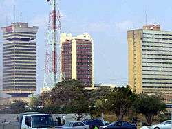
| Capital | Lusaka |
| Area | |
| • Total | 21,896 km2 (8,454 sq mi) |
| Population (2015) | |
| • Total | 2,777,439 |
| • Density | 130/km2 (330/sq mi) |
Lusaka Province is one of Zambia's ten provinces. The provincial capital is Lusaka, which is also the national capital. It is the smallest with 21,896 sq. km. In terms of population, Lusaka was the most populated and most densely populated with a population of 2,191,225 and density of 100 persons per sq. km as of 2010. It is the most urban province with most number of doctors and least number of Malaria related incidents. The province is bordered along Zimbabwe and separated by the Lower Zambezi National Park.
The Lower Zambezi National Park, parts of the Lunsemfwa River valley and the lower Luangwa Valley in the north-east and part of the Kafue Flats in the south-west are the major National parks and game area in Lusaka Province. The Nkhombalyanga festival celebrated in Chongwe District by Soli tribe during July, Dantho festival celebrated in Luangwa District by Chikunda tribe during September, Chakwela Makumbi festival celebrated in Chongwe District by Soli tribe during September are the major festivals in the province.
There are eight districts in the province. As of 2004, the literacy rate was 83 per cent, the unemployment rate was 31 per cent and the general unemployment rate for youth stood at 52 per cent as of 2008. Kenneth Kaunda International Airport and Lusaka City Airport are the two airports in the province.
Geography
Lusaka Province is bordered along Zimbabwe along Lower Zambezi National Park in the south, Central Province in the north, Southern Province in the southwest and Eastern Province in the north east. The general topography of the province is characterized by uplifted plantation surfaces. The general elevation of the nation as a whole is tended towards West to East from the Kalahari Basin. The level of land falls from the upper Congo towards the Zambezi depression in the South forming a plateau.[1]
Kafue River is a tributary of Zambezi River and it has huge valleys breaking the plateau. The province lies in the watershed between Congo DR and Zambezi river systems. The province lies in the frontier formed between the continental divide separating the Atlantic Ocean and the Indian Ocean, which traverses from DR Congo to the south of Tanzania. There are three major seasons: a cool dry season from April to August, a hot dry season from August to November and a warm wet season from November to April. The maximum heat and rainfall, both are experienced during October. The annual rainfall is less than 750 mm in the region.[2]
| Climate data for Lusaka (Zambia) | |||||||||||||
|---|---|---|---|---|---|---|---|---|---|---|---|---|---|
| Month | Jan | Feb | Mar | Apr | May | Jun | Jul | Aug | Sep | Oct | Nov | Dec | Year |
| Record high °C (°F) | 26 (79) |
25.9 (78.6) |
28.7 (83.7) |
25.8 (78.4) |
24.2 (75.6) |
22.6 (72.7) |
22.5 (72.5) |
25.1 (77.2) |
28.7 (83.7) |
30.3 (86.5) |
29 (84) |
26.3 (79.3) |
30.3 (86.5) |
| Average high °C (°F) | 21.1 (70) |
21 (70) |
20.8 (69.4) |
20.1 (68.2) |
17.2 (63) |
16.8 (62.2) |
15.1 (59.2) |
17 (63) |
21.4 (70.5) |
24.3 (75.7) |
22.3 (72.1) |
21.3 (70.3) |
24.3 (75.7) |
| Average low °C (°F) | 17.1 (62.8) |
16.9 (62.4) |
16.2 (61.2) |
15.8 (60.4) |
12 (54) |
11 (52) |
9.2 (48.6) |
11.3 (52.3) |
14.4 (57.9) |
19.2 (66.6) |
17.6 (63.7) |
17.3 (63.1) |
9.2 (48.6) |
| Average precipitation mm (inches) | 17 (0.67) |
17 (0.67) |
10 (0.39) |
3 (0.12) |
0 (0) |
0 (0) |
0 (0) |
0 (0) |
0 (0) |
2 (0.08) |
8 (0.31) |
17 (0.67) |
74 (2.91) |
| Source: [3] | |||||||||||||
Demographics
| Historical population | ||
|---|---|---|
| Year | Pop. | ±% |
| 1980 | 1,292,955 | — |
| 1990 | 1,342,632 | +3.8% |
| 2000 | 1,391,329 | +3.6% |
| 2010 | 2,191,225 | +57.5% |
| Sources: | ||
As per the 2010 Zambian census, Lusaka Province had a population of 2,191,225 accounting to 16.78% of the total Zambian population of 1,3,092,666. There were 1,082,998 males and 1,108,227 females, making the sex ratio to 1,023 for every 1,000 males, compared to the national average of 1,028.[5] The literacy rate stood at 83.00% against a national average of 70.2%.[6] The rural population constituted 15.35%, while the urban population was 84.65%. The total area of the province was 21,896 sq. km and the population density was 100.10 per sq. km. The population density during 2000 Zambian census stood at 100.10.[7] The decadal population growth of the province was 4.60%. The median age in the province at the time of marriage was 22.1.[8] The average household size was 5.1, with the families headed by females being 4.5 and 5.0 for families headed by men.[9] The total eligible voters in the province was 57.10%.[10] The unemployment rate of the province was 20.00%. The total fertility rate was 4.6, complete birth rate was 5.2, crude birth rate was 31.0, child women population at birth was 571, general fertility rate was 114, gross reproduction rate was 1.7 and net reproduction rate was 1.3.[11] The total labour force constituted 50.60% of the total population. Out of the labour force,65.5% were men and 36.3% women. The annual growth rate of labour force was 5.8%.[12] Bemba was the most spoken language with 17.60% speaking it.[13] Albinism is a condition where the victims do not have any pigment in their skin, hair or eyes. The total population in the province with the condition stood at 3,495.[14] The life expectancy at birth stood at 54 compared to the national average of 51.[15]
National Parks and culture
The Lower Zambezi National Park, parts of the Lunsemfwa River valley and the lower Luangwa Valley in the north-east and part of the Kafue Flats in the south-west are the major National parks and game area in Lusaka Province. The Nkhombalyanga festival celebrated in Chongwe District by Soli tribe during July, Dantho festival celebrated in Luangwa District by Chikunda tribe during September, Chakwela Makumbi festival celebrated in Chongwe District by Soli tribe during September, Mbambara festival celebrated in Luangwa District by Nsenga Luzi tribe during November, Chibwela Kumushi festival celebrated in Luangwa District by Soli tribe during November, Kailala festival celebrated in Kafue District by Goba tribe during November and Chibwela Kumushi festival celebrated in Luangwa District by Soli tribe during November are the major festivals celebrated in the Province.[16]
Administration
| Profession[17] | % of working population |
| Agriculture, Forestry & Fishing (by Industry) | 4.80 |
| Community, Social and Personnel | 33.90 |
| Construction | 35.80 |
| Electricity, Gas, and water | 26.80 |
| Financial & Insurance | 43.10 |
| Hotels and Restaurants | 36.70 |
| Manufacturing | 27.10 |
| Mining & Quarrying | 9.30 |
| Transportation and Storage | 37.00 |
| Wholesale & Retail Trade | 32.30 |
Provincial administration is setup purely for administrative purposes. The province is headed by a minister appointed by the President and there are ministries of central government for each province. The administrative head of the province is the Permanent Secretary, appointed by the President. There is a Deputy Premanent Secretary, heads of government departments and civil servants at the provincial level. Lusaka Province is divided into eight districts, namely, Chilanga District, Chirundu District, Chongwe District, Kafue District, Luangwa District, Lusaka District, Rufunsa District and Shibuyunji District. All the district headquarters are the same as the district names. There are eight councils in the province, each of which is headed by a an elected representative, called councilor. Each councilor holds office for three years.[18] The administrative staff of the council is selected based on Local Government Service Commission from within or outside the district. The office of the provincial government is located in each of the district headquarters and has provincial local government officers and auditors. Each council is responsible for raising and collecting local taxes and the budgets of the council are audited and submitted every year after the annual budget. The elected members of the council do not draw salaries, but are paid allowances from the council. Luapula is the province and country capital and it has one city council. The government stipulates 63 different functions for the councils with the majority of them being infrastructure management and local administration. Councils are mandated to maintain each of their community centres, zoos, local parks, drainage system, playgrounds, cemeteries, caravan sites, libraries, museums and art galleries. They also work along with specific government departments for helping in agriculture, conservation of natural resources, postal service, establishing and maintaining hospitals, schools and colleges. The councils prepare schemes that encourage community participation.[19]
Economy and education
| HIV infected & AIDS deaths[20] | ||
|---|---|---|
| Year | HIV infected | AIDS deaths |
| 1985 | 1,518 | 107 |
| 1990 | 23,828 | 640 |
| 1995 | 111,753 | 4,786 |
| 2000 | 155,729 | 12,188 |
| 2005 | 155,687 | 16,569 |
| 2010 | 141,663 | 15,429 |
As of 2004, the province had 502 basic schools, 39 high schools and the number of school children out of school in ages between 7 and 15 stood at 502 . The unemployment rate was 31 per cent and the general unemployment rate for youth stood at 52 per cent as of 2008. The province had 231 doctors as of 2005. There were 313 Malaria incidence for every 1,000 people in the province as of 2005 and there were 15,429 AIDS death as of 2010.[21]
The total area of crops planted during the year 2014 in the province was 82,603.72 hectares which constituted 4.35% of the total area cultivated in Zambia. The net production stood at 234,807 metric tonnes, which formed 5.76% of the total agricultural production in the country. Wheat was the major crop in the province with 48,510 metric tonnes, constituting 24.07% of the national output.[22] Kenneth Kaunda International Airport and Lusaka City Airport are the two airports in the province.[23][24]
Notes
- ↑ "Geography of Zambia". Zambia Tourism Board. 2011. Retrieved 19 October 2016.
- ↑ Williams, Geoffery J. (2003). "Physical and social geography of Zambia". Africa South of the Sahara 2004. Psychology Press. p. 1995. ISBN 9781857431834.
- ↑ "Weather statistics for Lusaka (Zambia)". Norway: Norwegian Meteorological Institute and Norwegian Broadcasting Corporation. 2007. Retrieved 20 October 2016.
- ↑ Summary report for the 2000 Census of population (Report). Lusaka: Central Statistical Office, Republic of Zambia. 2003. p. 6.
- 1 2 Census 2012, p. 7
- ↑ Census 2012, p. 24
- ↑ Census 2012, p. 17
- ↑ Census 2012, pp. 12-13
- ↑ Census 2012, p. 19
- ↑ Census 2012, p. 21
- ↑ Census 2012, p. 44
- ↑ Census 2012, p. 93
- ↑ Census 2012, p. 99
- ↑ Census 2012, p. 78
- ↑ Census 2012, p. 74
- ↑ "Traditional Ceremonies". Ministry of Tourism and Arts, Republic of Zambia. 2011. Retrieved 20 October 2016.
- ↑ "Labour force survey". Central Stastistical Office of Zambia. 2008. Retrieved 17 October 2016.
- ↑ Zambi Public administration Country profile (PDF) (Report). Division for Public Administration and Development Management (DPADM), Department of Economic and Social Affairs (DESA), United Nations. 2004. p. 7. Retrieved 16 October 2016.
- ↑ The local government system in Zambia (PDF) (Report). Common Wealth Local Government Forum. pp. 218–220. Retrieved 16 October 2016.
- ↑ "AIDS and HIV statistics". Central Stastistical Office of Zambia. 2011. Retrieved 17 October 2016.
- ↑ "Atlas Home". Zambia data portal, Central statistical Office of Zambia. 2011. Retrieved 16 October 2016.
- ↑ "Agriculture statistics of Zambia 2014". Central Stastistical Office of Zambia. 2016. Retrieved 17 October 2016.
- ↑ "Airports in Zamiba". The Great Circle Mapper. 2012. Retrieved 18 October 2016.
- ↑ "Code for Trade and Transport Locations". United Nations. 2012. Retrieved 18 October 2016.
References
- Summary report for the 2010 Census of population (PDF) (Report). Lusaka: Central Statistical Office, Republic of Zambia. 2012.
External links
Coordinates: 15°25′S 29°00′E / 15.417°S 29.000°E