Lysychansk
| Lysychansk Лисичанськ Лисичанск | |||
|---|---|---|---|
| City of regional significance | |||
|
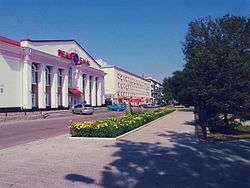
Dovzhenka Str. | |||
| |||
| Coordinates: 48°55′N 38°24′E / 48.917°N 38.400°ECoordinates: 48°55′N 38°24′E / 48.917°N 38.400°E | |||
| Country |
| ||
| Oblast |
| ||
| Raion | Lysychansk Municipality | ||
| Founded | 17101 | ||
| City rights | 1938 | ||
| Area[1] | |||
| • Total | 96 km2 (37 sq mi) | ||
| Elevation | 145 m (475.7 ft) | ||
| Population (January 1, 2014) | |||
| • Total | 103 459 | ||
| • Density | 1,201.430/km2 (3,111.69/sq mi) | ||
| Time zone | EET (UTC+2) | ||
| • Summer (DST) | EEST (UTC+3) | ||
| Postal code | 93100—93199 | ||
| Area code(s) | +380 6451 | ||
| Licence plate | BB | ||
| Climate | Dfb | ||
| Website | Lis.gov.ua | ||


Lysychansk (Ukrainian: Лисича́нськ [lɪsɪˈt͡ʃɑɲsʲk]) Russian: Лисича́нск) is a city in the Luhansk region of Ukraine. It is incorporated as a city of oblast significance and located on the high right bank of the Siverskyi Donets River, approximately 115 km from the oblast capital, Luhansk. Population: 104,314 (2013 est.)[2].
In 1952 Lysychansk became the regional center. The present borders of Lysychansk were finalized by the mid-1960s. In 1962 the city of Sievierodonetsk separated from Lysychansk and became its own independent city. In 1963 towns of Novodruzhesk and Pryvillia were included in the city limits of Lysychansk and became cities. In 1965 Lysychansk incorporated the cities of Verkhnie and Proletarsk.
Now, the administration of Lysychansk Municipality includes the cities of Novodruzhesk and Pryvillia.
Together with the cities of Sievierodonetsk, Rubizhne, Kreminna and the nearest towns, the Lysychansk area constitutes a major urban and industrial hub of the Donetsk coal basin area, with a population of about 353,000 (2009).
Geography
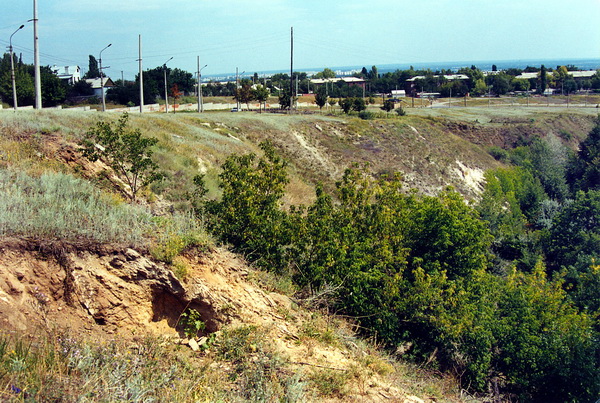
Lysychansk is located in the North-Western part of the Luhansk region, 115 km from Luhansk, on the high right bank of the Siverskyi Donets River. The area is surrounded by large hills, ravines and valleys. The city is interestingly situated on the northern spur of the Donets Ridge. This picturesque area was once called "Deer Mountain."
Lysychansk lies in the continental climate of the steppe zone of Ukraine. Water resources stemming from here are one of the most important resources. Siverskyi Donets Riveris the main water artery of the Lysychansk and the whole region. The length of the Siverskyi Donets River within the city is 26.5 km. Verkhnia Bilenka River, a tributary of the Siverskyi Donets River, flows through the southern part of the city, the length of the river within the city is 7.7 km.
Climate
Lysychansk has a humid continental climate (Dfb) according to the Köppen climate classification system.
Summers are warm and sometimes humid with average high temperatures of 26–27 °C (78.8–80.6 °F) and lows of 14–15 °C (57.2–59 °F). Winters are relatively cold with average high temperatures of -1 °C (30.2 °F) and lows of −8 to -6 °C (17.6 to 21.2 °F). Spring and autumn are generally chilly to mild.[3]
The highest ever temperature recorded in the city was 41.0 °C (105.8 °F) on June 1984. The coldest temperature ever recorded in the city was −34.0 °C (−29.2 °F) on February 1954.
Annual precipitation is 480 millimeters (18.9 in) with moderate rainfall throughout the year. Light snowfall mainly occurs from December through March, but snow cover does not usually remain for long.[4]
| Climate data for Lysychansk | |||||||||||||
|---|---|---|---|---|---|---|---|---|---|---|---|---|---|
| Month | Jan | Feb | Mar | Apr | May | Jun | Jul | Aug | Sep | Oct | Nov | Dec | Year |
| Record high °C (°F) | 16.0 (60.8) |
17.0 (62.6) |
23.0 (73.4) |
31.0 (87.8) |
37.0 (98.6) |
41.0 (105.8) |
40.0 (104) |
40.0 (104) |
36.0 (96.8) |
31.0 (87.8) |
21.0 (69.8) |
16.0 (60.8) |
29.1 (84.4) |
| Average high °C (°F) | −3.0 (26.6) |
−2.0 (28.4) |
5.0 (41) |
15.0 (59) |
22.0 (71.6) |
26.0 (78.8) |
28.0 (82.4) |
27.0 (80.6) |
21.0 (69.8) |
13.0 (55.4) |
4.0 (39.2) |
0.0 (32) |
13.0 (55.4) |
| Daily mean °C (°F) | −6.0 (21.2) |
−5.0 (23) |
1.6 (34.9) |
9.5 (49.1) |
15.5 (59.9) |
20.0 (68) |
22.0 (71.6) |
21.0 (69.8) |
15.0 (59) |
11.0 (51.8) |
1.0 (33.8) |
−3.0 (26.6) |
8.5 (47.3) |
| Average low °C (°F) | −9 (16) |
−8 (18) |
−3.0 (26.6) |
4.0 (39.2) |
9.0 (48.2) |
14.0 (57.2) |
16.0 (60.8) |
15.0 (59) |
9.0 (48.2) |
3.0 (37.4) |
−2.0 (28.4) |
−6 (21) |
3.5 (38.3) |
| Record low °C (°F) | −32.0 (−25.6) |
−34.0 (−29.2) |
−22.0 (−7.6) |
−11.0 (12.2) |
−3.0 (26.6) |
−3.0 (26.6) |
6.0 (42.8) |
4.0 (39.2) |
−5.0 (23) |
−12.0 (10.4) |
−24.0 (−11.2) |
−29.0 (−20.2) |
−13.7 (7.3) |
| Average rainfall mm (inches) | 32.0 (1.26) |
30.0 (1.181) |
36.0 (1.417) |
37.0 (1.457) |
48.0 (1.89) |
53.0 (2.087) |
61.0 (2.402) |
34.0 (1.339) |
45.0 (1.772) |
31.0 (1.22) |
37.0 (1.457) |
36.0 (1.417) |
480 (18.899) |
| Average rainy days (≥ 1.0 mm) | 6.0 | 5.0 | 7.0 | 9.0 | 9.0 | 8.0 | 7.0 | 5.0 | 7.0 | 9.0 | 9.0 | 8.0 | 89 |
| Source: Microsoft Corporation program "Weather" | |||||||||||||
History
The History of the Donetsk coal basin began in 1700 with the decree by Peter I to search for ore deposits, leading to the development of Lysychansk - "the cradle of Donbas." This type of coal mining lead to pit heaps.
Previously existing settlements in the area around Lysychansk were completely destroyed by the Muscovy punitive expedition against the Bulavin Rebellion. After the suppression of the uprising the area was resettled with Voronove (founded by Khokhlov's Cossacks), Syrotyne (Popov's and Sirotin's Cossacks), Borivske (partly settled by former residents of the burned the Borovskaya Sloboda), Metiolkine (Metelnikov's Cossacks) and Smolianynove (Smolkin's Cossacks).
 "Old Town"
 The first coal mine
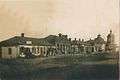 "Old Town"
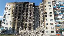 Damaged building in Lysychansk, 2014
During the 2014 pro-Russian conflict in Ukraine the town was captured early April 2014 by pro-Russian separatists.[5][6] On 22 July 2014 Ukrainian Ukrinform reported that the separatists "massively leave Lysychansk" with "seized cars from the population and in parking lots;" Russian ITAR-TASS reported the same day that the separatists had "decided to leave the town in order to save the population and stop clashes." This was mainly because their defeat in the Siege of Sloviansk and the evacuation of Kramatorsk made holding the city untenable.[7][8] The next day heavy fighting continued around the town while the Ukrainian National Guard and the Ukrainian army released a statement that stated "the military plan to free Lysychansk, Luhansk region, from terrorist groups in the near future."[9][10] On 24 July 2014 the Ukrainian army claimed its troops had entered Lysychansk and its Col. Andriy Lysenko stated "We will take the town, and the road will be open to Horlivka, then Donetsk."[11][12] On 25 July 2014, Ukrainian forces secured the city from the pro-Russian separatists.[13]
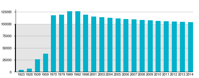
Population
- As of 1 January 2014 the population of Lyscychansk was 103,459.[14]
- According to the 2001 Census the population of the city proper was 115,229 people, while the population of the total area governed by the city council was 133,258 people.[15]
Ethnic Groups:[16]
- Ukrainians — 66.7%
- Russians — 30.5%
- Belarusians — 1%
- Others — 1.8%
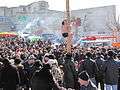 Carnival-Maslenitsa
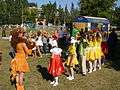 Carnival-Maksim Park
 War veterans
 City Day
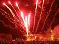 City Day
Industry
When Lysychansk was a city in the Soviet Union it was among the biggest industrial centres in Luhansk region.[17] It kept this status long after Ukraine became independent in 1991.[17] But since 2010 most major plants have been closed leading to massive lay-offs.[17]
The city and the surrounding area has 5 coal mines owned by Lysychanskvuhillia. Production of coal reserves amount to 179.7 million tons. Production capacity - 2,8 million tons of coal per year.
Companies that are:
- Lysychanskvuhillia
- Lysychansk Factory of Technical Textiles
- Lysychansk Gelatin Plant
- Lysychansk Engineering Works
- Lysychansk Brewery
- Lysychansk Plant of Glassworks
- Lysychansk Plant of Reinforced Concrete
- Lysychansk Factory of Christmas Tree Decorations
- Lysychansk Factory of Garment
Companies that are under construction:
- Lysychansk Refinery Plant
- Lysychansk Soda Plant
Bankrupt Companies:
- Lysychansk Plant of Rubber Products
- Lysychansk Plant of Meat
- Lysychansk Plant of Bakery
- Lysychansk Plant of Dairy
- Lysychansk Plant of Rare Gases
- Lysychansk Heat Elektrotsentral
- Lysychansk Tire-Repair Plant
- Lysychansk Farm of Poultry
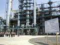 Lysychansk Plant Refinery
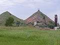 Coal mine
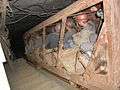 Descend into the mine
 Lysychansk Plant Soda (under construction)
Shopping centers and supermarkets
- Shopping centers:
"Кристалл", "Донбасс", "Лимон", "Октал", "Морозко плаза".
- Supermarkets:
"Сільпо", "Абсолют", "АТБ", "Парус", "Брусниця".
- Electronics Stores:
"Фокстрот", "Diawest"
Media
- The newspaper "Новый путь"
- Television and Radio Company "Акцент"
- Publishing house "Час Пик"
Education
Preschool
- Child Care №1 "Шпачок" ("Little Starling")
- Child Care №2 "Бірюза" ("Turquoise")
- Child Care №3 "Дюймовочка" ("Thumbelina")
- Child Care №4 "Росинка" ("Dewdrop")
- Child Care №5 "Усмішка" ("Smile")
- Child Care №6 "Чайка" ("Seagull")
- Child Care №7 "Іскорка" ("Sparklet")
- Child Care №8 "Світлячок" ("Firefly")
- Kindergarten №9 "Червона шапочка" ("Little Red Riding Hood")
- Child Care №10 "Малятко" ("Baby")
- Child Care №12 "Катруся" ("Catherine")
- Child Care №13 "Ромашка" ("Chamomile")
- Child Care №14 "Теремок" ("Little Terem")
- Child Care "Колосок" ("Spikelet")
Schools
- Comprehensive School І-ІІІ levels №2
- Comprehensive School І-ІІІ levels №3
- Comprehensive School І-ІІІ levels №4
- Comprehensive School І-ІІІ levels №5
- Special School І-ІІІ levels № 8
- Comprehensive School І-ІІ levels №9
- Comprehensive School І-ІІІ levels №12
- Comprehensive School І-ІІІ levels №13
- Comprehensive School І-ІІІ levels №14
- Comprehensive School І-ІІ levels №18
- Comprehensive School І-ІІ levels №24
- Comprehensive School І-ІІІ levels №26
- Comprehensive School І-ІІІ levels №27
- Comprehensive School І-ІІІ levels №30
- Educational Complex School I-II levels - Lyceum "Harant"
- Lysychansk Lyceum
- Lysychansk Multidisciplinary Gymnasium
Basic
- Vocational Technical School № 51
- Higher Vocational School № 94
- Lysychansk Medical School
- Lysychansk Professional Building Lyceum
- Lysychansk Professional Commercial and Culinary Lyceum
- Lysychansk Professional Mining and Industrial Lyceum
Higher
- Lysychansk Taras Shevchenko Pedagogical College
- Lysychansk Mountain College
- Lysychansk Petrochemical College
- Lysychansk Branch Donbas State Technical University
- Lysychansk of teaching and counseling center Luhansk State University of Internal Affairs
Other
- Lysychansk Children's Musical School №1
- Lysychansk Children's Musical School №2
Attractions
- Fox Beam - "the cradle of Donbas."
- Pereiznianska Church.
- National History Museum and the Polovtsian stone images (center, Lenin).
- Monument to the first mine in the Donbas Region.
- Monument Rudoznavtsiu Gregory Kapustin (the central market).
- Monument to Marshal of the Soviet Union Kliment Voroshilov (District Pereizna).
- House-Museum of Marshal of the Soviet Union Kliment Voroshilov (St.Pereizna, the former switch tower) - destroyed.
- T34 Tank - a monument to the defenders and liberators of Lysychansk.
- Monument Lysychanam - pilots of the WWII (District RTI, on a former airfield).
- WWII Memorial[18]
- "Chernobyl" Monument
- Monument to the Ukrainian poet Volodymyr Sosiura (Glass District, Square at DC).
- Sosiura Palace of Culture.
- Claw lake and Recreation area 48°54.1′N 38°30.5′E / 48.9017°N 38.5083°E
- City Park "Water Station" 48°55.58′N 38°26.02′E / 48.92633°N 38.43367°E
- Gresovsky Recreation Park: in the woods on the left bank of the Siverskyi Donets River opposite of the Mount of Kirov. The park is now under repair. Between 1940—1960 the recreation park of the city, "Lyssoda" and Power Plant was full of attractions and a great stadium for sporting events. 48°54.1′N 38°28.7′E / 48.9017°N 38.4783°E
- Конгресів яр (Гельмерсенів яр) — Geological Monument. Long, curved ravine with steep slopes at the end Sverdlova street, which stretches to the railway station Pereizna. On the surface you can see Paleozoic-Mesozoic geological formations. In the 1860s geological expeditions of Academician Gregory Helmersen were carried out, the ravine is now named for him. In the postwar years in the Donbas geological studies were conducted by the World Geological Congress, whose members visited Lysychansk and Helmerseniv Yar.[19][20] 48°53.8′N 38°28′E / 48.8967°N 38.467°E
Transportation
Public transport
(11.04.2014)
Trolley
- №1 Plant "Proletarii" - Brick Plant — € 0.09 or 0,12$
- №2 is currently closed.
- №3 Central Market - Comprehensive School І-ІІІ levels №3 — € 0.09 or 0,12$
Bus
A large number of buses run to and from Lysychansk as well as within the city. Most of the buses running in and out of the city stop running after 6 pm.
- №101: Central Market - mine "Chornomorka"
- №106: Central Market - Berezove
- №107: Central Market - Dibrovka
- №109: Central Market - Plant of Rubber Products — € 0.2 or 0,28$
- №111: Central Market - Plant "Proletarii" — € 0.11 or 0.16$
- №112: Central Market - Glass Plant — € 0.2 or 0,28$
- №114: Glass Plant - Plant of Rubber Products — € 0.14 or 0,2$
- №191: Central Market - Glass Plant — Plant of Rubber Products — € 0.2 or 0,28$
Railway
Railway Station Lysychansk
From the city centre the railway station can be reached by foot, down Malinowski Street, starting from the Central Market (15-20 minute walk) or by bus "Lysychansk — Sievierodonetsk."
The town has three railway stations: Nasvitevych, Pereizna, Volcheiarska, as well as 956th km (stop is for diesel commuter trains). Almost all transit distance trains stop at Stations Pereizna and Volcheiarska, allowing residents of Southern Lysychansk not to be dependent on the central railway station.
Trains running through Lysychansk allow access to all of Ukraine as well as run to Russian Federation and Belarus.
Intercity bus
Regular bus service is available to many Ukrainian cities. There are direct buses to Donetsk, Kharkiv, Berdiansk, Mariupol, etc.
Airport
The nearest airport is located 12 kilometers from the city center, located in Sievierodonetsk. Built in 1968 the airport is to serve residents and workers of the surrounding cities. The airport is administered by the Lysychansk District pipeline OAO Ukrtransnafta.[21]
Politics
In the 2010 Presidential Election Viktor Yanukovych won 90.95% of the vote in Lysychansk. Runner up Yulia Tymoshenko received 5.91% of the vote [22]
2004 Presidential Elections the city vote- Viktor Yanukovych (92.51%) and Yushchenko (5.08%) [23]
Famous people
- Gregory Kapustin- Russian rudoznatets.[24]
- Vladimir Chernikov (monumental artist, painter)
- Kliment Voroshilov - Marshal of the Soviet Union, Hero of the Soviet Union, the Politburo Central Committee, President of the Supreme Soviet of the USSR | Presidium of the Supreme Soviet of the USSR.[25]
- Volodymyr Sosiura - Ukrainian poet.[26]
- Peter Severs- Ukrainian writer.
- Dmitry Lalenkov - Honored actor theater and film.
- Kuzema Vadim - author and performer of songs in the style of Russian chanson, nominee of the prize "Chanson, in 2006."[27]
- Igor Sergeyev - Ministry of Defense of Russia | Russian Defense Minister from 1997–2001, Marshal of the Russian Federation.[28]
- Nicholas Chuzhikov - Olympic rowing champion.
Gallery
 Polovtsian Women.
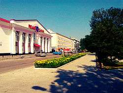 Dovzhenka Street.
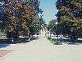 Park.
Park.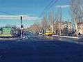 Sosiury Street.
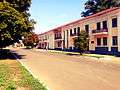 Hrushevsky Street.
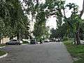 Next to the SBU building.
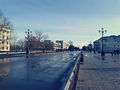 Peremohy Avenu.
References
- ↑ "Офіційний портал Верховної Ради України". Gska2.rada.gov.ua. 2010-05-19. Retrieved 2015-05-19.
- ↑ "Чисельність наявного населення України (Actual population of Ukraine)" (in Ukrainian). State Statistics Service of Ukraine. Retrieved 21 January 2015.
- ↑ "weather.com". weather.com. Retrieved 7 January 2013.
- ↑ "Climate figures". World Weather Information Service. Retrieved 18 January 2013.
- ↑ "Ukraine conflict: Air strikes 'hit Luhansk targets' - BBC News". Bbc.com. Retrieved 2015-05-19.
- ↑ "Police help Kremlin-backed insurgents in Luhansk Oblast's Lysychansk". Kyivpost.com. 2014-05-24. Retrieved 2015-05-19.
- ↑ "Terrorists fleeing from Severodonetsk and Lysychansk - media| Ukrinform". Ukrinform.ua. 2014-07-22. Retrieved 2015-05-19.
- ↑ "TASS: World - Ukraine troops continue attacks on Lisichansk — Luhansk militia commander". En.itar-tass.com. Retrieved 2015-05-19.
- ↑ "Ukrainian National Guard cleansing Severodonetsk, Lysychansk of militants". En.interfax.com.ua. 2014-07-23. Retrieved 2015-05-19.
- ↑ "Ukraine Votes to Call Up More Reservists". Voanews.com. 2014-07-22. Retrieved 2015-05-19.
- ↑ Marson, James (2014-07-24). "Ukraine President Petro Poroshenko Welcomes Breakup of Ruling Coalition - WSJ". Online.wsj.com. Retrieved 2015-05-19.
- ↑ "Ukrainian troops enter Lysychansk". Kyivpost.com. 2014-07-24. Retrieved 2015-05-19.
- ↑ Schwartz, Felicia (2014-07-25). "White House Says Putin 'Culpable' in Flight 17 Crash - WSJ". Online.wsj.com. Retrieved 2015-05-19.
- ↑ "Cities & towns of Ukraine". Pop-stat.mashke.org. Retrieved 2015-05-19.
- ↑
- ↑ Дністрянський М. Етнополітична географія України: проблеми теорії, методології, практики. — Львів: ЛНУ імені Івана Франка, 2006. — 490 с. (Ukrainian)
- 1 2 3 The Looming Revolt in Lysychansk, The Ukrainian Week (22 July 2013)
- ↑ Archived March 9, 2012, at the Wayback Machine.
- ↑ andrey ivchenko. "Донецкая складчатая область : фотографии Украины". Photoukraine.com. Retrieved 2015-05-19.
- ↑ История Луганского края. Глава 3. Луганщина в XIX веке. Геологические исследования края
- ↑ "Авиабилеты Авиатор". Aviator.net.ua. Retrieved 2015-05-19.
- ↑ "Ukraine. Presidential Election 2010 | Electoral Geography 2.0". Electoralgeography.com. Retrieved 2015-05-19.
- ↑ "Ukraine. Presidential Election 2004 | Electoral Geography 2.0". Electoralgeography.com. 2010-03-09. Retrieved 2015-05-19.
- ↑ (Капустин, Григорий Григорьевич)
- ↑ (Ворошилов, Климент Ефремович)
- ↑ (Сосюра Володимир Миколайович)
- ↑ (Кузема Вадим)
- ↑ (Игорь Сергеев)
External links
- (Russian) City portal
| Wikimedia Commons has media related to Lysychansk. |
| Raions | |||||||
|---|---|---|---|---|---|---|---|
| Cities |
| ||||||
| |||||||