M2 motorway (Great Britain)
| |
|---|---|
_map.svg.png) | |
| Route information | |
| Length: | 25.7 mi (41.4 km) |
| Existed: | 1963 – present |
| History: | Constructed 1963–65 |
| Major junctions | |
| From: | Shorne |
| To: | Boughton Street |
| Location | |
| Primary destinations: | Strood, Chatham, Rochester, Rainham, Sittingbourne, Faversham |
| Road network | |

The M2 is a motorway in Kent, England. It is 25.7 miles (41.4 km) long and acts as a bypass of the section of the A2 road which runs through the Medway Towns, Sittingbourne and Faversham.
Route
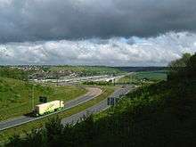
The M2 starts to the west of Strood at Three Crutches, diverging southeastwards from the A2 road that heads eastwards from London. It begins at Junction 1 with four lanes and descends towards the Medway Valley to the south of Rochester. On the west bank of the River Medway Junction 2, for the A228 towards Rochester and West Malling, is a complex junction where the exit roundabouts had to be built around the HS1 track and still maintain, by footbridge and tunnel, a public footpath. The Road then crosses the Medway Valley on two Medway viaducts, passing over the Medway Valley Line and Chatham Main Line prior to crossing the river. On the east bank of the River is the village of Borstal.
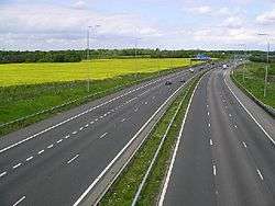
The M2 then diverges from the High Speed 1 route and climbs up the north side of Nashenden Valley to Blue Bell Hill and on to the North Downs on a split-level carriageway where it meets Junction 3 (for Chatham & Maidstone) at Walderslade. Here the road narrows to three lanes, and runs northeast across Cossington Fields, Westfield Sole, Lidsing, and Bredhurst towards Junction 4 (for Gillingham), where the road becomes two lanes for the remainder of its length.
Continuing east, passing Medway Service area, it crosses the A249 over the Stockbury Viaduct at Junction 5 (for Sheerness and Maidstone East). It then continues along the rural North Downs, with a connection at Junction 6 to the old A2 at Faversham. Shortly after this, it terminates at Junction 7, allowing traffic to continue on either the A299 towards Thanet which joins a dual carriage way or the A2 towards Canterbury and Dover which has been improved due to bypasses and other improvements as far as Lydden.
History
Original construction

The initial section of the motorway (junctions 2 to 5) was opened by the then Transport Minister Ernest Marples on 29 May 1963,[1] with the remainder being constructed in 1965. It was opened in three stages:[2]
- Junctions 1 to 2 in 1965
- Junctions 2 to 5 in 1963
- Junctions 5 to 7 in 1965
It was planned to extend the M2 to London and Dover, making it the main route between London and the channel ports, but this extension never materialised due to a lack of traffic demand.[3] Instead the A2 was dualled and improved from Brenley Corner to Dover.[4][5]
The M2 was originally to be designated as the A2(M), but as a result of the Daily Telegraph reporting it as the M2, the Ministry of Transport adopted this, and later decided upon the M20 designation for the main London-Channel Ports link.[6][7]
Junction amendments
Aside from retrofitting central crash barriers, like all early motorways, the alignment of the M2 did not significantly change until the late 1990s. Traffic using it decreased when the M20 was completed from London to Folkestone in May 1991,[8] while the M2 continued to Canterbury and the North Kent ports of Sheerness and Ramsgate. Junction 1 was altered when the A289 Wainscott Northern bypass was built in the late 1990s.[9]
Widening
The M2 was still busy between Junctions 1 and 4, and suffered from HGVs blocking the outside lane.[10] In 2000 work began on widening the M2 from two lanes to four lanes. A joint venture between Costain, Skanska and Mowlem (CSM) created the company that would undertake the project. The project required the redesign of Junction 2 and Junction 3, and a second Medway Bridge. The existing bridge was converted to a four lane eastbound carriageway (including a hard shoulder). The new bridge formed the westbound carriageway. The entire stretch was lit with streetlights (the old section was not lit). The old Medway Bridge was physically narrowed by removing part of the footpath. High-pressure water cutting equipment was used to cut the concrete into manageable sections for disposal. There is only one path open to the public now.
Spoil from the North Downs Tunnel was used to form the new embankment for the London bound traffic between Junction 2 and the Nashenden Valley.
The widening was completed in July 2003.[11]
Service area
The M2 opened with a single service area between Junctions 4 and 5, named Farthing Corner Services and operated by Top Rank.[12] Today the services are known as Medway services and are operated under the Moto brand with a Travelodge hotel.[13]
The services have an access road to the local network for service and delivery vehicles that is not, like some motorway service areas, restricted with a gate or barrier.[14] This has led to local businesses using the services as an unofficial exit from the motorway.[15]
Junctions
Data from driver location signs are used to provide distance (in kilometres) and carriageway identifier information. Where junctions extend over several hundred metres and the data are available, values are given for the start and end points of the junction.
| M2 motorway junctions | |||||
| miles | km | Westbound exits (B carriageway) | Junction | Eastbound exits (A carriageway) | Coordinates |
|---|---|---|---|---|---|
| 27.0 27.5 |
43.4 44.3 |
Road continues as A2 to London | J1 | Rochester A2 Gillingham, Grain A289 Non-motorway traffic |
51°23′58″N 0°26′36″E / 51.39953°N 0.44332°E |
| Grain, Rochester A289 | Start of motorway | ||||
| 28.8 29.0 |
46.3 46.6 |
Strood/Rochester, West Malling A228 | J2 | Strood/Rochester, West Malling A228 | 51°23′02″N 0°28′05″E / 51.38383°N 0.46799°E |
| 32.6 32.8 |
52.4 52.8 |
Maidstone, Chatham, Rochester A229 Chatham B12(A) |
J3 | Maidstone, Chatham A229 Channel Tunnel (M20) |
51°20′14″N 0°30′28″E / 51.33729°N 0.50790°E |
| 36.4 36.5 |
58.5 58.8 |
Gillingham A278 | J4 | Gillingham A278 | 51°20′10″N 0°35′04″E / 51.33616°N 0.58438°E |
| Medway Services | Services | Medway Services | 51°20′28″N 0°36′28″E / 51.34120°N 0.60781°E | ||
| 40.0 40.3 |
64.4 64.9 |
Maidstone, Sheerness A249 The WEST, Gatwick Airport (M20) |
J5 | Maidstone, Sittingbourne, Sheerness A249 | 51°19′47″N 0°39′44″E / 51.32986°N 0.66231°E |
| 50.6 50.8 |
81.5 81.8 |
Faversham, Ashford A251[16] | J6 | Faversham, Ashford A251 | 51°18′02″N 0°53′18″E / 51.30060°N 0.88843°E |
| 52.3 52.6 |
84.2 84.7 |
Start of motorway | J7 | Canterbury, Dover, Channel Tunnel A2 | 51°18′05″N 0°55′32″E / 51.30151°N 0.92543°E |
| Canterbury, Channel Tunnel, Dover, Faversham A2 Non-motorway traffic |
Road continues as A299 (Thanet Way) to Ramsgate | ||||
Notes
| |||||
| 1.000 mi = 1.609 km; 1.000 km = 0.621 mi | |||||
See also
References
- ↑ "Golden anniversary for the M2". Highways Agency. Retrieved 29 May 2013.
- ↑ "Motorway Database – M2 Timeline". CBRD. Retrieved 27 January 2007.
- ↑ Michael Heseltine (15 July 1970). "M2, Dover". Retrieved 18 September 2012.
- ↑ Michael Heseltine (15 July 1970). "M2 Motorway (Brenley Corner – Dover)". Retrieved 18 December 2012.
- ↑ Michael Heseltine (16 December 1970). "M2 Motorway (Extension)". Retrieved 18 December 2012.
- ↑ "Copy of Civili Service minute". Pathetic Motorways. Retrieved 27 January 2007.
- ↑ "Motorway Database » M2". CBRD. Retrieved 31 December 2011.
- ↑ "Road Schemes". 16 October 1995. Retrieved 18 December 2012.
- ↑ "New Road Schemes". 21 October 2002. Retrieved 18 December 2012.
- ↑ Kenneth Clarke (22 July 1980). "M2 (Heavy Vehicles)". Retrieved 18 December 2012.
- ↑ "Route Management Stratergy – A2/M2/A249". Highways Agency. Retrieved 27 January 2007.
- ↑ "Motorways (catering facilities)". 17 February 1964. Retrieved 18 December 2012.
- ↑ "Medway Services M2". Retrieved 18 December 2012.
- ↑ "Google Maps : Medway Services (Streetview)". Retrieved 18 December 2012.
- ↑ "Directions to Hartlip Place". 2008. Retrieved 18 December 2012.
- ↑ Stafford, Lowri (20 September 2013). "M2 London-bound near junction 6 for Faversham reopens after car crashes into central reservation". kentonline.co.uk. Retrieved 19 March 2014.
External links
- CBRD
- Photographs of the Medway Viaduct From Its Public Footpath
- Photographs of the M2 between Junctions 5 and 7
- The Motorway Archive – M2
| Great Britain | .svg.png) | |||||||
|---|---|---|---|---|---|---|---|---|
| Northern Ireland | ||||||||
| Former | ||||||||
| Unbuilt | ||||||||
| Proposed | ||||||||
| Related articles | ||||||||
| ||||||||