Mabury
| Mabury | |
|---|---|
| Neighbourhood | |
|
| |
 Mabury Location in California | |
| Coordinates: 37°22′49″N 121°51′05″W / 37.380269°N 121.851525°WCoordinates: 37°22′49″N 121°51′05″W / 37.380269°N 121.851525°W | |
| Country | United States |
| State | California |
| County | Santa Clara |
| Municipality | San Jose |
| Elevation | 85 ft (26 m) |
| Time zone | PST (UTC−8) |
| • Summer (DST) | PDT (UTC−7) |
| ZIP code | 95133 |
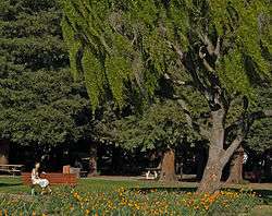
Mabury (pronounced "may-berry") is an area in San Jose, California belonging to the zip code of 95133. There are two parks belonging to the area of Mabury. One, Overfelt Gardens (37°21′47″N 121°51′13″W / 37.363029°N 121.853528°W), located at McKee Road and Educational Park Drive between East San Jose and the North Valley, pays tributes to Asian culture that thrives in and around its parts.[1] The other is the Penitencia Creek County Park (37°22′25″N 121°51′40″W / 37.373696°N 121.861245°W), located at Mabury Road and North Jackson Avenue, is a 78 acres (32 ha; 0.122 sq mi) linear park and regional trail.[2][3]
References
- ↑ "Overfelt Gardens". sanjoseca.gov.
- ↑ "Penitencia Creek". sccgov.org.
- ↑ "Penitencia Creek Trail". rhorii.com.
External links
- "US-101/Oakland/Mabury: Transportation Development Policy" (PDF). sanjoseca.gov. 20 October 2009.
This article is issued from Wikipedia - version of the 2/19/2015. The text is available under the Creative Commons Attribution/Share Alike but additional terms may apply for the media files.