Berryessa, San Jose, California
| Berryessa | |
|---|---|
| Neighborhood of San Jose | |
| Nickname(s): North Valley | |
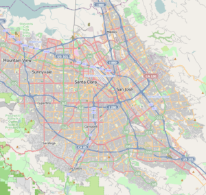 Berryessa Location within San Jose and Silicon Valley | |
| Coordinates: 37°23′11″N 121°51′38″W / 37.386329°N 121.86051°W | |
| Country | United States |
| State | California |
| County | Santa Clara |
| City | San Jose |
The Berryessa District or North Valley in San Jose, California is located in the northeast portion of the city, between Coyote Creek and the Diablo Range foothills. The neighborhood borders Milpitas along Landess Avenue to the north and the Alum Rock neighborhood of East San Jose along Mabury Road to the south. The name comes from a member of the prominent Basque–Spanish Berreyesa family: Nicolas Berreyesa, a Californio settler who was granted Rancho Milpitas in 1834. The residential neighborhood is part of the Fourth City Council District, along with Alviso, and was represented by Chuck Reed prior to his election as Mayor of San Jose. The district representative is now Kansen Chu.
The name North Valley is sometimes used by locals to refer to Berryessa.[1] Informal use of the term sometimes also includes parts of Milpitas and Alviso to mean the northern portion of the Santa Clara Valley.
History
In the late 19th century, Berryessa was a small farming community well-known across California for its high-quality fruit. Hostetter Road, Capitol Avenue, Piedmont Road, and Lundy Avenue were formerly surrounded by apricot and prune orchards, whereas today this area is distinguished as a fast-growing bedroom community of San Jose, served by VTA light rail and (in 2017), an extension of the Bay Area's BART system.
The J. F. Flickinger Fruit Packing Company, one of the largest fruit packing companies in the Santa Clara Valley, was located around present-day Hostetter Road. In the 1960s and 1970s, however, the orchards were developed into suburban residential neighborhoods and businesses. Tiny remnants of these lands remain today, including the Orlando Farm till 2013 when it too was developed into housing on Capitol Avenue and the Mattos' apricot orchard off Piedmont Road.[2]
Education
Berryessa Union School District operates public schools. Schools in Berryessa include Piedmont Hills High School, Independence High School, Piedmont Middle School, Sierramont Middle School, Morrill Middle School, Vinci Park Elementary School, Laneview Elementary School, Ruskin Elementary School, Cherrywood Elementary School, Noble Elementary School, Summerdale Elementary School, Majestic Way Elementary School, Brooktree Elementary School, Northwood Elementary School and Toyon Elementary School. St. Victors Catholic School is the lone private school in the area.
San José Public Library operates the Berryessa Branch Library and the Educational Park Branch Library.[3]
Art & Wine festival
The annual Berryessa Art & Wine festival is one of the most well known local events in the area and has been a yearly tradition for over 30 years. The current festival, typically held in May, includes 120-150 artist booths, 14 food booths (all run by non-profit groups from the Berryessa area), a Community Row area with booths from a variety of service groups and non-profits offering information to the festival goers, a Business Row with representatives from the Berryessa community and other local San Jose Businesses, a stage area with entertainment by local amateur entertainers as well as professional entertainment and booths from several local radio stations. The festival is held on the grounds of Penitencia Creek Park.
Notable Residents
The following list of people either grew up in Berryessa or are current residents of the area:
Rex Walters - former NBA player and Head basketball coach at USF
Chris Manak, aka Peanut Butter Wolf - DJ and Music producer
Chuck Reed - former Mayor of San Jose
See also
- creeks
- light rail stations
- future BART station (2018)
References
- ↑ "San Jose". McCormack's Guides. Retrieved 2008-02-27.
- ↑ "Berryessa". santaclararesearch.net. Retrieved 2008-02-03.
- ↑ "Berryessa Branch Library Archived March 16, 2010, at the Wayback Machine.." San José Public Library. Retrieved on March 27, 2010.
External links
- Berryessa Citizens Advisory Council
- City of San Jose, Council District 4
- Berryessa branch of San Jose Public Library system
Coordinates: 37°23′11″N 121°51′38″W / 37.3863287°N 121.8605104°W