Mapleville, North Carolina
Coordinates: 36°04′36″N 78°13′38″W / 36.07667°N 78.22722°W Mapleville is an unincorporated community in east central Franklin County, North Carolina, United States. It is located east of Louisburg, at an elevation of 325 feet (99 m). The primary cross roads where the community is located are N.C. Highway 56, N.C. Highway 581 and Strange Road (SR 1422).[1]
References
- ↑ North Carolina Department of Transportation: State Mapping Resources -- Franklin County, Retrieved Jan. 15, 2015.
Municipalities and communities of Franklin County, North Carolina, United States | ||
|---|---|---|
| Towns | 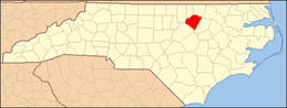 | |
| CDP | ||
| Unincorporated communities | ||
| Footnotes | ‡This populated place also has portions in an adjacent county or counties | |
This article is issued from Wikipedia - version of the 1/16/2015. The text is available under the Creative Commons Attribution/Share Alike but additional terms may apply for the media files.