Louisburg, North Carolina
| Louisburg, North Carolina | |
|---|---|
| Town | |
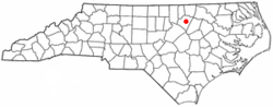 Location of Louisburg, North Carolina | |
| Coordinates: 36°6′1″N 78°17′56″W / 36.10028°N 78.29889°WCoordinates: 36°6′1″N 78°17′56″W / 36.10028°N 78.29889°W | |
| Country | United States |
| State | North Carolina |
| County | Franklin |
| Established | 1779 |
| Named for | King Louis XVI of France |
| Government | |
| • Type | Town Council |
| • Mayor | Karl T. Pernell (D) |
| Area | |
| • Total | 2.8 sq mi (7.3 km2) |
| • Land | 2.8 sq mi (7.3 km2) |
| • Water | 0.0 sq mi (0.0 km2) |
| Elevation | 220 ft (67 m) |
| Population (2010) | |
| • Total | 3,359 |
| • Density | 1,199.6/sq mi (460.1/km2) |
| Time zone | Eastern (EST) (UTC-5) |
| • Summer (DST) | EDT (UTC-4) |
| ZIP code | 27549 |
| Area code(s) | 919 and 984 |
| FIPS code | 37-39360[1] |
| GNIS feature ID | 0989040[2] |
| Website | http://www.townoflouisburg.com |
Louisburg is a town in Franklin County, North Carolina, in the United States. As of the 2010 census, the town population was 3,359. It is the county seat of Franklin County.[3] The town is located about 29 miles northeast from the state's capital Raleigh, North Carolina, and located about 31 miles south from the Virginia border line. It is part of the Research Triangle. It is also the home of Louisburg College, the oldest two-year coeducational college in the United States, and of one of the campuses of Vance-Granville Community College.
History and culture
Louisburg was established in the 1770s and named in honor of King Louis XVI of France, who was aiding the American Revolution at the time. It is the birthplace of author Edwin Wiley Fuller, home of the International Whistlers Convention, and site of the last hanging in North Carolina, chronicled in the book The Day The Black Rain Fell, by William F. Shelton and James S. Warren. "Black rain" actually did fall in Louisburg in March 1900.[4] Louisburg was the home of one governor of North Carolina, Thomas W. Bickett.[5]
Louisburg has a rich history of struggle against racial inequality and injustice. In June 1965, the local newspaper and radio station publicized the names and addresses of African-American families who had applied to attend white schools in Franklin County. When questioned on his actions, the man who read the names on the radio stated that though he was not a member of the Klan, he approved of their activities.[6] In part because of this disclosure, the families hoping to integrate the schools were attacked on numerous occasions by white extremists, who fired into the homes or destroyed the cars of families on the publicized list.[7] The movement for integration persevered in the coming years, and so did violent opposition. Summer of 1966 saw a series of cross burnings perpetrated by the Ku Klux Klan in Franklin County, including one in front of the County Board of Education in Louisburg.[8] One local African-American leader said in 1968, after gun shots were fired into his house, that his home had been firebombed on one occasion and nails left in his driveway no less than 20 times over the previous few years.[9]
Cascine, Cooke House, Dean Farm, Franklin County Training School-Riverside Union School, Fuller House, Green Hill House, Louisburg Historic District, Main Building, Louisburg College, Massenburg Plantation, Person Place, Portridge, Rose Hill, Patty Person Taylor House, Thomas and Lois Wheless House, and Williamson House are listed on the National Register of Historic Places.[10][11]
Geography
Louisburg is located at 36°06′01″N 78°17′56″W / 36.100413°N 78.299009°W (36.100413, -78.299009),[12] on the banks of the Tar River.
According to the United States Census Bureau, the town has a total area of 2.8 square miles (7.3 km2), all of it land.
Demographics
| Historical population | |||
|---|---|---|---|
| Census | Pop. | %± | |
| 1870 | 750 | — | |
| 1880 | 730 | −2.7% | |
| 1890 | 667 | −8.6% | |
| 1900 | 1,178 | 76.6% | |
| 1910 | 1,775 | 50.7% | |
| 1920 | 1,954 | 10.1% | |
| 1930 | 2,182 | 11.7% | |
| 1940 | 2,309 | 5.8% | |
| 1950 | 2,545 | 10.2% | |
| 1960 | 2,862 | 12.5% | |
| 1970 | 2,941 | 2.8% | |
| 1980 | 3,238 | 10.1% | |
| 1990 | 3,037 | −6.2% | |
| 2000 | 3,111 | 2.4% | |
| 2010 | 3,359 | 8.0% | |
| Est. 2015 | 3,553 | [13] | 5.8% |
As of the census[1] of 2010, there were 3,359 people, 1,197 households, and 654 families residing in the town. The population density was 1,199.6 people per square mile (460.1/km2). The racial makeup of the town was 47.3% White, 46.9% African American, 0.3% Native American, 0.9% Asian, 0.0% Pacific Islander, 2.9% from other races, and 1.7% from two or more races. Hispanic or Latino of any race were 5.5% of the population.
There were 1,197 households out of which 23.0% had children under the age of 18 living with them, 28.6% were married couples living together, 20.6% had a female householder with no husband present, and 45.4% were non-families. 40.3% of all households were made up of individuals and 21.4% had someone living alone who was 65 years of age or older. The average household size was 2.17 and the average family size was 2.94.
In the town the population was spread out with 29.4% under the age of 20, 10.7% from 20 to 24, 15.8% from 25 to 44, 22.7% from 45 to 64, and 21.5% who were 65 years of age or older. The median age was 38.2 years. For every 100 females there were 89.8 males. For every 100 females age 18 and over, there were 91.3 males.
The median income for a household in the town was $27,325, and the median income for a family was $72,583. Males had a median income of $49,375 versus $35,104 for females. The per capita income for the town was $18,529. About 15.7% of families and 23.7% of the population were below the poverty line, including 27.3% of those under age 18 and 19.8% of those age 65 or over.
Housing
There were 1,345 housing units at an average density of 480.4 per square mile (184.2/km²). 11.0% of housing units were vacant.
There were 1,197 occupied housing units in the town. 511 were owner-occupied units (42.7%), while 686 were renter-occupied (57.3%). The homeowner vacancy rate was 4.7% of total units. The rental unit vacancy rate was 5.5%.[1]
Government
Louisburg is governed by a mayor and six-member Town Council, who are elected in staggered four-year terms.
- Mayor: Karl T. Pernell[15]
- Town Administrator: Jonathan Franklin
- Assistant Town Administrator: Tony L. King
- Town Clerk: Carolyn Patterson
- Councilman: Tom Clancy
- Councilman: Christopher L. Neal[16]
- Councilman: Joe Shearon
- Councilman: Boyd Sturges
- Councilman: Bill Williamson
- Councilwoman: Emma B. Stewart
- Finance Director: Sean Medlin
- Business Office Manager: Jill Wester
Points of interest
Franklin County Library
The Main or Central library is the Franklin County Library located in Louisburg. There are three branches in other municipalities across the county as well as an outreach program through the Bookmobile. The branch libraries give people outside the county seat easier access to the information and materials they need. The hours of the library are Monday – Friday 12-7. Library Services
Library Cards
Library cards are free to Franklin County residents. Replacement fee for lost cards is $2.00. The card you will receive is valid at all Franklin County Branch Libraries including the Bookmobile. They are issued as follows:
- Children ages 5–15 with parents signature
- Adults 16 and over with valid identification
Library Circulation
• Most Library materials can be checked out for two weeks, with the exception of audio-visual equipment. A/V Equipment check-out times vary. You must call for time on a specific piece of equipment. • You have the option of renewing materials twice, as long as there is no reserve on the particular item. This may be done in person or by telephone. • Overdue fines for late returns are $0.10 per day per item with a maximum of $2.00 per item. • A 24-hour book drop is available at each library location
Franklin County Courthouse
Franklin County was formed in 1779 from Bute County. Bute County was abolished in 1779, and the records were transferred to Warren and Franklin Counties. The County is bordered by Warren County (northeast), Nash County (east), Wake County (southwest), Granville County (west), Vance County (northwest). It was named in honor of Benjamin Franklin. The present land area is 492.02 square miles (1,274 km2) and the 2000 population was 47,260. The act establishing the county authorized that the first court be held at the home of Benjamin Seawell. The justices were to determine where subsequent courts were to be held until the courthouse could be erected. In 1779, Louisburg was established on land purchased by the commissioners for the erection of the courthouse. Louisburg is the county seat. http://www.mynorthcarolinagenealogy.com/nc_county/fr.htm
United States Post Office
The Louisburg Post Office is located on Main Street in the heart of Downtown Louisburg.
Sheriff’s Office
The Franklin County Sheriff’s Office has 44 full-time sworn Deputies and 8 part-time sworn Deputies. The Office is responsible for patrolling over 495 square miles (1,282 km2) and protecting its 54,000 plus population. Last year the Sheriff’s Office responded to over 19,000 calls for service.
Franklin County Schools
The main office buildings of Franklin County Schools are located at 53 West River Road, Louisburg NC 27549 (919-496-2600) in the former Franklin County Training School-Riverside Union School. Franklin County Schools (FCS) consists of 15 schools and more than 8,500 students serving the towns of Franklinton, Louisburg, Youngsville and Bunn, North Carolina. Of the 15 existing schools, there are eight elementary schools, three middle schools, three high schools and one alternative school. The school district also consists of traditional and a year round school which is located at Youngsville Elementary School. For more information on Franklin County Schools contact the web site at www.fcschools.net.
Louisburg Police Department
The Louisburg Police Department was first opened in 1779. Today the chief of police is Rick Lassiter. The department is located at 104 Wade Avenue in Louisburg. Their phone number is (919)496-4175.
Airport
The Triangle North Executive Airport is located approximately 5 miles southwest of the central business district.
Louisburg College
A two-year residential college located in Louisburg, North Carolina, that focuses on getting students ready for the next step to a four-year school offering baccalaureate degrees. The three degree programs offered: an Associate in Arts (general college degree), an Associate in Science (general science degree), and an Associate in Business degree. It also offers these special programs: Academy (tutoring support for ALL students), the Learning Partners Program (for students with learning disabilities and/or ADHD), and the Crossroads Program (for first-year students as they handle the transition from high school). Louisburg College has comprehensive transfer agreements with many public and private colleges and universities, including the 16 branches of the University of North Carolina system, that allow Louisburg College graduates to make a seamless transition upon entering four-year schools as full-fledged juniors.
Vance-Granville Community College
A community college in North Carolina serving Vance, Granville, Franklin, and Warren counties. It was established in 1969 by the North Carolina General Assembly. It is accredited by the Southern Association of Colleges and Schools to award associate degrees. In addition to a main campus in Henderson, VGCC maintain three satellite campuses, of which the Franklin Campus is one,
The Franklin County Campus is located on N. C. 56 about one mile (2 km) west of Louisburg between Louisburg and Franklinton. It sits on a scenic 22 acres (89,000 m2) site that boasts a two-building complex that opened to students in 1998. It contains general classrooms, vocational, computer and science labs, a childcare center, computer and conference room, book store, and faculty and administrative
Climate
Louisburg, being located in eastern North Carolina, has long hot humid summers, and winters which are short and mild by comparison to much of the rest of the country, with snow being a rarity. In Louisburg, between 60 and 90 days per year are over 86 °F (30 °C), according to the Heat Zone Map published by the American Horticultural Society.[17] By comparison, the great majority of the upper midwest and northeast has less than 30 such days per year.[17] These hot days, combined with the South's high humidity, make it sweltering in the summer. The average daytime temperature is in the high 70s or above for at least 5 months out of the year (May through September).[18][19][20][21][22]
The following is the average weather for Louisburg:
| Climate data for Louisburg, North Carolina | |||||||||||||
|---|---|---|---|---|---|---|---|---|---|---|---|---|---|
| Month | Jan | Feb | Mar | Apr | May | Jun | Jul | Aug | Sep | Oct | Nov | Dec | Year |
| Average high °F (°C) | 51 (11) |
55 (13) |
63 (17) |
73 (23) |
79 (26) |
87 (31) |
90 (32) |
89 (32) |
83 (28) |
73 (23) |
64 (18) |
54 (12) |
71.8 (22.2) |
| Average low °F (°C) | 25 (−4) |
26 (−3) |
34 (1) |
42 (6) |
51 (11) |
60 (16) |
65 (18) |
63 (17) |
56 (13) |
42 (6) |
34 (1) |
27 (−3) |
43.8 (6.6) |
| Average precipitation inches (mm) | 4.14 (105.2) |
3.52 (89.4) |
4.37 (111) |
3.19 (81) |
4.34 (110.2) |
3.73 (94.7) |
4.48 (113.8) |
5.28 (134.1) |
4.39 (111.5) |
3.66 (93) |
3.27 (83.1) |
3.13 (79.5) |
47.5 (1,206.5) |
| Source: Weather.com[23] | |||||||||||||
References
- 1 2 3 "American FactFinder". United States Census Bureau. Retrieved 2015-01-16.
- ↑ "US Board on Geographic Names". United States Geological Survey. 2007-10-25. Retrieved 2015-01-16.
- ↑ "Find a County". National Association of Counties. Retrieved 2011-06-07.
- ↑ Jerome Clark and John Clark, Unnatural Phenomena: A Guide to the Bizarre Wonders of North America (ABC-CLIO, 2005), p241
- ↑ NC Historical Marker
- ↑ "Scribe Details KKK Activities in N. Carolina". Chicago Defender. 21 May 1966.
- ↑ Hatch, Richard (28 May 1966). "Bullets Ripped Their Homes after Newspaper and Radio Revealed Transfer Requests". New Journal and Guide (Norfolk).
- ↑ "Franklin's Klan 'Burns' Over School Integration". New Journal and Guide (Norfolk). 23 July 1966.
- ↑ "Fire into Rev. Home". New Pittsburgh Courier. 6 January 1968.
- ↑ National Park Service (2010-07-09). "National Register Information System". National Register of Historic Places. National Park Service.
- ↑ "National Register of Historic Places Listings". Weekly List of Actions Taken on Properties: 1/03/12 through 1/06/12. National Park Service. 2012-01-13.
- ↑ "US Gazetteer files: 2014". United States Census Bureau. 2014-02-12. Retrieved 2015-01-16.
- ↑ "Annual Estimates of the Resident Population for Incorporated Places: April 1, 2010 to July 1, 2015". Retrieved July 2, 2016.
- ↑ "Census of Population and Housing". Census.gov. Retrieved June 4, 2015.
- ↑ Town of Louisburg, Retrieved Oct. 7, 2015.
- ↑ WRAL TV Channel 5, Franklin County Election Results -- November 3, 2015, Retrieved Nov. 3, 2015.
- 1 2 http://www.ahs.org/pdfs/05_heat_map.pdf
- ↑ http://www.prism.oregonstate.edu/products/viewer.phtml?file=/pub/prism/us_30s/graphics/tmax/Normals/us_tmax_1971_2000.05.png&year=1971_2000&vartype=tmax&month=05&status=final
- ↑ http://www.prism.oregonstate.edu/products/viewer.phtml?file=/pub/prism/us_30s/graphics/tmax/Normals/us_tmax_1971_2000.06.png&year=1971_2000&vartype=tmax&month=06&status=final
- ↑ http://www.prism.oregonstate.edu/products/viewer.phtml?file=/pub/prism/us_30s/graphics/tmax/Normals/us_tmax_1971_2000.07.png&year=1971_2000&vartype=tmax&month=07&status=final
- ↑ http://www.prism.oregonstate.edu/products/viewer.phtml?file=/pub/prism/us_30s/graphics/tmax/Normals/us_tmax_1971_2000.08.png&year=1971_2000&vartype=tmax&month=08&status=final
- ↑ http://www.prism.oregonstate.edu/products/viewer.phtml?file=/pub/prism/us_30s/graphics/tmax/Normals/us_tmax_1971_2000.09.png&year=1971_2000&vartype=tmax&month=09&status=final
- ↑ "Average Weather for Louisburg, NC". The Weather Channel. 2010. Retrieved 2010-04-09.
- William S. Powell, The North Carolina Gazetteer: A Dictionary of Tar Heel Places, 1968, The University of North Carolina Press at Chapel Hill, ISBN 0-8078-1247-1, Library of Congress Catalog Card #28-25916, page 301. Retrieved Jan. 15, 2015.
External links
- Official Town of Louisburg, NC Website
- Louisburg College
- Tar River Barbecue Festival
- International Whistlers Convention
Municipalities and communities of Franklin County, North Carolina, United States | ||
|---|---|---|
| Towns |  | |
| CDP | ||
| Unincorporated communities | ||
| Footnotes | ‡This populated place also has portions in an adjacent county or counties | |