Marion Township, Lawrence County, Indiana
| Marion Township | |
|---|---|
| Township | |
|
Intersection of U.S. 50 and State Road 37 from the Speedway gas station in Marion Township | |
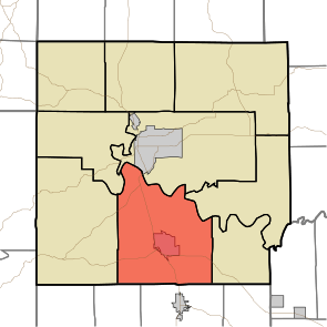 Location in Lawrence County | |
| Coordinates: 38°44′59″N 86°28′50″W / 38.74972°N 86.48056°WCoordinates: 38°44′59″N 86°28′50″W / 38.74972°N 86.48056°W | |
| Country |
|
| State |
|
| County | Lawrence |
| Government | |
| • Type | Indiana township |
| Area | |
| • Total | 66.82 sq mi (173.1 km2) |
| • Land | 66.34 sq mi (171.8 km2) |
| • Water | 0.48 sq mi (1.2 km2) 0.72% |
| Elevation | 673 ft (205 m) |
| Population (2010) | |
| • Total | 9,449 |
| • Density | 142.4/sq mi (55.0/km2) |
| ZIP codes | 47421, 47446, 47452 |
| GNIS feature ID | 0453609 |

Marion Township is one of nine townships in Lawrence County, Indiana, United States. As of the 2010 census, its population was 9,449 and it contained 4,218 housing units.[1]
History
Marion Township is named for Francis Marion.[2]
Geography
According to the 2010 census, the township has a total area of 66.82 square miles (173.1 km2), of which 66.34 square miles (171.8 km2) (or 99.28%) is land and 0.48 square miles (1.2 km2) (or 0.72%) is water.[1]
Cities, towns, villages
Unincorporated towns
- Hartleyville at 38°47′46″N 86°32′06″W / 38.796162°N 86.534993°W
- Rabbitville at 38°46′07″N 86°28′26″W / 38.768663°N 86.473880°W
- Redding at 38°46′28″N 86°30′14″W / 38.774496°N 86.503881°W
- Spring Mill Village at 38°44′06″N 86°25′37″W / 38.735053°N 86.426934°W
- Tarry Park at 38°48′05″N 86°30′33″W / 38.801440°N 86.50916°W
- Woodville at 38°45′21″N 86°29′06″W / 38.755885°N 86.484992°W
- Yockey at 38°47′17″N 86°29′35″W / 38.788107°N 86.493048°W
(This list is based on USGS data and may include former settlements.)
Cemeteries
The township contains these thirteen cemeteries: Bass, Burton, Connelly, Crest Haven, Erwin, Freedom, Hall, Hamer, Isom, Knott, Red Cross, Sheeks and Thomason.
Major highways
Lakes
- Sheeks Lake
Landmarks
School districts
- Mitchell Community Schools
Political districts
- Indiana's 4th congressional district
- State House District 62
- State House District 65
- State Senate District 44
References
- "Marion Township, Lawrence County, Indiana". Geographic Names Information System. United States Geological Survey. Retrieved 2009-10-08.
- United States Census Bureau 2008 TIGER/Line Shapefiles
- IndianaMap
- 1 2 "Population, Housing Units, Area, and Density: 2010 - County -- County Subdivision and Place -- 2010 Census Summary File 1". United States Census. Retrieved 2013-05-10.
- ↑ History of Lawrence and Monroe Counties, Indiana: Their People, Industries, and Institutions. B.F. Bowen. 1914. p. 36.
External links
- Indiana Township Association
- United Township Association of Indiana
- City-Data.com page for Marion Township
 |
Indian Creek Township | |
Shawswick Township | |
| Spice Valley Township | |
Bono Township Guthrie Township | ||
| ||||
| | ||||
| Orangeville Township, Orange County | Orleans Township, Orange County |
This article is issued from Wikipedia - version of the 11/3/2016. The text is available under the Creative Commons Attribution/Share Alike but additional terms may apply for the media files.