Marion Township, Pike County, Indiana
| Marion Township Pike County | |
|---|---|
| Township | |
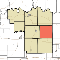 Location in Pike County | |
| Coordinates: 38°22′54″N 87°07′48″W / 38.38167°N 87.13000°WCoordinates: 38°22′54″N 87°07′48″W / 38.38167°N 87.13000°W | |
| Country |
|
| State |
|
| County | Pike |
| Government | |
| • Type | Indiana township |
| Area | |
| • Total | 36.11 sq mi (93.5 km2) |
| • Land | 35.41 sq mi (91.7 km2) |
| • Water | 0.7 sq mi (2 km2) 1.94% |
| Elevation | 518 ft (158 m) |
| Population (2010) | |
| • Total | 724 |
| • Density | 20.4/sq mi (7.9/km2) |
| ZIP codes | 47564, 47590, 47598 |
| GNIS feature ID | 0453611 |
Marion Township is one of nine townships in Pike County, Indiana, United States. As of the 2010 census, its population was 724 and it contained 310 housing units.[1]
History
Marion Township was organized in 1857.[2]
Geography
According to the 2010 census, the township has a total area of 36.11 square miles (93.5 km2), of which 35.41 square miles (91.7 km2) (or 98.06%) is land and 0.7 square miles (1.8 km2) (or 1.94%) is water.[1]
Unincorporated towns
- Hartwell Junction at 38°21′38″N 87°08′27″W / 38.360606°N 87.140839°W
- Survant at 38°22′26″N 87°09′19″W / 38.373939°N 87.155284°W
- Velpen at 38°21′19″N 87°06′07″W / 38.355329°N 87.101948°W
- White Sulphur Springs at 38°23′08″N 87°05′31″W / 38.385607°N 87.091948°W
- Whiteoak at 38°24′34″N 87°08′47″W / 38.409495°N 87.146396°W
(This list is based on USGS data and may include former settlements.)
Cemeteries
The township contains these six cemeteries: Beadles, Bruster Branch, Corn, Flat Creek, Hayes and Walnut Grove.
Lakes
School districts
- Pike County School Corporation
Political districts
- State House District 63
- State Senate District 48
References
- "Marion Township, Pike County, Indiana". Geographic Names Information System. United States Geological Survey. Retrieved 2009-11-26.
- United States Census Bureau 2009 TIGER/Line Shapefiles
- IndianaMap
- 1 2 "Population, Housing Units, Area, and Density: 2010 - County -- County Subdivision and Place -- 2010 Census Summary File 1". United States Census. Retrieved 2013-05-10.
- ↑ History of Pike and Dubois Counties, Indiana. Goodspeed Brothers. p. 276. ISBN 978-5-87521-222-2.
External links
- Indiana Township Association
- United Township Association of Indiana
- City-Data.com page for Marion Township
 |
Jefferson Township | | ||
| Patoka Township | |
Madison Township, Dubois County | ||
| ||||
| | ||||
| Lockhart Township | Patoka Township, Dubois County |
Municipalities and communities of Pike County, Indiana, United States | ||
|---|---|---|
| City | ||
| Towns | ||
| Townships | ||
| CDP | ||
| Other unincorporated communities |
| |
| Footnotes | ‡This populated place also has portions in an adjacent county or counties | |
This article is issued from Wikipedia - version of the 10/12/2016. The text is available under the Creative Commons Attribution/Share Alike but additional terms may apply for the media files.