Marconi (mountain)
| Marconi | |
|---|---|
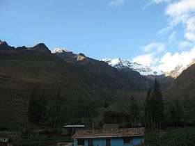 Marconi (center) and Veronica (on the right) | |
| Highest point | |
| Elevation | 5,300 m (17,400 ft) |
| Coordinates | 13°09′33″S 72°21′07″W / 13.15917°S 72.35194°WCoordinates: 13°09′33″S 72°21′07″W / 13.15917°S 72.35194°W |
| Geography | |
 Marconi Peru | |
| Location | Peru |
| Parent range | Andes, Urubamba |
Marconi[1][2] (possibly from Aymara marqu a medical plant,[3] -ni a suffix, "the one with the marqu plant") is a mountain in the Urubamba mountain range in the Andes of Peru, about 5,340 m (17,520 ft) high.[2] It is located in the Cusco Region, La Convención Province, Huayopata District, and in the Urubamba Province, Ollantaytambo District. It lies north of the Urubamba River, west of Veronica.[1]
References
- 1 2 Peru 1:100 000, Urubamba (27-r). IGN (Instituto Geográfico Nacional - Perú).
- 1 2 Echevarría, Evelio (1973). "A Survey of Andean Ascents". American Alpine Journal. 18–2 (47): 389. ISBN 9780930410704.
- ↑ Radio San Gabriel, "Instituto Radiofonico de Promoción Aymara" (IRPA) 1993, Republicado por Instituto de las Lenguas y Literaturas Andinas-Amazónicas (ILLLA-A) 2011, Transcripción del Vocabulario de la Lengua Aymara, P. Ludovico Bertonio 1612 (Spanish-Aymara-Aymara-Spanish dictionary) see: Artemisa
This article is issued from Wikipedia - version of the 7/15/2016. The text is available under the Creative Commons Attribution/Share Alike but additional terms may apply for the media files.