Marvin, North Carolina
| Marvin, North Carolina | |
|---|---|
| Village | |
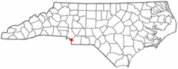 Location of Marvin, North Carolina | |
| Coordinates: 34°59′7″N 80°49′0″W / 34.98528°N 80.81667°WCoordinates: 34°59′7″N 80°49′0″W / 34.98528°N 80.81667°W | |
| Country | United States |
| State | North Carolina |
| County | Union |
| Area | |
| • Total | 3.9 sq mi (10.2 km2) |
| • Land | 3.9 sq mi (10.2 km2) |
| • Water | 0.0 sq mi (0.0 km2) |
| Elevation | 696 ft (212 m) |
| Population (2010) | |
| • Total | 5,579 |
| • Density | 1,429/sq mi (551.8/km2) |
| Time zone | Eastern (EST) (UTC-5) |
| • Summer (DST) | EDT (UTC-4) |
| ZIP code | 28173 |
| Area code(s) | 704 |
| FIPS code | 37-41720[1] |
| GNIS feature ID | 1027423[2] |
Marvin is a village in Union County, North Carolina, United States. The population was 5,579 at the 2010 census. It is considered by some to be an affluent suburb of Charlotte, North Carolina.
Geography
Marvin is located at 34°59′07″N 80°49′00″W / 34.985372°N 80.816788°W.[3]
According to the United States Census Bureau, the village has a total area of 3.9 square miles (10 km2), of which, 3.9 square miles (10 km2) of it is land and 0.04 square miles (0.10 km2) of it (0.51%) is water.
Demographics
| Historical population | |||
|---|---|---|---|
| Census | Pop. | %± | |
| 2000 | 1,039 | — | |
| 2010 | 5,579 | 437.0% | |
| Est. 2015 | 6,181 | [4] | 10.8% |
As of the census[1] of 2010, there were 5,579 people, 1,553 households, and 1,463 families residing in the village. The population density was 1429 people per square mile (551.8/km2). There were 1506 housing units at an average density of 386 per square mile (149.1/km2). The racial makeup of the village was 86.2% White, 5.7% African American, 5.4% Asian, and 1.6% from two or more races. Hispanic or Latino of any race were 3.3% of the population.
There were 1553 households out of which 67.7% had children under the age of 18 living with them, 89.4% were married couples living together, 2.3% had a female householder with no husband present, and 5.8% were non-families. 4.8% of all households were made up of individuals and 1.7% had someone living alone who was 65 years of age or older. The average household size was 3.59 and the average family size was 3.73.
In the village the population was spread out with 33.6% under the age of 18, 3.4% from 18 to 24, 33.8% from 25 to 44, 24.2% from 45 to 64, and 5.1% who were 65 years of age or older. The median age was 37 years. For every 100 females there were 102.5 males. For every 100 females age 18 and over, there were 97.1 males.
The median income for a household in the village was $157,297, and the median income for a family was $158,537. Males had a median income of $127,159 versus $51,053 for females. The per capita income for the village was $57,822. About 1.6% of families and 1.6% of the population were below the poverty line, including 2.2% of those under age 18 and 0% of those age 65 or over.
The median house value was $580,000.
The Village enacted a new land use plan in 2004, in an attempt to firmly establish its desire to preserve its open spaces, and low-density character. Marvin is located near Ballantyne, South Charlotte.
References
- 1 2 "American FactFinder". United States Census Bureau. Retrieved 2008-01-31.
- ↑ "US Board on Geographic Names". United States Geological Survey. 2007-10-25. Retrieved 2008-01-31.
- ↑ "US Gazetteer files: 2010, 2000, and 1990". United States Census Bureau. 2011-02-12. Retrieved 2011-04-23.
- ↑ "Annual Estimates of the Resident Population for Incorporated Places: April 1, 2010 to July 1, 2015". Retrieved July 2, 2016.
- ↑ "Census of Population and Housing". Census.gov. Archived from the original on May 11, 2015. Retrieved June 4, 2015.
Municipalities and communities of Union County, North Carolina, United States | ||
|---|---|---|
| City | 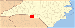 | |
| Towns | ||
| Villages | ||
| CDP | ||
| Unincorporated communities | ||
| Ghost town | ||
| Footnotes | ‡This populated place also has portions in an adjacent county or counties | |