Maryfield, Cornwall
| Maryfield | |
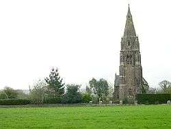 The Church of St Philip and St James, Maryfield |
|
 Maryfield |
|
| OS grid reference | SX424561 |
|---|---|
| Civil parish | Antony |
| Unitary authority | Cornwall |
| Ceremonial county | Cornwall |
| Region | South West |
| Country | England |
| Sovereign state | United Kingdom |
| EU Parliament | South West England |
Coordinates: 50°23′02″N 4°13′05″W / 50.384°N 4.218°W
Maryfield is a hamlet north of Torpoint and east of Antony House in southeast Cornwall, England.[1][2]
References
Cornwall Portal | |
| Unitary authorities | |
| Major settlements |
|
| Rivers | |
| Topics | |
This article is issued from Wikipedia - version of the 2/11/2016. The text is available under the Creative Commons Attribution/Share Alike but additional terms may apply for the media files.