Maryland County
| Maryland County | ||
|---|---|---|
| County | ||
| ||
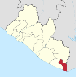 Location in Liberia | ||
| Coordinates: 4°45′N 7°45′W / 4.750°N 7.750°WCoordinates: 4°45′N 7°45′W / 4.750°N 7.750°W | ||
| Country |
| |
| Capital |
Harper Largest city (Pleebo) | |
| Districts | 7 | |
| Established | 1857 | |
| Government | ||
| • Superintendent | Nazarine Tubman | |
| Area | ||
| • Total | 2,297 km2 (887 sq mi) | |
| Population (2008) | ||
| • Total | 136,404 | |
| • Density | 59.4/km2 (154/sq mi) | |
| Time zone | GMT (UTC+0) | |

Maryland County is a county in the southeastern portion of Liberia. One of 15 counties that comprise the first-level of administrative division in the nation, it has two districts. Harper serves as the capital with the area of the county measuring 2,297 square kilometres (887 sq mi).[1] As of the 2008 Census, it had a population of 136,404, making it the seventh most populous county in Liberia.[1]
Named after the State of Maryland in the United States, it was an independent country as the Republic of Maryland from 1854 until it joined Liberia in 1857. The most populous city in the county is Pleebo with 22,963 residents, while Maryland's County Superintendent is Nazarine Tubman.[1][2] The county is bordered by Grand Kru County to the west and River Gee County to the north. The eastern part of Maryland borders the nation of Ivory Coast, separated by the Cavalla River.
History
Maryland was first established as a colony of the Maryland State Colonization Society 1834,[3] but was not granted independence until 1854. Following a referendum in 1853, the colony declared its independence from the Colonization Society and formed the Republic of Maryland. It held the land along the coast between the Grand Cess and San Pedro Rivers. In 1856, the independent state of Maryland (Africa) requested military aid from Liberia in a war with the Grebo and Kru peoples who were resisting the Maryland settlers' efforts to control their trade in slaves. President Roberts assisted the Marylanders, and a joint military campaign by both groups of Americo-Liberian colonists resulted in victory. Following a referendum in February 1857 the Republic of Maryland joined Liberia as Maryland County on 6 April 1857. As of May 2004, a DRC census estimated the county's population to be 107,100.
Districts
Districts of Maryland County include (2008 population):[1]
Details
Farming is the main economic activity in Maryland County, accounting for the employment of approximately 60% of residents. Rice and cassava are the main crops raised in the county. The flag of Maryland County, Liberia, consists of a drawing of a tree and a lighthouse on a cliff with a small Liberian flag in the upper left corner.
In 2007 WBAL-TV in Baltimore produced a special titled Africa's Maryland, which focused on this region and its cultural roots to the state of Maryland.
References
- 1 2 3 4 "2008 National Population and Housing Census: Preliminary Results" (PDF). Government of the Republic of Liberia. 2008. Retrieved 2008-10-14.
- ↑ Brown, Roberta; J. Nan Larsah (August 30, 2007). "Maryland and Bong Counties Sign Bilateral Agreements with the State of Maryland, USA". The Perspective. Retrieved 2008-10-14.
- ↑ https://books.google.com/books?id=jx8SAAAAIAAJ&pg=PA42&lpg=PA42
External links
- CIA World Factbook
- Doctors without Borders in Harper, Liberia offers photos and one man's journal of the living conditions in Maryland County.
- WBAL-TV's documentary, "Africa's Maryland"
- County Development Agenda
- Place name codes