Harper, Liberia
| Harper | |
|---|---|
|
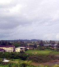
Harper in 2004 | |
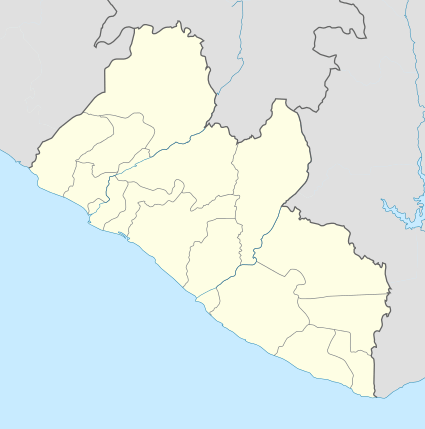 Harper Location in Liberia | |
| Coordinates: 4°22′N 7°43′W / 4.367°N 7.717°W | |
| Country |
|
| County | Maryland County |
| Population (2008) | |
| • Total | 17,837 |
| Climate | Af |
Harper, situated on Cape Palmas, is the capital of Maryland County in Liberia. It is a coastal town situated between the Atlantic Ocean and the Hoffman River. Harper is Liberia's 11th largest town, with a population of 17,837.[1]
The town is named after Robert Goodloe Harper, a prominent U.S. politician and member of the American Colonization Society. It was he who proposed the name Liberia for the American Colonization Society's settlement in Africa, and the town of Harper was named in honor of him.[2] Harper was the capital of the short-lived Republic of Maryland.
Before the First Liberian Civil War, Harper was an important administrative centre. Harper is slowly being rebuilt but without central electricity or water. No hotels and few low standard guesthouses and restaurants are functional. Tubman University, one of only two public universities in Liberia, is located in Harper.
Magnificent unexploited beaches stretch for miles on both sides of Harper and warm ocean temperature year round. Fish are found in abundance, as well as whales, dolphins and large oysters. Fanti Canoes sail from Harper to Monrovia via Greenville. This trip can take from 3 to 6 days depending on the wind and weather. A UNMIL ship, the MV Catarina, sails fortnightly between Harper and Monrovia. From the Ivory Coast, Harper is accessible from Tabou.
One of the town's most famous sons is President William Tubman, who was born in Harper.
Cape Palmas is considered to be one of the traditional hometowns of the Americo-Liberians, descendants of freed slaves from the United States who settled in Liberia and declared it an independent country in 1847. John Brown Russwurm, an African American abolitionist and governor of Monrovia, was buried in Harper after his death. There is a statue to commemorate his grave site.
References
- ↑ 2008 National Population And Housing Census. Government Of The Republic Of Liberia.
- ↑ Maryland Historical Society Library: Harper-Pennington Papers, 1701-1899, MS. 431
External links
| | |||||||||
|---|---|---|---|---|---|---|---|---|---|
| Rank | Name | County | Pop. | ||||||
 Monrovia |
1 | Monrovia | Montserrado | 939,524 |  Kakata | ||||
| 2 | Gbarnga | Bong | 45,835 | ||||||
| 3 | Kakata | Margibi | 33,945 | ||||||
| 4 | Bensonville | Montserrado | 33,188 | ||||||
| 5 | Harper | Maryland | 32,661 | ||||||
| 6 | Voinjama | Lofa | 26,594 | ||||||
| 7 | Buchanan | Grand Bassa | 25,731 | ||||||
| 8 | Zwedru | Grand Gedeh | 25,678 | ||||||
| 9 | New Yekepa | Nimba | 24,695 | ||||||
| 10 | Greenville | Sinoe | 16,434 | ||||||
Coordinates: 4°22′N 7°43′W / 4.367°N 7.717°W