Mateiros
| Mateiros | |
|---|---|
| Municipality | |
| The Municipality of Mateiros | |
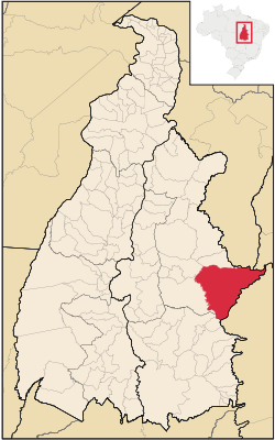 Location of Mateiros in the State of Tocantins | |
| Coordinates: 05°15′25″S 48°12′00″W / 5.25694°S 48.20000°WCoordinates: 05°15′25″S 48°12′00″W / 5.25694°S 48.20000°W | |
| Country |
|
| Region | North |
| State |
|
| Founded | January 1, 1992 |
| Area | |
| • Total | 9,591.543 km2 (3,703.315 sq mi) |
| Elevation | 493 m (1,617 ft) |
| Population (2008) | |
| • Total | 1,788 |
| • Density | 0.2/km2 (0.5/sq mi) |
| [1] | |
| Time zone | UTC-3 (UTC-3) |
| • Summer (DST) | UTC-2 (UTC-2) |
| HDI (2000) | 0.584 – medium[2] |
Mateiros is the easternmost city in the state of Tocantins. It is the only city in Tocantins to border the state of Piauí
The municipality is in the microregion of Jalapão.[3]
Conservation
The municipality contains part of the 707,079 hectares (1,747,230 acres) Serra Geral do Tocantins Ecological Station, a strictly protected conservation unit created in 2001 to preserve an area of cerrado.[4] It contains part of the 724,324 hectares (1,789,840 acres) Nascentes do Rio Parnaíba National Park, created in 2002.[5] It also contains the 158,885 hectares (392,610 acres) Jalapão State Park, a fully protected conservation unit created in 2001.[6]
References
- ↑ IBGE 2008 statistics
- ↑ - UNDP
- ↑ "Como chegar/Mapa", Turismo Tocantins (in Portuguese), retrieved 2016-06-11
- ↑ Unidade de Conservação: Estação Ecológica Serra Geral do Tocantins (in Portuguese), MMA: Ministério do Meio Ambiente, retrieved 2016-05-28
- ↑ Unidade de Conservação: Parque Nacional das Nascentes do Rio Parnaíba (in Portuguese), MMA: Ministério do Meio Ambiente, retrieved 2016-05-01
- ↑ PES do Jalapão (in Portuguese), ISA: Instituto Socioambiental, retrieved 2016-06-11
This article is issued from Wikipedia - version of the 11/1/2016. The text is available under the Creative Commons Attribution/Share Alike but additional terms may apply for the media files.