Mavoor
| Mavoor മാവൂർ | |
|---|---|
| Village | |
|
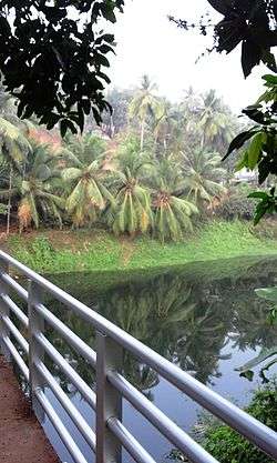
Nochikkad Kadavu Bridge, Mavoor | |
| Coordinates: 11°15′35″N 75°56′55″E / 11.25972°N 75.94861°ECoordinates: 11°15′35″N 75°56′55″E / 11.25972°N 75.94861°E | |
| Country |
|
| State | Kerala |
| District | Kozhikode |
| Population (2001) | |
| • Total | 29,781 |
| Languages | |
| • Official | Malayalam, English |
| Time zone | IST (UTC+5:30) |
| PIN | 673661 |
| Telephone code | 0495 288 |
| Vehicle registration | KL 11 |
| Sex ratio | 1:1 ♂/♀ |
| Website |
www |


Mavoor is a town situated in Kozhikode district in Kerala, India. It is 20 km away from Kozhikode city.
Etymology
The former name of Mavur was Pulpparambu, or "hayfields" in Malayalam, as grass for thatching houses was stored in this town. (In malayalam 'pul' means grass/hay, 'Parampu' means field).
Geography
Mavoor is 20 km east of Kozhikode city, beside the river Chaliyar.
Grasim Factory
Until the 1960s, Mavoor was like any other village in Kerala. During the 1963s the industrial house of Birla established a factory named 'Gwalior Rayons' (later renamed as Grasim) at Mavoor for producing pulp and fibre in 316 acre's of land. An integrated township with schools, hospital, Police station also came up. The arrival of Gwalior Rayons caused a rapid change in area.
In 1985 Grasim shut down for 3 years. The disruption caused to the local economy was significant. (11 suicides in Mavoor have been attributed to this. In 1988, the Government of Kerala offered more concessions to the management and the factory was re-opened by the management.
The factory faced many protests as it turned out to be a heavily polluting unit. The management avoided the use of any pollution control measures, citing profitability concerns. A large quantity of pollutants produced by Grasim ended up in the Chaliyar river which flows beside the factory. The thick effluents recklessly released by the factory have been identified as poisonous. Besides the water pollution, the factory was also a serious air polluter. The impact of the pollution could be seen in the every aspect of the town. Cases of asthma and other respiratory diseases shot up. There was a marked decline in the fish population. Thousands of dead fishes and other aquatic forms surfaced from Chaliyar river. Environmental organizations started agitations focusing on this aspect of the factory. E N Peethambaran master was a significant figure who worked for restoration of the environmental cleanliness, as well as ensuring justice to the workers of the factory. A series of labour strikes and heightened trade union was also witnessed at the plant. All these factors contributed to the shut down of Gwalior Rayons in 2001. (See also The First Environmental Movement In Kerala.) The closure of factory caused loss of employment around 3000 people.
Future plans
386 acres of land is still owned by the Birla group of companies in Mavoor town. The government can utilize this land for the development of Mavoor town. But the ontrol of the land is still vested with the Birla management. The Kerala Government is planning to build another industrial hub in Mavoor which will be an eco-friendly project. This area is also considered ideal for the setting up of the AIIMS hospital, considering the availability of the required amount of land in the vicinity of an abundant fresh water source- the Chaliyar. More over, Mavoor, owing to the previous presence of a factory, is fully equipped to house big installations and organizations.
Culture
Many Temples, Mosques and Churches are situated in the nearby places. There have not been any communal problems reported from Mavoor until now. Kalchira Sree Narasimha Moorthi Kshethram, Mavoor Juma masjid, Valiya juma masjid,kalpally juma masjid, Christ the King Church, Little flower church etc. are the major religious centers in Mavoor. Arts and sports clubs drive the cultural aspirations of people. The Mavoor Public Library is on the ground floor of the Grama Panchayath Office.
Climate
The district has a generally humid climate with a hot season extending from March to May. The most important rainy season is during the South West Monsoon, which sets in the first week of June and extends up to September. In June,July season most of the places suffer threat of floods.
Demographics
As of 2001 India census,[1] Mavoor had a population of 27,843. Males constitute 50% of the population and females 50%. Mavoor has an average literacy rate of 82%, higher than the national average of 59.5%: male literacy is 85%, and female literacy is 79%. In Mavoor, 13% of the population is under 6 years of age.
Suburbs of Mavoor
Kuttikkadavu, Valayanoor, Kuniyankadavu, Chittaripilakkal, Thathoor, Koolimad, Cheruvadi, Kettungal, Ayamkulam, Kacherikunnu, Kanniparamba, Cherupa, Kuttikadave, Valayanoor, Peruvayal, Cheruppa, Thengilakkadavu, Kalleri, Manakkad, KolakkottThazham, Kalpally and Parammal.
Educational institutions
Some of the educational institutes are Mavoor GMUP school, GHSS Mavoor, Mahlara Public school, Crescent English school, St.Mary's English Medium school, Aduvad AUP school, GUP school, Arayancode ALP school, ALP School Kanniparamba.
See also
References
- Website for mavoor with photos: www.mavoor.net
- www.mavoor.net
- ↑ "Census of India 2001: Data from the 2001 Census, including cities, villages and towns (Provisional)". Census Commission of India. Archived from the original on 2004-06-16. Retrieved 2008-11-01.
External links
| Wikimedia Commons has media related to Mavoor. |
- Website for mavoor with photos: www.mavoor.net
- Documentary on Mavoor chaliyar pollution: Final Struggle/Documentary by P.Baburaj & C.Saratchandran