McKinney, Kentucky
| McKinney, Kentucky | |
|---|---|
| Unincorporated community | |
 McKinney, Kentucky | |
| Coordinates: 37°27′09″N 84°45′33″W / 37.45250°N 84.75917°WCoordinates: 37°27′09″N 84°45′33″W / 37.45250°N 84.75917°W | |
| Country | United States |
| State | Kentucky |
| County | Lincoln |
| Elevation | 1,020 ft (310 m) |
| Time zone | Eastern (EST) (UTC-5) |
| • Summer (DST) | EDT (UTC-4) |
| ZIP code | 40448 |
| Area code(s) | 606 |
| GNIS feature ID | 497905[1] |
McKinney is an unincorporated community in Lincoln County, Kentucky, United States. McKinney is located along Kentucky Route 198 and the Norfolk Southern Railway, 7.6 miles (12.2 km) southwest of Stanford.[2] McKinney has a post office with ZIP code 40448.[3][4]
Notable people
- William B. Baugh, awarded a Medal of Honor for his actions in the Korean War.
- Harry Camnitz, professional baseball player.
- Joseph K. Carson, Jr., 40th mayor of Portland, Oregon.
References
- ↑ "McKinney". Geographic Names Information System. United States Geological Survey.
- ↑ State Primary Road System: Lincoln County (PDF) (Map). Kentucky Transportation Cabinet. 2012. Retrieved January 6, 2013.
- ↑ United States Postal Service (2012). "USPS - Look Up a ZIP Code". Retrieved 2012-02-15.
- ↑ "Postmaster Finder - Post Offices by ZIP Code". United States Postal Service. Retrieved January 6, 2013.
Municipalities and communities of Lincoln County, Kentucky, United States | ||
|---|---|---|
| Cities | 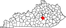 | |
| Unincorporated communities | ||
| Footnotes | ‡This populated place also has portions in an adjacent county | |
This article is issued from Wikipedia - version of the 9/29/2014. The text is available under the Creative Commons Attribution/Share Alike but additional terms may apply for the media files.