Merrill Field
| Merrill Field | |||||||||||||||||||
|---|---|---|---|---|---|---|---|---|---|---|---|---|---|---|---|---|---|---|---|
 | |||||||||||||||||||
| IATA: MRI – ICAO: PAMR – FAA LID: MRI | |||||||||||||||||||
| Summary | |||||||||||||||||||
| Airport type | Public | ||||||||||||||||||
| Owner | Municipality of Anchorage | ||||||||||||||||||
| Location | Anchorage, Alaska | ||||||||||||||||||
| Elevation AMSL | 137 ft / 42 m | ||||||||||||||||||
| Coordinates | 61°12′49″N 149°50′40″W / 61.21361°N 149.84444°WCoordinates: 61°12′49″N 149°50′40″W / 61.21361°N 149.84444°W | ||||||||||||||||||
| Website | |||||||||||||||||||
| Map | |||||||||||||||||||
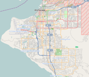 MRI Location of airport in Anchorage | |||||||||||||||||||
| Runways | |||||||||||||||||||
| |||||||||||||||||||
| Statistics (2013) | |||||||||||||||||||
| |||||||||||||||||||
Merrill Field (IATA: MRI, ICAO: PAMR, FAA LID: MRI)[2] is a public-use general aviation airport located one mile (1.6 km) east of downtown Anchorage in the U.S. state of Alaska. The airport is owned by Municipality of Anchorage.[1]
History

Merrill Field, located on the east end of 5th Avenue in Anchorage, was the first official airport in the city when it opened in 1930. It was the Anchorage's only airport until 1951, when the introduction of ever larger and faster commercial aircraft required that an airfield with longer and heavier runways be built.
The airport is named for Russel Merrill, an Alaskan aviation pioneer. The first aviation beacon in the Territory of Alaska was located at Merrill Field and was dedicated on September 25, 1932 in Merrill's honor.
The airfield remains in use today as the primary field for private wheel equipped aircraft in the warmer months, and for ski equipped in the winter.
Facilities and aircraft
Merrill Field covers 436 acres (176 ha, 1.76 km²) and has three runways:[1]
- Runway 5/23: 2,000 x 60 ft (610 x 18 m), Surface: Gravel/Dirt
- Runway 7/25: 4,000 x 100 ft (1,219 x 30 m), Surface: Asphalt
- Runway 16/34: 2,640 x 75 ft (805 x 23 m), Surface: Asphalt
For the 12-month period ending September 30, 2013, the airport had 126,234 aircraft operations, all of which were general aviation. There are 844 aircraft based at this airport: 786 single engine, 41 multi-engine, 16 helicopters and one glider.[1]
There are no based jets,[1] although one retired Boeing 727 donated by FedEx is used as a training aid by the University of Alaska Anchorage's Aviation Technology Division,[3][4] which is based at the airfield. It is not air-worthy.
When it landed in February 2013, the Boeing 727 was the largest aircraft ever to have landed at Merrill Field.[5] The landing required special permission from the city,[3][5] and preparatory surveys of the runway and airfield infrastructure to ensure the aircraft could be landed safely;[4] the captain practised the landing in a flight simulator beforehand.[6]
The airfield hosts two locally owned flight schools, air taxi services, and fixed-base operators. An extension of the Q Taxiway connects the airport to Alaska Regional Hospital for MEDEVAC operations.
A section of the airport is built over the closed Merrill Field Land Fill. This section requires slightly more maintenance due to settling and emissions.
References
- 1 2 3 4 5 FAA Airport Master Record for MRI (Form 5010 PDF), effective 2007-03-15
- ↑ Great Circle Mapper: MRI / PAMR - Anchorage, Alaska (Merrill Field)
- 1 2 Anderson, Ben (26 February 2013). "Unusual 727 landing at Anchorage's Merrill Field draws a crowd". Alaska Dispatch News. Retrieved 2015-06-18.
- 1 2 "727 landing puts spotlight on UAA's aviation technology programs". Green & Gold News. University of Alaska Anchorage. 4 March 2013. Retrieved 2015-06-18.
- 1 2 Hopkins, Kyle (7 February 2013). "University wants Boeing 727 to land at Merrill Field". Alaska Dispatch News. Retrieved 2015-06-18.
- ↑ Erickson, Evan (12 March 2013). "The eagle has landed at Merrill Field: FedEx donates Boeing 727 to Aviation program". The Northern Light. Retrieved 2015-06-18.
External links
| Wikimedia Commons has media related to Merrill Field. |
- Municipality of Anchorage: Merrill Field (official web site)
- FAA Airport Diagram for Merrill Field (MRI) (PDF), effective December 8, 2016
- FAA Terminal Procedures for Merrill Field (MRI), effective December 8, 2016
- Resources for this airport:
- FAA airport information for MRI
- AirNav airport information for PAMR
- ASN accident history for MRI
- FlightAware airport information and live flight tracker
- NOAA/NWS latest weather observations for PAMR
- SkyVector aeronautical chart for MRI