Metro Baguio
| BLISTT Metro Baguio | |
|---|---|
| Metropolitan Area | |
|
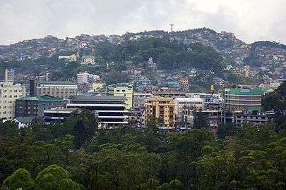
Baguio City Skyline | |
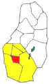 Location in Benguet province with Baguio City highlighted in red | |
| Country | Philippines |
| Region |
Cordillera Administrative Region (CAR) |
| Province | Benguet |
| Metropolitan Center | Baguio |
| City/Municipality | |
| Government[1] | |
| • Type | Council |
| • Chairman |
Mauricio Domogan (mayor of Baguio City) |
| • Co-Chairman |
Arthur Baldo (mayor of Sablan) |
| • Treasurer |
Edna Tabanda (mayor of La Trinidad) |
| • Secretary |
Ruben Paoad (mayor of Tublay) |
| Area | |
| • Total | 1,094.79 km2 (422.70 sq mi) |
| Elevation | 500 to 1,850 m (1,500 to 6,069 ft) |
| Population (2010) | |
| • Total | 551,764 |
| • Density | 500/km2 (1,300/sq mi) |
| Time zone | PST (UTC+8) |
| Area Code | +63 74 |
BLISTT (informally, Metro Baguio) is an agglomeration of the city of Baguio and five municipalities of the province of Benguet, namely: La Trinidad, Itogon, Sablan, Tuba, and Tublay.
Long proposed and supported by the NEDA-Regional Development Council-Cordillera, it as one of twelve defined metropolitan areas in the Philippines.[2] The original "BLIST" long existed as a concept since its inception in August 1990, a month after the 1990 earthquake which devastated the city of Baguio and other surrounding areas,[3] and only existed as an informal reference to the area. The concept was later amended into "BLISTT" in 2009, which included the municipality of Tublay, despite not being adjacent to the city of Baguio.[3] It was officially established after a signing of a memorandum of agreement by the mayors of the component local government units.[4]
Component local government units
BLISTT, like Metro Manila and Metro Cebu, is not an administrative political unit but an agglomeration of independent local government units (LGUs), the third level government in the Philippine political system.[5]
| Location | City/Municipality | Image | Population (2010)[5] |
Area (km²)[5] |
Pop. density (per km²) |
Income classification[5] |
|---|---|---|---|---|---|---|
 |
Baguio |  |
318,676 | 57.5 | 5,542 | 1st Class |
 |
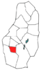
La Trinidad | 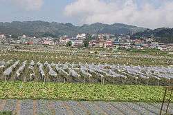 |
107,188 | 82.74 | 1,295.48 | 1st Class |
 |
Itogon | 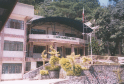 |
55,960 | 450 | 124.4 | 1st Class |
 |
Sablan | 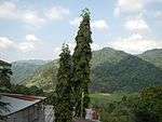 |
10,511 | 106 | 99.2 | 5th Class |
 |
Tuba | 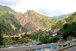 |
42,874 | 296 | 144.84 | 1st Class |
 |
Tublay |  |
16,555 | 102.55 | 161.433 | 5th Class |
| BLISTT | 551,764 | 1094.79 | 503.9907 | - | ||
History
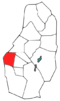
The original BLIST concept was visualized by the Baguio Jaycees and the Baguio Correspondents and Broadcasters Club in August 1990 after the 1990 Luzon earthquake devastated Baguio.[3] Supported by a European Union grant in 1992, the BLIST Urban Plan was completed in 1994, which aimed to reconstruct the city following the earthquake and to reduce overcrowding in the city. The concept was not supported by the component Benguet municipalities of La Trinidad, Itogon, Sablan, and Tuba such that it was prepared with little consultation, and was primarily developed for the sole convenience of Baguio.[3]
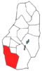
In 2009, the municipality of Tublay in the Province of Benguet was included in the new BLISTT plan as revived by the Regional Development Council of the Cordillera Administrative Region (RDC-CAR).[3]
 |
|
| The original BLIST in the province of Benguet |
The new BLISTT which includes Tublay |
The concept had long been pushed through by the city government of Baguio, for the prime purpose of alleviating the city's overpopulation and decongestion problems.[6][7] It was criticized by other government officials as heavily geared towards the alleviating of the problems of Baguio.[8]
It was officially established after a signing of a memorandum of agreement by the mayors of the component LGUs.[4] The first set of council officials were elected on February 27, 2014, with Baguio Mayor Mauricio Domogan as Chairman, Sablan Mayor Arthur Baldo as Co-Chairman, La Trinidad Mayor Edna Tabanda as Treasurer, and Tublay Mayor Ruben Paoad as Secretary, all of whom would serve for a one-year term.[1]
Geography and Climate
Geography
Most of the metropolitan area, like Baguio, is located some 1,500 meters above sea level, nestled within the Cordillera Central mountain range in northern Luzon. It covers a total area of 1094.79 square kilometers.
Climate
BLISTT features a subtropical highland climate under the Köppen climate classification. The area is known for its mild climate. Owing to its high elevation, the temperature is 8 degrees Celsius lower compared to the average temperature of the rest of the country. Average temperature ranges from 15 to 23 degrees Celsius. It is usually lower during the late and early months of the year. The lowest recorded temperature in Baguio was 6.3 degrees Celsius on January 18, 1961. This is in contrast to the all-time high of 30.4 degrees Celsius recorded on March 15, 1988 during the 1988 El Niño season. Baguio seldom exceeds 26 degrees Celsius even during the warmest part of the year. Like many other cities with a subtropical highland climate, BLISTT sees noticeably less precipitation during its “low-sun” months. The metropolitan area though sees an extraordinary amount of precipitation during its wetter months, with the months of July and August seeing on average more than 1,000 mm of rain. BLISTT averages over 4500 mm of precipitation annually.[9]
| Climate data for Baguio, Philippines | |||||||||||||
|---|---|---|---|---|---|---|---|---|---|---|---|---|---|
| Month | Jan | Feb | Mar | Apr | May | Jun | Jul | Aug | Sep | Oct | Nov | Dec | Year |
| Record high °C (°F) | 26 (79) |
27 (81) |
28 (82) |
29 (84) |
27 (81) |
27 (80) |
27 (80) |
27 (80) |
26 (79) |
27 (81) |
27 (80) |
27 (80) |
29 (84) |
| Average high °C (°F) | 22 (72) |
23 (73) |
24 (76) |
25 (77) |
24 (76) |
24 (75) |
22 (71) |
22 (71) |
22 (71) |
23 (73) |
23 (74) |
23 (74) |
23 (74) |
| Average low °C (°F) | 13 (55) |
13 (56) |
14 (58) |
16 (60) |
16 (61) |
16 (61) |
16 (60) |
16 (60) |
16 (60) |
16 (60) |
15 (59) |
14 (57) |
15 (59) |
| Record low °C (°F) | 6 (43) |
8 (47) |
11 (52) |
10 (50) |
14 (57) |
12 (53) |
12 (54) |
13 (55) |
14 (57) |
11 (52) |
9 (49) |
8 (46) |
6 (43) |
| Average precipitation mm (inches) | 22.86 (0.9) |
22.86 (0.9) |
43.18 (1.7) |
109.2 (4.299) |
401.3 (15.799) |
436.9 (17.201) |
1,074.4 (42.299) |
1,160.8 (45.701) |
713.7 (28.098) |
381 (15) |
124.5 (4.902) |
50.8 (2) |
4,541.5 (178.799) |
| Source: http://www.weatherbase.com/weather/weather.php3?s=082389&refer= | |||||||||||||
Government
Unlike Metro Manila, BLISTT, before the signing of the MOA, didn't have a government that directly administered the area. [3] However, on February 27, 2014, the first set of council officials were elected, with Baguio Mayor Mauricio Domogan as Chairman, Sablan Mayor Arthur Baldo as Co-Chairman, La Trinidad Mayor Edna Tabanda as Treasurer, and Tublay Mayor Ruben Paoad as Secretary, all of whom would serve for a one-year term.[1]
Transportation
On land
Three main access roads lead to the city of Baguio from the lowlands; Kennon Road, Aspiras-Palispis Highway (formerly Marcos Highway), and Naguilian Road (also known as Quirino Highway). Kennon Road starts from Rosario in La Union province, and winds through a narrow, steep valley. Although perilous and being prone to landslides during rainy season, it is the fastest route to Baguio from the lowlands, and offers a scenic view. Aspiras Highway, which starts from Agoo, La Union and connects to Palispis Highway at Benguet-La Union highway border, and Naguilian Road, which starts from Bauang, La Union, are longer but safer routes than Kennon Road. For this, they are preferred by coaches, buses and lorries. All three major highways traverse the municipality of Tuba, also known as the "Gateway to Baguio".[10][11] A significant portion of Naguilian Road covers the municipality of Sablan.
From Itogon, Baguio is connected by the Baguio-Bua-Itogon Road, while La Trinidad's main access route to the city is via the Halsema Highway (also known as the "Mountain Trail"), which leads north through the mountainous portion of the Cordillera Administrative Region. The municipality of Tublay, situated at the north of La Trinidad, is likewise traversed by the Halsema Highway.
Another access to Baguio from Aritao in the Nueva Vizcaya province passes through Itogon, but is less traveled. The road is not well-maintained, and public transportation through this route is not as regular.
Several bus lines link Baguio with Manila and the rest of the lowlands. Most transportation companies also offer express and air-conditioned buses at a much higher fare, though some minibuses offer cheaper fares. Bus services that operate in Baguio include Philippine Rabbit, Dangwa Tranco, Dagupan Bus, Victory Liner, Partas, Genesis, and Saulog Transit.[12]By air
Loakan Airport is the lone airport serving the general area. The airport is classified as a trunkline airport, or a major commercial domestic airport, by the Civil Aviation Authority of the Philippines, a body of the Department of Transportation and Communications that is responsible for the operations of not only this airport but also of all other airports in the Philippines except the major international airports. It is about 10 minutes by car from the city center going south. Due to the limited length of the runway which is 1,802 meters or 5,912 feet, it is restricted to commuter size aircraft. This perhaps contributed to the city's declining competitiveness against other medium-sized cities around the country. The airport is used primarily by helicopters, turbo-prop and piston engine aircraft, although on rare occasion light business jets (LBJ) have flown into the airport.
References
- 1 2 3 Toyoken, Freda. "First Set of Blistt Governing Council Officials Elected". National Economic and Development Authority - Cordillera Administrative Region. Retrieved 1 February 2015.
- ↑ http://www.neda.gov.ph Building globally competitive metropolitan areas in the Philippines PDF
- 1 2 3 4 5 6 Liporada, Cesar. "Why BLISTT?". Baguio Midland Courier. Retrieved 25 September 2014.
- 1 2 Cabreza, Vincent (5 November 2012). "Better Trade, Traffic Seen Between Baguio, Neighbors". Philippine Daily Inquirer. Retrieved 1 February 2015.
- 1 2 3 4 "Province: Benguet". Philippine Statistics Authority - National Statistical Coordination Board. Retrieved 1 February 2015.
- ↑ Agreda, JM (6 July 2012). "Metro Baguio concept pushed". Sun.Star Baguio. Retrieved 25 September 2014.
- ↑ See, Dexter A. (26 April 2010). "Domogan Says BLIST Will Solve Baguio's Problems". Northern Philippine Times. Retrieved 1 February 2015.
- ↑ Catajan, Maria Elena (4 September 2013). "Governor: BLISTT Should Be for True Development". Sun.Star Baguio. Retrieved 1 February 2015.
- ↑ Baguio#Geography and climate
- ↑ Galacgac, Aure (14 November 2011). "Gateway to Baguio marks centennial". Sun.Star Baguio. Retrieved 3 October 2014.
- ↑ Laking, Jimmy (10 August 2014). "Tuba to clear 2-story structure blocking Bridal Veil Falls' view". Baguio Midland Courier. Retrieved 3 October 2014.
- ↑ Baguio City#Transportation
Summer Capital of the Philippines | ||
| Geography |  | |
| Buildings | ||
| Education |
| |
| Culture | ||
| Transportation | ||
| Others | ||
La Trinidad (capital) | |
| Municipalities | |
| Highly urbanized city |
|
| Barangays | |