Rosario, La Union
| Rosario | ||
|---|---|---|
| Municipality | ||
|
Rosario town center | ||
| ||
 Location in the province of La Union | ||
.svg.png) Rosario Location in the Philippines | ||
| Coordinates: 16°13′55″N 120°29′17″E / 16.23194°N 120.48806°ECoordinates: 16°13′55″N 120°29′17″E / 16.23194°N 120.48806°E | ||
| Country |
| |
| Region | Ilocos (Region I) | |
| Province | La Union | |
| District | 2nd District | |
| Founded | 1869 | |
| Barangays | 33 | |
| Government[1] | ||
| • Mayor | Bellarmin Flores III | |
| Area[2] | ||
| • Total | 73.98 km2 (28.56 sq mi) | |
| Population (2010)[3] | ||
| • Total | 52,679 | |
| • Density | 710/km2 (1,800/sq mi) | |
| Time zone | PST (UTC+8) | |
| ZIP code | 2506 | |
| Dialing code | 72 | |
| Income class | 1st class | |

Rosario (Ilocano: Ili ti Rosario, Pangasinan: Baley na Rosario) is a first class municipality in the province of La Union, Philippines. According to the 2010 Philippine census, it has a population of 52,679 people,[3] with average annual income of Php 86,125,676.88. It has a land area of 7,398 hectares (18,280 acres).[2]
The Kennon Road starts from this town and ends at Baguio City. It is being proposed that this town will be the terminus of the Tarlac-Pangasinan-La Union Expressway. Rosario is 215 kilometres (134 mi) away from Metro Manila. Rosario links Ilocos and Cordillera Provinces. The flight distance between Manila and Rosario is 189 km.[4]
Etymology
Rosario came from the phrase “rosas del rio” (beautiful landscape with narrow valleys, wild animals, birds, rivers, brooks, dense forest and riverscape, as discovered by Spaniards). Another version or story, is that the long range of foothill far west of the Poblacion appearing like big Rosary beads was source of the town's name (giant and long rocky rosary).
Rosario is the southernmost town of La Union and the Ilocos Region, hence called the “Gateway to Ilocandia”. Rosario's national highway passes along a mountain at barangay Agat (of Sison, Pangasinan), then into the Bued bridge (the boundary marker between La Union and Pangasinan).
History
Rosario was formerly a part of Santo Tomas and became a municipality in 1869 by a decree. Natives of Rosario emanated from Santo Tomas and Magsingal (Ilocos Sur), and also from Agoo, Tubao, Aringay, San Fernando and Bacnotan.
It was Don Mariano Posadas, Don Mariano Narcelles and Don Gavino Ordoña, who filed a petition with the authorities for conversion of Rosario to a town from sitio or barangay. In 1869, the Spanish Provincial Governor created Rosario town and appointed Don Agustin Isidro de Guzman as its first Capitan Municipal.
Demographics
| Population census of Rosario | ||
|---|---|---|
| Year | Pop. | ±% p.a. |
| 1990 | 35,010 | — |
| 1995 | 38,376 | +1.73% |
| 2000 | 43,497 | +2.72% |
| 2007 | 49,025 | +1.66% |
| 2010 | 52,679 | +2.65% |
| Source: National Statistics Office[3][5] | ||
Local Government
Just as the national government, the municipal government of Rosario, is divided into three branches: executive, legislative and judiciary. The judicial branch is administered solely by the Supreme Court of the Philippines. The LGUs have control of the executive and legislative branch.
The executive branch is composed of the mayor and the barangay captain for the barangays.Local Government Code of the Philippines, Book III, Department of Interior and Local Government official website.
The legislative branch is composed of the Sangguniang Bayan (town assembly), Sangguniang Barangay (barangay council), and the Sangguniang Kabataan for the youth sector.
The seat of Government is vested upon the Mayor and other elected officers who hold office at the Pugo Town hall. The Sanguniang Bayan is the center of legislation, stationed in Rosario Legislative Building or Town hall.[6]
Barangays
| Rank | Barangay | Population | Rank | Barangay | Population | Rank | Barangay | Population | |
|---|---|---|---|---|---|---|---|---|---|
| 1 | Concepcion | 3,206 | 13 | Parasapas | 1,757 | 25 | Rabon | 990 | |
| 2 | Camp One(Saytan) | 2,823 | 14 | Gumot-Nagcolaran | 1,695 | 26 | Alipang | 928 | |
| 3 | Subusub | 2,586 | 15 | Poblacion West | 1,690 | 27 | Bangar | 916 | |
| 4 | Cataguingtingan | 2,528 | 16 | Nagtagaan | 1,632 | 28 | Puzon | 824 | |
| 5 | Tabtabungao | 2,460 | 17 | Bani | 1,554 | 29 | Nangcamotian | 789 | |
| 6 | Tay-ac | 2,362 | 18 | Carunuan East | 1,425 | 30 | Tanglag | 637 | |
| 7 | Damortis | 2,352 | 19 | Marcos | 1,396 | 31 | Casilagan | 587 | |
| 8 | Vila | 2,245 | 20 | Inabaan Sur | 1,312 | 32 | San Jose | 522 | |
| 9 | Udiao | 2,214 | 21 | Carunuan West | 1,297 | 33 | Ambangonan | 497 | |
| 10 | Poblacion East | 2,093 | 22 | Bacani | 1,285 | Rosario Total | 52,679 | ||
| 11 | Amlang | 2,088 | 23 | Benteng-Sapilang | 1,187 | ||||
| 12 | Inabaan Norte | 1,769 | 24 | Cadumanian | 1,033 | ||||
Tourism
Rosario has the following landmark attractions:
- Beach resorts
- Zoo
- The Queen of Peace Priory
- The Tree House
- World War II Vintage Canons located at the Town Plaza
- The Rosario Nature Park is hectares of lush green (La Union’s biggest camping site. It is the venue of the Boys and Girls Scouts of the Philippines' Jamborees. It is also the meeting place of Air Soft Enthusiasts' War Games.
- Agoo–Damortis Protected Landscape and Seascape
- Public Market (near the Rosario-Pugo Junction Road and a new Slaughter House which, unlike its predecessor, was built away from residential areas.
- Yearly, on December 8, the Feast of Immaculate Concepcion, the town celebrates its fiesta. But it centers on the Linubian Festival (local cassava and banana cake) held from April 17 to 19. Rosario holds an Agri Trade Fair, showcasing its harvests topped by street-dancing competitions.[8]
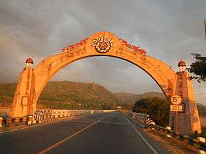 La Union Welcome Arch at Rosario
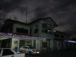 Municipal hall
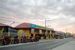
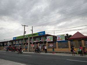 Public market
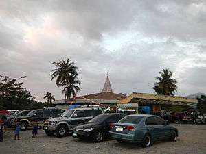 Rosario intersection
 Rosario rural landscape
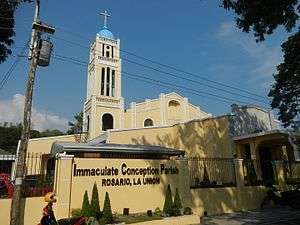
1869 Immaculate Concepcion Parish Church
The Immaculate Concepcion Parish Church was canonically erected in 1869. It is under the jurisdiction of the Roman Catholic Diocese of San Fernando de La Union (Dioecesis Ferdinandopolitana ab Unione, Suffragan of Lingayen – Dagupan, which was created on January 19, 1970 and erected on April 11, 1970, comprising the Civil Province of La Union, under the Titular, St. William the Hermit, February 10). The Church is under a diocese of the Latin Rite of the Roman Catholic Church in the Philippines from the Archdiocese of Nueva Segovia.
The Rosario Church is under the Vicariate of St. Francis Xavier with Vicar Forane, Fr. Joel Angelo Licos. [9] [10] Its Parish Priestis Fr. Raul S. Panay.
The church is located at the eastern side fronting the National Highway and the Municipal Building. It has an access road to the Rosario-Pugo-Baguio Road.
 Church facade
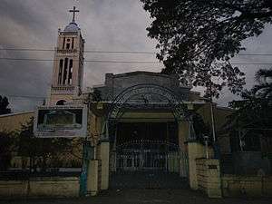 Church gate
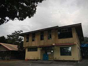 Convent and Parish rectory
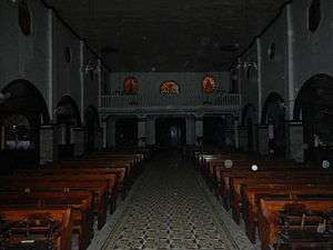 Interior and choir
References
- ↑ "Municipalities". Quezon City, Philippines: Department of the Interior and Local Government. Retrieved 30 July 2013.
- 1 2 "Province: La Union". PSGC Interactive. Makati City, Philippines: National Statistical Coordination Board. Retrieved 30 July 2013.
- 1 2 3 "Total Population by Province, City, Municipality and Barangay: as of May 1, 2010" (PDF). 2010 Census of Population and Housing. National Statistics Office. Retrieved 30 July 2013.
- ↑ 189 Km - Flight distance between Manila and Rosario - La Union Philippines
- ↑ "Province of La Union". Municipality Population Data. LWUA Research Division. Retrieved 30 July 2013.
- ↑ Local Government Units: Municipality of Rosario-Government - Province of La Union :: Official Website
- ↑ "2010 Census of Population and Housing: Population Counts - Cordillera Administrative Region" (PDF). National Statistics Office (Philippines), April 4, 2012. Retrieved 16 November 2014.
- ↑ Local Government Units: Municipality of Rosario - Province of La Union :: Official Website
- ↑ "Diocese of San Fernando de La Union". Claretian Publications. Retrieved 28 September 2014.
- ↑ "Diocese of San Fernando de La Union". Catholic Hierarchy. Retrieved 28 September 2014.
External links
| Wikimedia Commons has media related to Rosario, La Union. |
- Rosario, La Union Website
- Philippine Standard Geographic Code
- Philippine Census Information
- Local Governance Performance Management System
 |
Santo Tomas / Tubao | Pugo | | |
| Lingayen Gulf | |
Tuba, Benguet | ||
| ||||
| | ||||
| San Fabian, Pangasinan | Sison, Pangasinan |