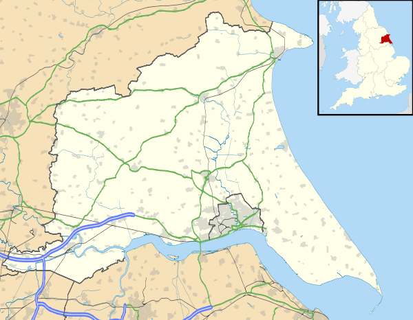
Millington, East Riding of Yorkshire
| Millington | |
 Millington |
|
| Population | 242 (2011 census)[1] |
|---|---|
| OS grid reference | SE830517 |
| – London | 170 mi (270 km) S |
| Civil parish | Millington |
| Unitary authority | East Riding of Yorkshire |
| Ceremonial county | East Riding of Yorkshire |
| Region | Yorkshire and the Humber |
| Country | England |
| Sovereign state | United Kingdom |
| Post town | YORK |
| Postcode district | YO42 |
| Dialling code | 01759 |
| Police | Humberside |
| Fire | Humberside |
| Ambulance | Yorkshire |
| EU Parliament | Yorkshire and the Humber |
| UK Parliament | East Yorkshire |
Coordinates: 53°57′19″N 0°44′07″W / 53.955271°N 0.735413°W
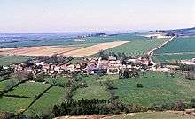
Millington is a small village and civil parish in the East Riding of Yorkshire, England. It is situated approximately 2 miles (3.2 km) north-east of Pocklington.
The civil parish is formed by the village of Millington and the hamlets of Great Givendale and Ousethorpe. According to the 2011 UK census, Millington parish had a population of 242,[1] an increase on the 2001 UK census figure of 217.[2]
Nearby is Millington Woods and Millington Pastures. Millington Woods is one of the few remaining wooded dales in the Yorkshire Wolds. The woods includes Millington Springs, which formerly supported beds of watercress. Millington Pastures holds a stock of highland cattle, and is used for bike riding and walking.
The church dedicated to St Margaret was designated a Grade I listed building in 1967 and is now recorded in the National Heritage List for England, maintained by Historic England.[3]
Millington has two public houses: The Gait Inn and The Ramblers Rest.
The Yorkshire Wolds Way National Trail, a long distance footpath passes through the parish, to the east of the village.
In 1823 Millington was a village and civil parish in the Wapentake of Harthill and the Liberty of St Peter's. The eccesiastical parish living was under the patronage of the Dean of York. Population at the time was 282. Occupations included three farmers, a blacksmith, a wheelwright, a corn miller, a shopkeeper, and the landlord of The Gate public house. Resident were a school master, the parish vicar, and a gentleman.[4]
References
- 1 2 "Key Figures for 2011 Census: Key Statistics: Area: Millington CP (Parish)". Neighbourhood Statistics. Office for National Statistics. Retrieved 6 February 2013.
- ↑ "2001 Census: Key Statistics: Parish Headcounts: Area: Millington CP (Parish)". Neighbourhood Statistics. Office for National Statistics. Retrieved 19 May 2008.
- ↑ Historic England. "Church of St Margaret (1161938)". National Heritage List for England. Retrieved 11 August 2013.
- ↑ Baines, Edward (1823). History, Directory and Gazetteer of the County of York. p. 370.
- Gazetteer — A–Z of Towns Villages and Hamlets. East Riding of Yorkshire Council. 2006. p. 8.
External links
 Media related to Millington at Wikimedia Commons
- Millington in the Domesday Book