Yorkshire Wolds Way
| Yorkshire Wolds Way | |
|---|---|
|
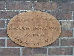
Yorkshire Wolds Way sign at Market Weighton | |
| Length | 79 mi (127 km) |
| Location | Yorkshire, England |
| Designation | UK National Trail |
| Trailheads |
Hessle, East Riding of Yorkshire 53°43′26″N 0°26′10″W / 53.724°N 0.436°W Filey, North Yorkshire 54°12′36″N 0°17′31″W / 54.210°N 0.292°W |
| Use | Hiking |
| Hiking details | |
| Season | All year |
The Yorkshire Wolds Way is a National Trail in Yorkshire, England. It runs 79 miles (127 km) from Hessle to Filey, around the Yorkshire Wolds. At Filey Brigg, it connects with the Cleveland Way, another National Trail. In 2007 the Yorkshire Wolds Way celebrated the 25th anniversary of its official opening which took place on 2 October 1982.[1]

Yorkshire Wolds Way through Bratt Wood, Nunburnholme
Route
The route of the Yorkshire Wolds Way passes close to or through the following places:
- Hessle
- North Ferriby
- Melton
- Welton
- Brantingham
- South Cave
- North Newbald
- Goodmanham
- Market Weighton
- Londesborough
- Nunburnholme
- Pocklington
- Millington
- Huggate
- Fridaythorpe
- Thixendale
- Wharram Percy
- Wharram le Street
- Wintringham
- Sherburn
- Potter Brompton
- Ganton
- Muston
- Filey
Places in italics are slightly off the main route.
See also
References
- ↑ "Yorkshire Wolds Way chalks up 25 years". The National Trail website. Natural England. 2007. Retrieved 2007-10-25.
Further reading
- Walking The Wolds Way, David Clensy, 2007. ISBN 978-1-4303-1019-8
- Yorkshire Wolds Way, Roger Ratcliffe, 2011. Official National Trail Guide. ISBN 978-1-84513-643-7
External links
| Wikimedia Commons has media related to Yorkshire Wolds Way. |
- Yorkshire Wolds Way - National Trails official site
- Yorkshire Wolds Way - The Rambler's Association
- The Long Distance Walkers Association
- Walk the Yorkshire Wolds Way
This article is issued from Wikipedia - version of the 12/3/2016. The text is available under the Creative Commons Attribution/Share Alike but additional terms may apply for the media files.