Mingoose

Mingoose

Trenerry Farm, Mingoose
Mingoose
 Mingoose shown within Cornwall
OS grid referenceSW710488
Civil parishSt Agnes
Unitary authorityCornwall
Ceremonial countyCornwall
RegionSouth West
CountryEngland
Sovereign stateUnited Kingdom
EU Parliament South West England
List of places
UK
England
Cornwall

Coordinates: 50°17′38″N 5°13′01″W / 50.294°N 5.217°W / 50.294; -5.217

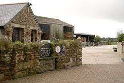
Mingoose is a hamlet near St Agnes and north of Mount Hawke in Cornwall, England.[1][2]

References

  1. Ordnance Survey: Landranger map sheet 203 Land's End & Isles of Scilly (St Ives & Lizard Point) (Map). Ordnance Survey. 2009. ISBN 978-0-319-23289-7.
  2. Ordnance Survey One-inch Map of Great Britain; Truro and Falmouth, sheet 190. 1961


This article is issued from Wikipedia - version of the 2/11/2016. The text is available under the Creative Commons Attribution/Share Alike but additional terms may apply for the media files.